Trails for everyone, forever

Home Go Hiking Hiking Guide Welcome Pass

Welcome Pass

North Cascades > Mount Baker Area
48.9135, -121.6998 Map & Directions
Length
4.6 miles, roundtrip
Elevation Gain
2,800 feet
Highest Point
5,200 feet
Calculated Difficulty About Calculated Difficulty
Moderate/Hard
View from High Divide. Photo by ljcollins. Full-size image
  • Wildflowers/Meadows
  • Mountain views
  • Old growth
  • Dogs allowed on leash
  • Ridges/passes

Parking Pass/Entry Fee

None
Saved to My Backpack

Providing access to the gorgeous views along the High Divide, Welcome Pass is a nice option for those looking for a workout. Count the 66 switchbacks from the trailhead to the pass at 5,200 feet. Continue reading

Rating
3.60 out of 5

(15 votes) Log in to rate

Hiking Welcome Pass

Providing access to the High Divide, Welcome Pass is a nice option for those looking for a workout. Count the 66 switchbacks from the trailhead to the pass at 5,200 feet. This trail ascends through the steep forest, delivering hikers onto the ridge without wasting any time or ground. 

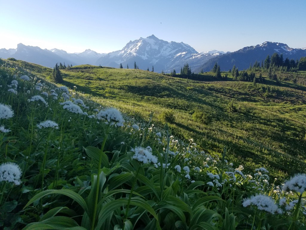
Your uphill efforts will be rewarded as you arrive at the doorstep of jaw-dropping views of Mount Shuksan and  glimpses of Price Lake, a glacier-fed beauty on the side of Shuksan. If you continue westward to the ridge, your walk will be a flower lined journey with views of Komo Kulshan (Mount Baker). On the way back down, enjoy the elusive points and crags of the Picket Range poking out in the distance. 

WTA worked here in 2022, 2020, 2013, 2012, 2011 and 2010!

Welcome Pass

Map & Directions

Trailhead
Co-ordinates: 48.9135, -121.6998 Open in Google Maps

Before You Go

See weather forecast

Parking Pass/Entry Fee

None

WTA Pro Tip: Save a copy of our directions before you leave! App-based driving directions aren't always accurate and data connections may be unreliable as you drive to the trailhead.

Getting There

From Glacier, travel east on Highway 542. Go about 11.5 miles from the Glacier Public Service Center until you get to Milepost 45. Turn onto forest service road 3060, which will be on the left between milepost 45 and 46. This road is not signed and is easy to miss. If you get to milepost 46, you've gone too far. The trailhead and parking area are 1.5 miles from the highway, at the end of Road 3060.

More Hike Details

Trailhead

North Cascades > Mount Baker Area

High Divide (#630)

Mt. Baker-Snoqualmie National Forest, Mount Baker Ranger District

Guidebooks & Maps

Day Hiking: North Cascades (Romano - Mountaineers Books)

Green Trails Mount Shuksan No. 14

You can improve or add to this guidebook entry!

Welcome Pass

184 Trip Reports

Hiked here recently?

Submit a trip report!
 
Trip Reports