Trails for everyone, forever

Home Go Hiking Hiking Guide Wenaha River Trail

Wenaha River Trail

Eastern Washington > Palouse and Blue Mountains
45.9475, -117.4544 Map & Directions
Length
29.9 miles, one-way
Elevation Gain
2,500 feet
Highest Point
4,000 feet
Calculated Difficulty About Calculated Difficulty
Hard
Bighorns on the Wenaha River Trail. Photo by Holly Weiler.
  • Dogs allowed on leash
  • Established campsites
  • Fall foliage
  • Good for kids
  • Old growth
  • Rivers
  • Wildflowers/Meadows
  • Wildlife

Parking Pass/Entry Fee

None
Saved to My Backpack

Hike along a section of the Wenaha River in the Wenaha-Tucannon Wilderness. Continue reading

Rating
4.00 out of 5

Hiking Wenaha River Trail

The main access for the Wenaha River Trail is from the Troy Trailhead near Troy, Oregon.  With a starting elevation of less than 2,000 feet above sea level, this portion of the trail can be accessible nearly year-round depending on weather conditions.  

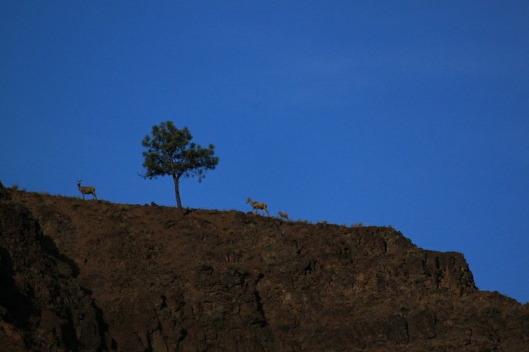
From the trailhead, it is approximately five miles to the boundary of the Wenaha-Tucannon Wilderness.  The trail contours above the Wenaha River, a designated Wild & Scenic River, sometimes hugging the cliffs, and other times coming down to flat benches along the river with access to good campsites. Watch the hillsides for deer, elk, and bighorn sheep, and look overhead for eagles and other birds of prey.

Just inside the Wenaha-Tucannon Wilderness, at approximately the six-mile mark, the trail intersects the Crooked Creek Trail. Although portions of the trail were heavily impacted by the 2015 Grizzly Complex Fire, the forest is beginning to recover nicely. The bridge over Crooked Creek was replaced in late 2023, restoring early season access to the upper reaches of the Wenaha River drainage. The full length of the Wenaha River Trail is 29.9 miles. With numerous intersecting trails, it is possible to create a number of longer loop backpack trips once the snow melts on the higher elevation trails within the Wenaha-Tucannon Wilderness. 

Toilet Information

  • No toilet at trailhead

More information about toilets

Hike Description Written by
Holly Weiler, WTA Correspondent

Wenaha River Trail

Map & Directions

Trailhead
Co-ordinates: 45.9475, -117.4544 Open in Google Maps

Before You Go

See weather forecast

Parking Pass/Entry Fee

None

WTA Pro Tip: Save a copy of our directions before you leave! App-based driving directions aren't always accurate and data connections may be unreliable as you drive to the trailhead.

Getting There

From Pomeroy in Washington, take Highway 12 east for 29 miles to where you can exit south (right) for State Highway 129. Proceed down Highway 129 for 38 miles, then turn right on Grande Ronde Road and follow it for 17.4 miles, entering Oregon along the way. Turn right on Barlett Road and follow for about 0.5 miles to the trailhead.

More Hike Details

Trailhead

Eastern Washington > Palouse and Blue Mountains

Wenaha River Trail (#3106)

Umatilla National Forest, Pomeroy Ranger District

Guidebooks & Maps

100 Hikes in the Inland Northwest

Rich Landers

Mountaineers Books

Pomeroy Ranger District (including Wenaha-Tucannon Wilderness) Umatilla National Forest

USFS 2013.

You can improve or add to this guidebook entry!

Wenaha River Trail

35 Trip Reports

Hiked here recently?

Submit a trip report!
 
Trip Reports