
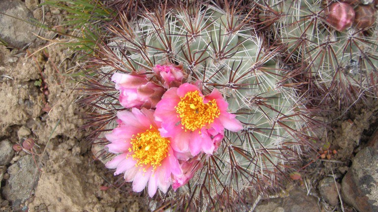
This is a fairly flat route with views of Mount Rainier and a diverse mixture of flowers in the spring. Look for hillsides tinted pink in May as Big Headed Clover and Hedgehog Cacti bloom on the slopes.
Death camas, a toxic native plant, also grows along this route. One of several poisonous plants at Wild Horse, it provides a not so friendly reminder to refrain from picking the flowers.
This route also features flowering beauties such as sage violet, wooly breeches, and small bluebells which grow in the shade of the big sage.
Pick your own adventure on this trail. Just after walking under the power lines, you will come to a Y in the trail. The left branch dead ends on the top of a rocky knoll covered in cactus. Go straight to drop down into a canyon and Schnebly Spring. From here, there are numerous backcountry hiking options on DNR and WDFW property.
Equipped with the Quilomene Whiskey Dick map from WDFW, you can try out multiple 7-8 mile loops that stroll up remote canyons and along the open ridgeline of Whiskey Dick Mountain. Elk and deer are seen in these valleys during spring and late fall.
Whiskey Dick Wildlife Area - Backcountry Trail

-
 Length
- 0.8 miles, roundtrip
-
 Elevation Gain
- 80 feet
This is a fairly flat route with views of Mount Rainier and a diverse mixture of flowers in the spring. Look for hillsides tinted pink in May as Big Headed Clover and Hedgehog Cacti bloom on the slopes.
Continue reading
Hiking Whiskey Dick Wildlife Area - Backcountry Trail
Map & Directions
 Trailhead
Before You Go
WTA Pro Tip: Save a copy of our directions before you leave! App-based driving directions aren't always accurate and data connections may be unreliable as you drive to the trailhead.
Getting There
Drive east on Interstate 90 to exit 115 for Kittitas and head north over the freeway. Follow Parke Creek Road and Vantage Hwy to Beacon Ridge Road. Turn left onto Cleman Rd/Main Street and follow Main Street for just under a mile. Turn right onto Railroad Avenue and continue onto Clark St. Turn right onto Parke Creek Road, then turn right onto Vantage Highway. Turn left onto Beacon Ridge Road, and the trailhead is on the left.
Note: Lands within the Wild Horse Wind and Solar Facility are open to hunting, hiking, biking, bird watching, horseback riding and other recreational activities by written permission only. The entry gate off of the Vantage Highway is open April 1 to Nov. 30, from two hours before sunrise to two hours after sunset.
To get permission to walk the grounds, complete the free online application form then pick up your permit at the Renewable Energy Center from 9:00-5:30, seven days a week. You can also fill out the entire permit in person at the Renewable Energy Center. The free permit is valid from April through November of that year.


