
Get ready for 28 miles of very scenic hiking on the Pacific Crest Trail (PCT). This is a great intro to backpacking route: Four days, seven to eight miles per day of relatively flat backpacking. The trail is well marked, there are abundant camp sites and many stopping points along the way.
The best way to approach this thru-hike is to use two cars or a key swap. Drop one car at Chinook Pass, drive approximately 45 minutes to White Pass and start hiking from there.
It is strongly recommended that you go south to north. It's the most scenic--unfolding and becoming more spectacular each day, and you won't be hiking with the sun in your eyes.
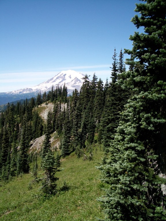
Wildflower meadows, still ponds and small lakes evolve into beautiful crest vistas of the Goat Rocks, Mount St. Helens and Mount Rainier, and any climbing you do will be towards the end of your hike, after you've gotten your hiking legs strengthened with a couple of days of walking.
If you're looking for camping spots, consider the following:
Day 1: White Pass to Sand Lake (3 mi) or Pipe Lake (7.5 mi)
Day 2: Fish Lake or Crag Lake
Day 3: American Lake or Cougar Lake
Day 4: Out via Dewey Lake, to Chinook Pass
White Pass to Chinook Pass

-
 Length
- 28.0 miles, one-way
-
 Elevation Gain
- 5,060 feet
-
 Highest Point
- 6,900 feet
SR 410 (Chinook Pass) is closed between Crystal Mountain Boulevard (12 mi north of summit) and Morse Creek (5 mi east of summit) for the winter season.
Get ready for 28 miles of very scenic hiking on the Pacific Crest Trail. This is a great intro to backpacking route: Four days, seven to eight miles per day of relatively flat backpacking. The trail is well marked, there are abundant camp sites and many stopping points along the way.
Continue reading
Parking Pass/Entry Fee
Northwest Forest PassHiking White Pass to Chinook Pass

WTA worked here in 2024, 2013, 2012, 2007 and 1998!
Map & Directions
 Trailhead
Before You Go
SR 410 (Chinook Pass) is closed between Crystal Mountain Boulevard (12 mi north of summit) and Morse Creek (5 mi east of summit) for the winter season.
Parking Pass/Entry Fee
Northwest Forest PassWTA Pro Tip: Save a copy of our directions before you leave! App-based driving directions aren't always accurate and data connections may be unreliable as you drive to the trailhead.


