
A loop hike, beginning and ending in the old-growth forests of the North Fork Sauk River that traverses high ridges and passes of the pacific crest, visits beautiful alpine lakes, finally following the high and lonesome Pilot Ridge Trail before descending back down to the trail junction on the North Fork Sauk River.
The trail begins in the phenomenal forests of the North Fork Sauk River Valley, passing giant Western Red Cedars, Douglas Firs, And Western Hemlock.
At mile 1.9 pass the Pilot Ridge Trail junction. You will return to this point near the end of your trip. At 4.5 miles, pass a good campsite with a toilet at Red Creek and then at 6 miles, reach Mackinaw Shelter and the last dependable water before White Pass.
Switchback steeply upward for another 2.8 miles through open avalanche tracks and meadows to the junction with the Pacific Crest Trail, turning right (east) on the PCT and hiking another mile to White Pass. Good camps can be found below the pass. Turn right where the sign directs you down to the lower pass area and camps. Please respect the "Camp Elsewhere" signs and do not camp on the ridge above the camp area near the PCT. The Forest Service has spent decades working at restoring the delicate vegetation here, that had been badly impacted from over use.
If you have the time, use White Pass as a base camp and take a side trip or two. The trail from White Pass along the base of White Mountain and out to the Foam Creek Basin is absolutely beautiful! Expect incredible meadows and flower shows. When the trail seems to disappear, hike up to the top of a small knoll and gaze out to breathtaking views in all directions. Glacier Peak dominates the scene but Mount Baker, Sloan Peak, Pugh, White Chuck and dozens of other peaks are visible. Look down from there into the upper White Chuck basin, a land of snow, rock and ice.
Another highly recommended side trip from White Pass is to hike west along the PCT to Red Pass and up to the summit of Portal Peak, just northwest of the pass. It's a fairly easy scramble on an established track along the ridge to the summit, although you may need to use your hands for balance in a place or two. More incredible views from there! Back down at Red Pass, you can continue hiking north and east on the PCT and down into the Glacier Peak Meadows area.
Another interesting diversion is to hike to the top of the White Chuck Cinder Cone, visible just to the north of the PCT.
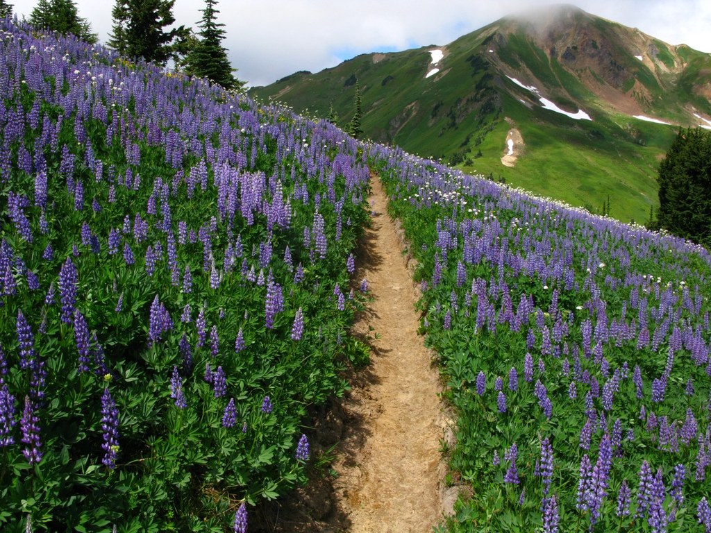
To continue the loop from White Pass, head south on the PCT over miles and miles of mind-boggling ridges, meadows and flower fields, passing Reflection Pond, Kid Pond, Indian Pass, Kodak Peak, which is worth hiking to the top. One mile after passing the Little Wenatchee Trail junction, find yourself at Dishpan Gap. There is a great campsite here, despite being right on the trail.
Hang a right at Dishpan Gap and hike west 0.8 miles. Bear right on the Blue Lakes High Route. This route is rough and passes over several sections of scree. You should feel confident in both your route-finding abilities and surefooted if you want to attempt this route. Alternatively, you can go around the High Route, and continue hiking another two miles west on the Bald Eagle Trail towards June Mountain, then turn right onto Trail 652 to Blue Lakes and proceed to Little Blue Lake. This adds about 4 miles to your loop.
The Blue Lakes High Route ascends a steep, cairn-dotted trail to a high pass with a beautiful view across to Johnson Mountain and down to a sometimes frozen Blue Lake in a rocky basin below. The trail down from this notch to the lake can contain a very steep snow slope in early season. If you think you'll be uncomfortable on it, stick to the Pilot Ridge Trail to access Blue Lakes. Keep your eyes peeled for the small spur trail to the right - the sign for blue lakes is semi-hidden from the path just as it starts ascending to the left.
Blue Lake is spectacular, and a wonderful place to camp. There is a good toilet near the campsites. Blue Lake also offers the last reliable source of water before the North Sauk.
To continue onto the Pilot Ridge Trail, take the trail northeast from the lake outlet that descends to the Pilot Ridge Trail junction. Keep right at the junction, ascending through talus and scree for a bit an then on to the huge meadows that traverse the slopes of Johnson Mountain. The trail turns back to the east, following the west ridge of Johnson Mountain, reaching the Johnson Mountain Trail junction, Trail 652.2. With spectacular meadows, flowers and territorial views from the top, the short 0.5 mile side trip to the summit of Johnson Mountain is a must. The entire south Glacier Peak region lies before you. Check out the old lookout site and the four stone pillars that used to support the lookout. What a perch!
Back at the junction, continue north and west on the Pilot Ridge Trail 652, crossing huge sloping meadows that seem to go on forever. The trail tread through these meadows has not received a lot of maintenance in past years, but is still fairly easy to follow. Eventually the trail finds its way down to the forest but then heads back up and down, and up,then finally switchbacks relentlessly down for 2.5 miles to the North Fork Sauk River.
The trail reaches the valley floor where you're able to cross the North Fork Sauk River on your choice of several stout logs. Walking through a small campsite on the river, you immediately reach the North Fork Sauk trail junction. Turn left and reach the trailhead in another 1.9 miles of glorious forest walking.
White Pass - Pilot Ridge Loop

-
 Length
- 29.2 miles, roundtrip
-
 Elevation Gain
- 7,500 feet
-
 Highest Point
- 6,360 feet
12.24.25: The Mountain Loop Highway is closed at milepost 37.5 (15.5 miles south of Darrington) due to a landslide. This restricts access to FR 49 and this trailhead.
Parking Pass/Entry Fee
Northwest Forest Pass
A loop hike, beginning and ending in the old-growth forests of the North Fork Sauk River that traverses high ridges and passes of the Pacific crest, visits beautiful alpine lakes, and finally follows the high and lonesome Pilot Ridge Trail before descending back down to the trail junction on the North Fork Sauk River.
Continue reading
Hiking White Pass - Pilot Ridge Loop
Map & Directions
 Trailhead
Before You Go
12.24.25: The Mountain Loop Highway is closed at milepost 37.5 (15.5 miles south of Darrington) due to a landslide. This restricts access to FR 49 and this trailhead.
Parking Pass/Entry Fee
Northwest Forest PassWTA Pro Tip: Save a copy of our directions before you leave! App-based driving directions aren't always accurate and data connections may be unreliable as you drive to the trailhead.


