
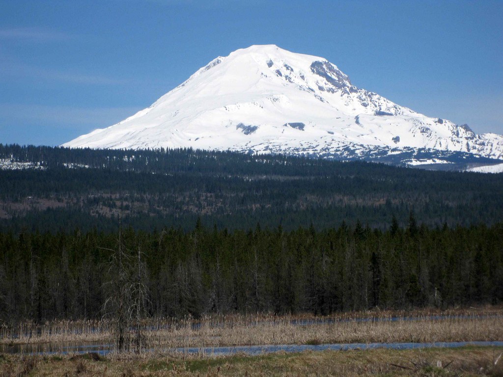
The Willard Springs Trail is a loop along the edge of the Conboy Lake marsh and through the pine forest. Beginning at the refuge headquarters, the trail parallels the west shore of the old Conboy Lake lakebed, with views across the lakebed and north to the 12,000-foot Mt. Adams from the Observation Platform, then returns through the forest.
The trail is gentle and suitable for all skill levels, but it is not officially ADA accessible. Parking, restrooms and a picnic table are available at the trailhead at the refuge headquarters.
Wildflowers and wildlife are abundant on this trail, including sandhill cranes, northern harriers, bald eagles, swifts, swallows, warblers, and juncos, among many other birds.
Willard Springs Trail

-
 Length
- 3.5 miles, roundtrip
-
 Elevation Gain
- 219 feet
-
 Highest Point
- 1,905 feet
Parking Pass/Entry Fee
None
The Willard Springs Trail is a loop along the edge of the Conboy Lake marsh and through the pine forest. Beginning at the refuge headquarters, the trail parallels the west shore of the old Conboy Lake lakebed, with views across the lakebed and north to the 12,000-foot Mt. Adams from the Observation Platform, then returns through the forest.
Continue reading
Hiking Willard Springs Trail
Willard Springs Trail
Map & Directions
 Trailhead
Before You Go
Parking Pass/Entry Fee
NoneWTA Pro Tip: Save a copy of our directions before you leave! App-based driving directions aren't always accurate and data connections may be unreliable as you drive to the trailhead.
Getting There
Directions from White Salmon, Washington. Head west on State Route 14 (Lewis and Clark Highway). Turn right onto State Route 141A (Washington 141 Alternate North). After 2.2 miles, turn left onto State Route 141 North. Follow this for about 7.9 miles and turn right onto Glenwood Road. In about 1 mile Glenwood Road turns into the BZ-Glenwood Highway; follow this for another 8.1 miles and turn left onto Laurel Road. In 3.5 miles turn right onto Trout Lake-Greenwood Road. In another mile, turn right into the marked entrance for Conboy Lake National Wildlife Refuge. The parking area will be a mile ahead of you.


