Trails for everyone, forever

Home Go Hiking Hiking Guide Wilson Creek Cottontail Trail

Wilson Creek Cottontail Trail

Central Washington > Potholes Region
47.4220, -119.1215 Map & Directions
Length
1.6 miles, roundtrip
Elevation Gain
11 feet
Highest Point
1,290 feet
Calculated Difficulty About Calculated Difficulty
Easy
The paved Wilson Creek Cottonwood trail is a great, miles-long outing near a tiny town in central Washington. Photo by Mary Hartman. Full-size image
  • Dogs allowed on leash
  • Good for kids

Parking Pass/Entry Fee

None
Saved to My Backpack

This level, paved trail on a former railroad grade offers a pleasant, accessible route alongside the tiny town of Wilson Creek in central Washington. Continue reading

Rating
0.00 out of 5

(0 votes) Log in to rate

Hiking Wilson Creek Cottontail Trail

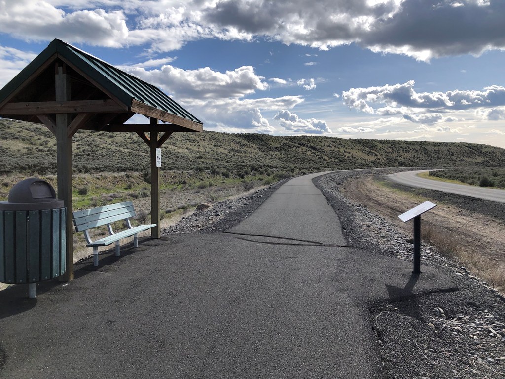
This accessible, paved trail is built on a former railroad grade. It runs parallel to Railroad Street beyond the east end of town, with views of the surrounding shrub steppe. Along the way there are three covered benches with informational signs about Native people, local wildlife and the "Last Grand Roundup" of range horses (around 1905).

Toilet Information

  • Toilet at trailhead
  • Accessible toilet

More information about toilets

Hike Description Written by
Mary Hartman, WTA Correspondent

Wilson Creek Cottontail Trail

Map & Directions

Trailhead
Co-ordinates: 47.4220, -119.1215 Open in Google Maps

Before You Go

See weather forecast

Parking Pass/Entry Fee

None

WTA Pro Tip: Save a copy of our directions before you leave! App-based driving directions aren't always accurate and data connections may be unreliable as you drive to the trailhead.

Getting There

The town of Wilson Creek is located off Washington Highway 28, 23 miles east of Soap Lake. Drive into town and park adjacent to the City Park on Railroad Street.  Find the pink caboose and walk across Fourth Street to the trailhead. A sign on the side of the Public Works Fire District building on the corner identifies the trail as Cottontail Trail.

The city park has an accessible restroom that may be closed seasonally.

More Hike Details

Trailhead

Central Washington > Potholes Region

Wilson Creek Cottontail (#00)

Grant County and Town of Wilson Creek

Guidebooks & Maps

Top 26 Trails and 12 Watchable Wildlife Units in Grant County Washington,” https://www.grantcountywa.gov/1311/Resources

Washington State Department of Natural Resources - Moses Lake

You can improve or add to this guidebook entry!

Wilson Creek Cottontail Trail

0 Trip Reports

Hiked here recently?

Submit a trip report!
 
There aren't any trip reports for this hike yet.