Trails for everyone, forever

Home Go Hiking Hiking Guide Longmire to Devil's Dream Camp
WTA is a nonprofit that needs you

We're just as excited as you to get the summer hiking season started. We're psyched our website, app and work for trails help you get outside.

But we're a nonprofit that runs on donations from regular people. If everyone who visited this site this holiday weekend donated $9/month, it would fully fund our work for the next 2 years. Time spent outdoors is priceless, but every donation large or small helps us support those experiences for everyone. Thank you and happy hiking!


Please take 2 minS to chip in $9

link

Longmire to Devil's Dream Camp

Mount Rainier Area > SW - Longmire/Paradise
46.7537, -121.8131 Map & Directions
Length
5.5 miles, one-way
Elevation Gain
2,400 feet
Highest Point
5,000 feet
Calculated Difficulty About Calculated Difficulty
Moderate/Hard
Views of Mt. Rainier from the trail. Photo by Jess2643. Full-size image
  • Wildflowers/Meadows
  • Ridges/passes
  • Established campsites
  • Mountain views
  • Old growth
  • Rivers
Saved to My Backpack

Climb up and up on the Wonderland Trail as you make your way along the southwest side of Mount Rainier. Enjoy sweeping views of the mountain and surrounding peaks. Continue reading

Rating
0.00 out of 5

(0 votes) Log in to rate

Hiking Longmire to Devil's Dream Camp

Begin or continue your journey on Mount Rainier's iconic Wonderland Trail. This section of trail takes you around the southwest side of the mountain through some of the most stunning views in the park. Climb up and down ridges, over creeks, and through meadows on your way to Devil's Dream Camp.

Begin from Longmire. Be sure to stop by the visitor center to gather all the information you need and to say hi to the nice park rangers. The trail starts just across the street. It starts quickly, climbing right up Rampart Ridge. Reach the top at Cougar Rock, and follow the Wonderland Trail left for .2 miles then right over the ridge.

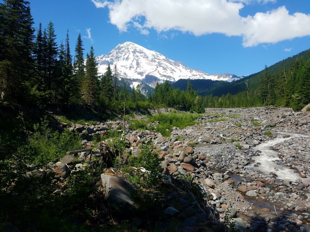
Descend into Kautz Creek and cross it. Pyramid Creek Camp is between Kautz and Pyramid Creeks. Stop to chat with others attempting the Wonderland. Quickly begin to climb again as you push the last distance towards Devil's Dream Camp between Satulick and Iron Mountains. Squaw Lake is just off the trail on Devil's Dream Creek, and from camp you can enjoy views of the whole park.

Hike Description Written by
McKenzie Carlson, WTA Correspondent

Longmire to Devil's Dream Camp

Map & Directions

Trailhead
Co-ordinates: 46.7537, -121.8131 Open in Google Maps

Before You Go

See weather forecast

WTA Pro Tip: Save a copy of our directions before you leave! App-based driving directions aren't always accurate and data connections may be unreliable as you drive to the trailhead.

Getting There

From Seattle: South on I-5 to SR 512 (exit 127). East on SR 512 to SR 7. South on SR 7 to SR 706 in Elbe. East on SR 706 through Ashford to the Nisqually Entrance.

More Hike Details

Trailhead

Mount Rainier Area > SW - Longmire/Paradise

Mount Rainier National Park

You can improve or add to this guidebook entry!

Longmire to Devil's Dream Camp

10 Trip Reports

Hiked here recently?

Submit a trip report!
 
Trip Reports