Trails for everyone, forever

Home Go Hiking Hiking Guide Z Lake

Alert: Landslide risk, tree-fall in saturated soils and related hazards remain high and have closed trails and roads, including major highways and forest roads. 

Respect closures, check forecasts, carefully consider your recreation plans, and stay safe out there.


Z Lake

Central Washington > Grand Coulee
47.5923, -118.4002 Map & Directions
Length
2.4 miles, roundtrip
Elevation Gain
93 feet
Highest Point
2,235 feet
Calculated Difficulty About Calculated Difficulty
Easy
Clouds reflected in the lake. Photo by Holly Weiler. Full-size image
  • Dogs allowed on leash
  • Good for kids
  • Lakes
  • Wildflowers/Meadows
  • Wildlife

Parking Pass/Entry Fee

Discover Pass
Saved to My Backpack

Z Lake is a short hike to a small narrow lake surrounded by shrub-steppe habitat teeming with wildlife and wildflowers. Continue reading

Rating
0.00 out of 5

(0 votes) Log in to rate

Hiking Z Lake

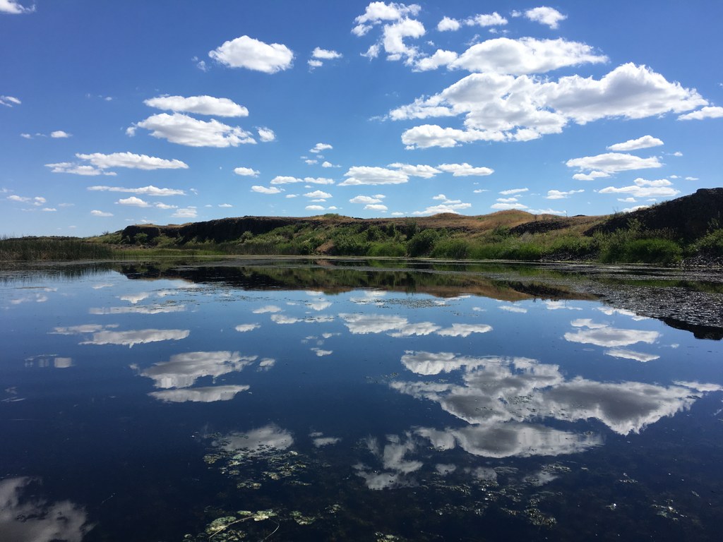
Z Lake is located within the 21,000-acre Swanson Lakes Wildlife Area, an area that boasts many wetlands and incredible wildlife habitat (particularly for waterfowl), but has few established trails. The short trail to Z Lake is actually an old farm road leading past the site of a former homestead on its way to the lake, making it a short and easy introduction to the larger area. At a mere 1.2 miles each way with very little elevation change, it’s an easy hike, passing a few additional wetlands along the way. 

Bring a pair of binoculars, as this is a great area for birdwatching at the wetlands. Z Lake is also occasionally stocked for walk-in trout fishing. There is even a first-come, first-served loaner rowboat at the lake — bring your own personal flotation device and take a tour of the lake by the water!

The trail ends at Z Lake, but the surrounding landscape consists mostly of sagebrush, bunch grass and other low-growing shrub-steppe plants, where off-trail exploration is fairly easy for those with strong map and compass skills. The area is also adjacent to some Bureau of Land Management land for additional exploration on public land. Since the area is former farm and range land, there are still old barbed wire fence lines in some areas.

In the spring, the area has fantastic wildflower displays. Note that both ticks and rattlesnakes call this area home.

Toilet Information

  • No toilet at trailhead

More information about toilets

Wheelchair Accessibility

The trail leading to Z Lake is an old double-track farm road, starting at a narrow gate. The farm road is wide and relatively flat, but does cross multiple cattle guards and has tire ruts with grass growing in the middle. Depending on the mobility device used, access may be difficult.

Hike Description Written by
Holly Weiler, WTA Correspondent

Z Lake

Map & Directions

Trailhead
Co-ordinates: 47.5923, -118.4002 Open in Google Maps

Before You Go

See weather forecast

Parking Pass/Entry Fee

Discover Pass

WTA Pro Tip: Save a copy of our directions before you leave! App-based driving directions aren't always accurate and data connections may be unreliable as you drive to the trailhead.

Getting There

From Highway 2 at Telford, turn south onto Telford Road. Travel 9 miles to a small pull-off and parking area located on the west side of Telford Road. Please do not block the gate.

More Hike Details

Trailhead

Central Washington > Grand Coulee

Washington Department of Fish and Wildlife, Swanson Lakes Wildlife Area

Guidebooks & Maps

Day Hiking Eastern Washington (Landers and Romano - Mountaineers Books)

USGS Rocklyn SW

BLM Spokane District Telford Recreation Area map

You can improve or add to this guidebook entry!

Z Lake

9 Trip Reports

Hiked here recently?

Submit a trip report!
 
Loading trip reports...
Trip Reports