

There haven’t been recent notes for this hike/climb, so I figured I’d fill in the blanks. Sorry for the length.
First, there are two parking lots—go farther in to the trailhead and park there if you can.
The early trail is lovely and despite passing under I-90, it is nice, but there are many rooty/rocky sections that make it a rough tread. Some rocks embedded in trail, some talus slopes, some sections of trail up rocky stream beds. Not may favorite trail, but it’s okay. Minimal bug problems. About 2 hours to the lake, which is also lovely. Almost no snow on trail.
I took the “standard” route to Kaleetan’s summit (per Smoot and older WTA trail notes). By crossing the logjam at the lake and heading up to the left. When you see the toilet sign, take the right “trail” and you’re off to point 5700. What a steep, sketchy route that is! Some of it clear, some of it through tangles of branches, some up and over rocks, and that was just to the talus slopes above—there really is a trail there (or more correctly, many routes that weave about and intersect) climb another couple hundred feet on talus and you arrive at the giant cairn at point 5700 (5560 on my watch). 55 minutes from lake to 5700.
Then the “fun” starts. The standard ridge route goes just below and to the left of the actual ridge and there really seems to be a trail there trying like hell to be seen, but the lingering snow fields on these steep slopes makes it tough to find it and stay on it. This section of 1-1.5 miles was the toughest part of the whole climb—not terrible going, and eventually even a trail-losing-expert like me found the right way. Thanks in part to an old hand I met at 5700 who convinced me there were discernible routes (but who suggested it might be 2-3 more hours to the top) and one guy coming down from the summit who encouraged me that I’d be there in half an hour—he was right. It took maybe 90 minutes from 5700 to the summit. But that involved a lot of free-lancing down soggy snow, then finding/losing/finding the trail across talus slopes and scrambling up to actual trails at the base of the peak.
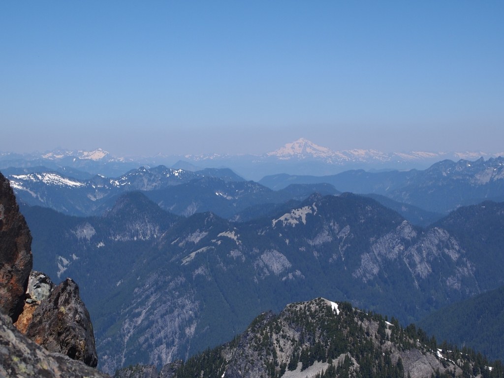
Steep snow slopes are bad, lots of talus crossing is unpleasant, but there are real trails up to the summit block (triangular snow patch leads the way just below the gully scramble). I was fully prepared to turn back at 5700 ("pant pant pant, hey, that looks kinda far..."), but figured what the heck, and was glad I pressed on. Once you are at the base of the summit block, the scramble is pretty basic and takes about 10 minutes (in each direction) and the views are outstanding.
Coming back off the top, then across the talus was easy, but the most effort I expended all day was trying to regain the ridge trail up the snow slopes and wet, heathery hillsides. True pain in the butt, easy to get semi-lost, steep and slick slopes, muddy, heathery, snowy. In the end, I just charged straight uphill to where I knew the trail would be, but it was an ugly and exhausting ten minutes. Huff huff huff. I made it, packed snow under my ball cap, and wound down the lengths of talus below 5700 (“hmm, this doesn’t look familiar, does it?” it was but I was pretty spent) before regaining the cool forest, then the lake, then the trail home. Including stops for rest, snack, summit, about 8.5 hours total—5 in and 3.5 back out.
Today was brutally hot and I drank over 4 liters of liquids total but my scale at home indicates I still lost 6 lbs. on the climb. Sweating out 14 lbs of liquid is an unpleasant thing—make sure you have bug spray, sunscreen, and much water. If I do this one again, I'll start a couple hours earlier, or go on a cooler day, and take a bit more time so I'm not so spent. The final scramble was enjoyable, but some other parts were just masochism. Gear notes: brought ice axe but never used it. Used trekking poles extensively. Forgot microspikes but don't think they'd have helped as nothing was icy. Crampons may have helped on some of those firmer snow slopes, but kicking steps both up and down worked okay.


Comments