
Type of Hike
Day hikeTrail Conditions
Trail in good conditionRoad
Road suitable for all vehiclesBugs
No bugsSnow
Snow free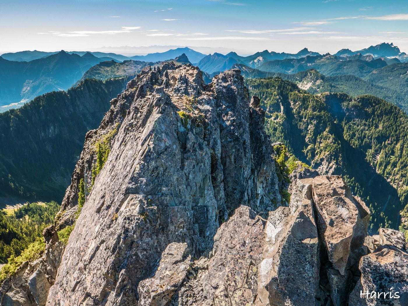
I’ve been so curious about the name Mount Forgotten, and great weather today led me to this curious peak.
I hit the trail at ~9am since I found out that was not, in fact, a short hike; there was moderate elevation gain, and the trail was not easy (sometimes needed class 3 scrambling).
I started not from the Dickerman TH but from the abandoned forest road connected to the Perry Creek Trail.
This abandoned part of FR was overgrown and there were a few fallen trees, but they were easy to pass (except the first one: I could go over it, but it was huge tree.)
The Perry Creek Trail (#711) that continues up to Mt. Forgotten Meadows was in good condition.
Switch back started from the Perry Creek Fall and I reached at the saddle around 11am.
I felt a little hungry and spent almost half an hour picking blueberries.
Yes. blueberries are everywhere.
The meadow was one of the best places to enjoy north cascade views.
I found a few good camp sites there and I really wanted to come back and camp there another time.
The trail from the meadow to Mt. Forgotten was a little tricky.
It was hard to find the route (luckily, I downloaded this route to the Ramblr App and followed it. Otherwise, I wouldn't have made it), I needed to scramble sometimes (It said class 3 but wasn't that bad at all) and go through dense trees.
It was just 2 miles, but took way longer to make it than I expected.
At the summit, the panoramic view was just AMAZING!
I found a geocache at the top and saw that one geocacher was there 3 days ago.
I found a few hikers who hiked up to the meadow, but I don’t think there are too many people on the Mt. Forgotten trail because there wasn’t a foot trace on the trail.
I recommend bringing a GPS or a navigation app if you plan to hike up Mt. Forgotten, if you are not an experienced navigator.
On the way back, I met two backpackers and they said they would camp somewhere at the saddle.
This was my first hike to Mt.Forgotten and I couldn’t forget it.
Please see Ramblr link below for more pics and stories.
Comments