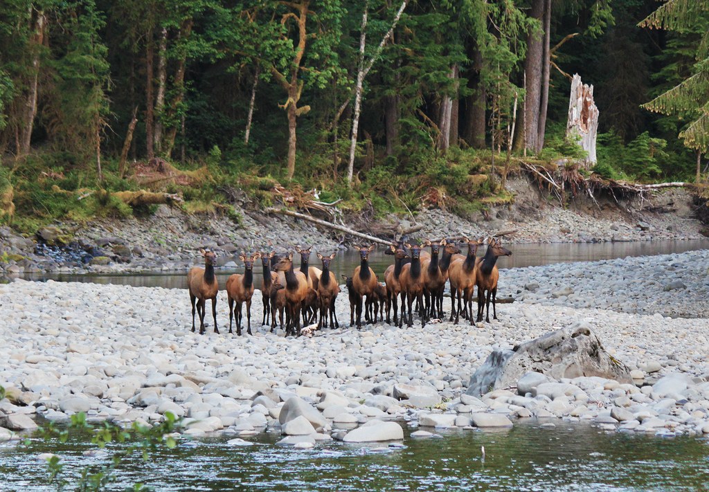
The Bogachiel River is a classic example of a lowland rainforest ecosystem, with a rough and tumble trail that extends all the way to the head of the valley. Born on lower mountains than the Hoh, Queets, and Quinault, it lacks the glacial coloration and tremendous flow associated with those valleys. What it makes up for is miles of solitude and adventure.
From the trailhead, drop 150 feet to the valley floor amid spruce and alder. A fallen tree doubles as a bridge over Morganroth Creek. Just after it is the junction with the Ira Spring Wetland trail, an alternate return option. Keep right to stay on the Bogachiel Trail.
At 0.3 mile is the junction with the Homestead Loop, which circles the flat next to the river. The Bogachiel Trail now follows an old road for a half-mile through mossy alders and luxuriant galleries of sword fern. This section of trail, like the rest up valley, is often muddy from fall until summer. The name Bogachiel mean “muddy waters” and in the right kind of weather, can apply to the trail itself.
A small creek must be crossed just before the trail breaks out at the river’s edge. Here the Bogachiel has been eating away at the bank, taking the trail along with it. As a result, the trail is being rerouted through the forest, away from the river. Soon the trail meets the opposite end of the Ira Spring Wetland loop. Turn right to continue, and immediately cross Kahkwa Creek.
At 1.7 miles is the Olympic National Park boundary. A trail marker and backcountry register are on the left. The trail now penetrates deeper forest, with occasional stumps of former old growth giants on either side. Several large trees that fell during the winter storm of 2017 lie across the trail and are cut to allow the trail to pass through them.
At about 3 miles the trail comes again to the river where the bank has been eroded. The trail now goes up to where a rope has been placed to allow passage above the cut bank. High above the river, the trail bounds up and down while skirting a ledge directly over the river. Descend another rope and back onto the valley bottom at Mosquito Creek.
The next few miles are often muddy and overgrown, meandering beneath beautiful old growth spruce, hemlock, and fir. In the dry season, and if the salmon berries have been cut, this section is as splendid as it gets. The hiker will delight in the many picturesque streams chattering under dapple sunshine. Conversely, the muddy conditions will deter most people during wet months when the water stands deep and covers the trail.
At 4.8 miles the trail crosses an unnamed creek next to the river. Immediately upon crossing the stream, a way path leads down to a pleasant campsite next to the river beneath a couple very large spruce. This is now the most impressive tract of forest yet. Here the rainforest reaches its optimum growth, and reminds the hiker of the famed Hoh and Quinault valleys.
At 6.0 miles the trail reaches a junction with the old Snider-Jackson Trail. This is the site of the former Bogachiel Ranger Station, shelter, and horse stable. All of the structures were washed away in 1989, along with many large trees. The trail now comes upon the river just beyond the junction where a small campsite sits right on the brink of the bank.
Just beyond the campsite is a possible river access point to the wide gravel bars, although each year a little more bank is cut. From here on the trail is often unmaintained, rough, and hard to follow. It is possible to hike to Sol Duc Hot Springs, 29 miles from the trailhead, or to venture on to the Hoh valley by fording the Bogachiel.
Bogachiel River

-
Length
- 12.0 miles, roundtrip
-
Elevation Gain
- 400 feet
-
Highest Point
- 500 feet
-
Calculated Difficulty
About Calculated Difficulty
- Moderate

 Full-size image
-
Dogs not allowed
-
Established campsites
-
Old growth
-
Rivers
-
Wildlife
Parking Pass/Entry Fee
Northwest Forest Pass
The Bogachiel River is a classic example of a lowland rainforest ecosystem, with a rough and tumble trail that extends all the way to the head of the valley. Born on lower mountains than the Hoh, Queets, and Quinault, it lacks the glacial coloration and tremendous flow associated with those valleys. What it makes up for is miles of solitude and adventure.
Continue reading 
Hiking Bogachiel River

WTA worked here in 2025, 2024, 2020, 2019 and 2018!
Hike Description Written by
Wes Partch,
WTA Correspondent
Map & Directions
 Trailhead
Before You Go
Parking Pass/Entry Fee
Northwest Forest PassWTA Pro Tip: Save a copy of our directions before you leave! App-based driving directions aren't always accurate and data connections may be unreliable as you drive to the trailhead.
Getting There
From Forks take US Highway 101 south for 5 miles. Turn left onto Undi Road, directly opposite from Bogachiel State Park. Drive 2 miles until the ‘Dead End’ sign. Turn left onto the bypass road, following signs for the Bogachiel trailhead. The bypass is about 2 miles long. Come upon Undi Road once again, and turn left. Continue on Undi Road for 2 more miles until its end at the Bogachiel Trailhead, about 11 miles from Forks.
More Hike Details
Trailhead
Olympic Peninsula > Pacific Coast
Bogachiel River (#20)
Olympic National Park
Guidebooks & Maps
Day Hiking: Olympic Peninsula (Romano - Mountaineers Books)
Custom Correct Bogachiel Valley
You can improve or add to this guidebook entry!


