Hiking in Circles: 10 Winter Lowland Loops
Whether you're looking to walk around a lake, take some new hikers for a stroll or find the perfect training route, everyone loves a loop. When you never have to return the way you came, every step forward feels like an adventure.
Most of the grand Washington loops are buried under feet of snow this time year. But there are tons of lowland loops, nature trails and routes through parks to explore all year long.
So while you daydream about your big summertime loop adventures, you can explore some of these lower-elevation loops.
Bundle up, pack a picnic, review our winter safety tips and go in circles! We always love to read a trip report when you are back from your hike.
Dune Forest Loop - Leadbetter Point State Park
Location: Southwest Washington — Long Beach Area
Mileage: 2.9 miles, roundtrip
Elevation Gain: 60 feet

View from Bay Loop Trail near the Dune Forest Loop. Photo by Beircheart.
Hike, play on the beach and spot wildlife at Leadbetter Point State Park. Located on the northern end of the Long Beach Peninsula, this spot is a bird-watcher's paradise, especially in the spring and fall when more than 200 species of migrating birds fly over.
This is the best place to access the Willapa National Wildlife Refuge for bird-watching and photography. One of the best excursions in winter is the Dune Forest Loop, a three-mile hike through sand dunes, shoreline and pine that captures the unique ecosystem of the area.
> Plan your visit to Dune Forest Loop using WTA's Hiking Guide
Lower Lake Trail - Battle Ground State Park
Location: Southwest Washington — Lewis River Region
Mileage: 1.0 mile, roundtrip
Elevation Gain: 120 feet
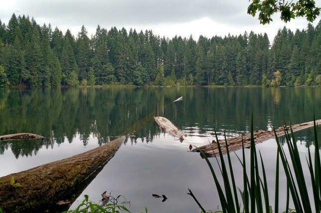
Photo by rosemarylp.
This little lake was once a small volcano that blew it's top and formed a small crater. Now, the 280-acre park around the crater offers hiking, riding, fishing and camping. One of the most interesting trails is the Lower Lake Trail, which encircles the geologic wonder.
> Plan your visit to Lower Lake Trail using WTA's Hiking Guide
Coyote Wall - Moab/Maui Loop
Location: Southwest Washington — Columbia River Gorge
Mileage: 3.8 miles, roundtrip
Elevation Gain: 850 feet
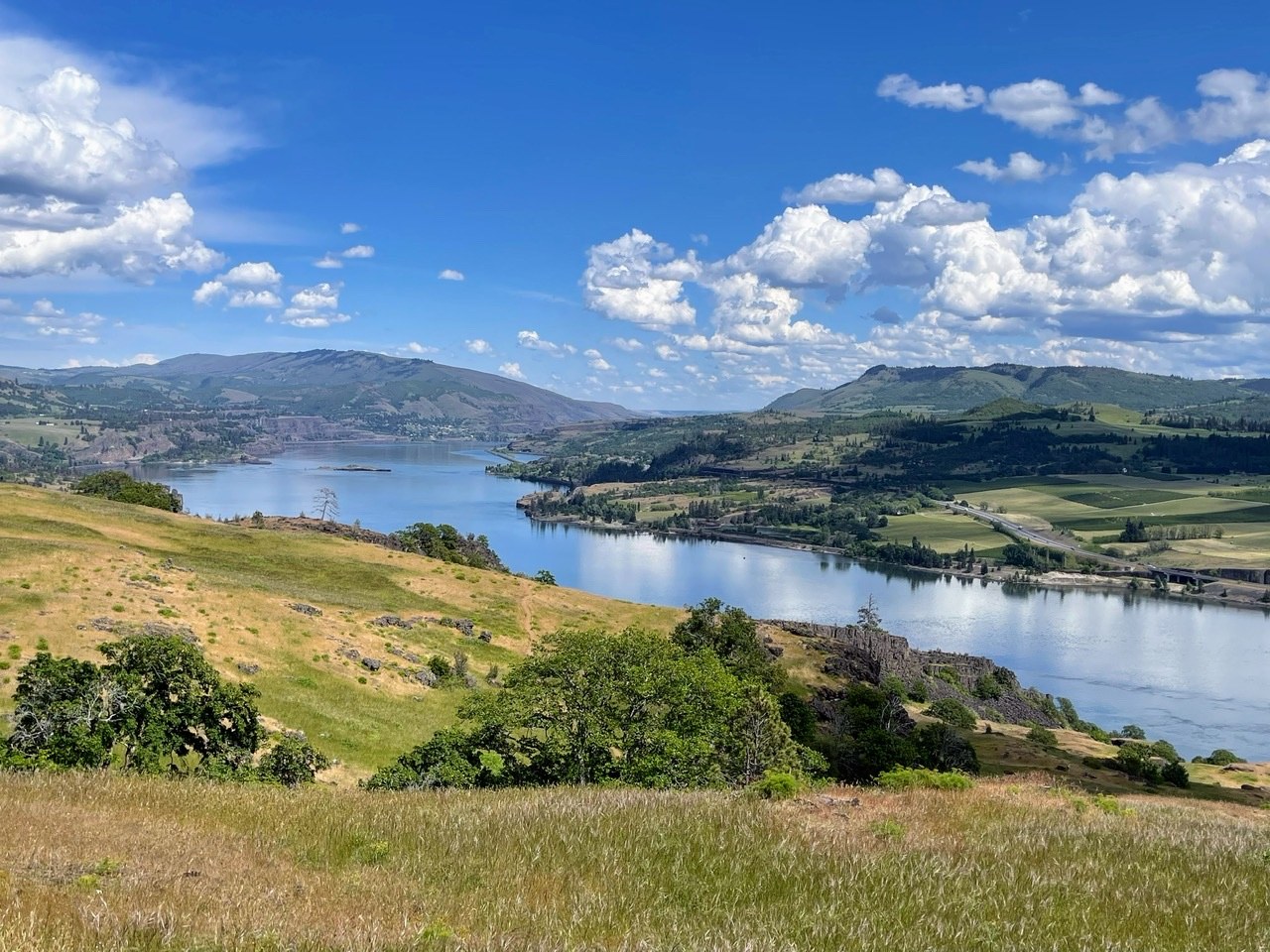
The view from Little Maui trail is gorgeous on sunny days, but the drama is enhanced by storms and snows in the winter. Photo by trip reporter hikingchungs.
This short loop offers dramatic views of the Columbia River Gorge in a multi-use area, so expect to share the trail with mountain bikers. If you want more, it's possible to extend your loop further up the hillside on the Coyote Wall trail, recently rerouted to increase its sustainability. Do note that the Forest Service determined that mountain bikers have right-of-way in that section, a departure from the standard on-trail yielding practices.
A note of caution: Freeze/thaw cycles in winter in the Gorge can make for muddy, slippery trails. This loop is better during dry spells.
> Plan your visit to Coyote Wall - Moab / Maui Loop using WTA's Hiking Guide
Hog Canyon Lake
Location: Eastern Washington — Spokane Area
Mileage: 3.5 miles, roundtrip
Elevation Gain: 900 feet

Hog Lake in the winter. Photo by Karen Soenke.
In late winter and spring, Hog Lake is thriving with songbirds, waterfowl and wildflowers. Even better, it's not thriving with swarms of mosquitoes. Hike the 1.3 mile loop above the lake, through stands of ponderosa pine, and then drop down a steep trail to the lake itself. Bring a fishing pole along and spend a quiet afternoon gazing out on the reflective lake.
> Plan your visit to Hog Canyon Lake using WTA's Hiking Guide
Potholes State Park - Frenchman Hills Trail Loop
Location: Central Washington — Potholes Region
Mileage: 3.0 miles of trail
Elevation Gain: minimal

A rushing river runs across the photo with green grasses running along the banks and a mix of yellow and brown grasses covering the remaining countryside. Some larger shrubs and trees are seen in the distance. Photo by trip reporter Aug17.
Potholes State Park is a popular spot for picnickers and boaters, but there are also 3 miles of trail to explore. The way is flat, and the views of the river make for a nice, peaceful stroll.
> Plan your visit to Frenchman Hills Trail Loop using WTA's Hiking Guide
Bridle Trails State Park
Location: Puget Sound and Islands — Seattle-Tacoma Area
Mileage: 3.5 miles, roundtrip
Elevation Gain: 450 feet

A wide dirt trail leads slightly uphill in the middle of the photo, surrounded on both sides by tall evergreens and low green shrubbery. Photo by trip reporter Kris & Renna.
Nestled amid a quiet neighborhood of horse ranches and single-family homes, this 482-acre park has served largely as an equestrian recreation area since the 1950s. The winding, forested trails have also proven to be popular with other trail users, namely hikers, trail runners and dog walkers. Routes wind through a sea of second-growth trees standing at attention under which lush ferns carpet the forest floor.
> Plan your visit to Bridal Trails State Park using WTA's Hiking Guide
Phantom Lake Loop
Location: Puget Sound and Islands — Seattle-Tacoma Area
Mileage: 3.2 miles, roundtrip
Elevation Gain: 130 feet
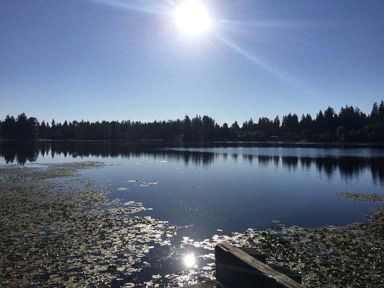
View across Phantom Lake from east shore. Photo by superstar325.
Hike all the way around the Phantom Lake area, nestled in between Bellevue's Weowna Park and the main section of Lake Hills Greenbelt Park. Much of the shore is taken up by homes, but you can enjoy expansive views across the lake from both the western end and eastern end. And much of the hiking path is bordered by trees that give the illusion of a more rural setting.
> Plan your visit to Phantom Lake Loop using WTA's Hiking Guide
Mountain Lake in Moran State Park
Location: Puget Sound and Islands — San Juan Islands
Mileage: 3.9 miles, roundtrip
Elevation Gain: 50 feet
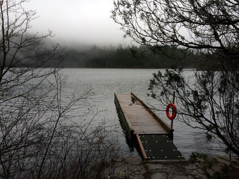
A foggy day overlooking Mountain Lake. Photo by LizzyRN.
Whether you're visiting Orcas specifically to explore the islands' trails or just looking for a place to stretch your legs while you're there, this 4-mile loop around Mountain Lake in Moran State Park is a great place to start. It sparkles on a sunny day, but is almost more delightful shrouded in a foggy mist.
In winter and spring, the trails can be a little muddy, but WTA's been doing some early season work there, and you'll find most of the trail tread easy underfoot.
> Plan your visit to Mountain Lake using WTA's Hiking Guide
Boulder-Garden Loop
Location: Snoqualmie Region — North Bend Area
Mileage: 2.5 miles, roundtrip
Elevation Gain: 800 feet

The trail winds by giant boulders. Photo by thenomadicartist.
Sitting at the foot of Mount Si, this loop winds through a forest littered with giant, moss-covered boulders. While it may only be 2.5 miles long, this loop gains 800 feet, which is challenge enough for plenty of hikers. Better yet, it often escapes the snow-cover of Mount Si's higher elevation.
> Plan your visit to Boulder Garden Loop using WTA's Hiking Guide
Old Sauk Trail - ADA Loop
Location: North Cascades — Mountain Loop Highway
Mileage: 1 miles, roundtrip
Elevation Gain: 200 feet
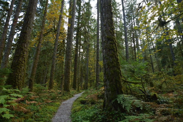
Take a stroll on the Old Sauk for towering trees, dripping mosses and a mighty river. Photo by Jon Lee.
The Old Sauk Trail has trailhead that provides barrier-free access to a viewpoint of the Sauk River via a mile-long loop trail. This gentle trail makes it easy to slow down and enjoy the stately stands of Douglas-fir and cedar as well as to spy eagles, or perhaps an occasional coyote.
> Plan your trip to Old Sauk Trail ADA Loop using WTA's Hiking Guide


