How To Use WTA's Hiking Guide
WTA’s online Hiking Guide is full of information about thousands of trails across the state. With so many options, it can be daunting to find that perfect trail.
Luckily, you can find the right trail for you and get the most out of the trail description with these tips. There are so many great features packed into every hike that will make planning easier and help you pick where to go.
How Do I Find the Perfect Hike?
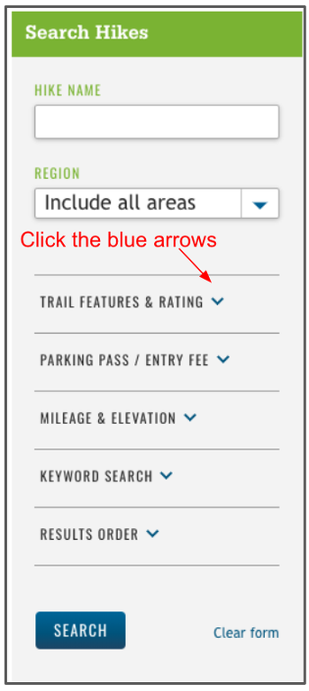
We can’t tell you what your perfect hike will be, but we can help you narrow down the options based on what you’re looking for. Search the Hiking Guide using filters and you will only see results that are relevant to you.
 Region: Start by selecting a region from the drop-down menu. The option to choose a subregion will appear to help narrow your search down further.
Trail Features & Rating: If you are looking for a specific type of landscape or nature experience, select from this list to find hikes that include those elements you want to see. This is also where you can find our wheelchair-friendly filter.
Parking Pass / Entry Fee: Different land managers require different parking passes, so this is a great way to find places where you can use the pass you already have, or trailheads that don’t require any pass at all.
Mileage & Elevation: This filter will help you set your parameters for the ideal length and steepness of hike. This is also where you can set the maximum high point, which is great during the winter to find snow-free hikes if you know where the snow level is.
Keyword Search: This is an open-ended filter where you can search the hike description for any word or phrase. This is a great option if you’re looking for something specific (larches, suspension bridges, rock walls, etc…).
How Do I Get the Most Out of the Hiking Guide?
Each Hiking Guide entry is so much more than just a trail description. You can get a weather forecast tailored to the exact location of the trailhead, read trip reports from recent hikers, get driving directions and so much more.
You will for sure want to create a My Backpack account to save hikes for later and keep track of all the places you've been.

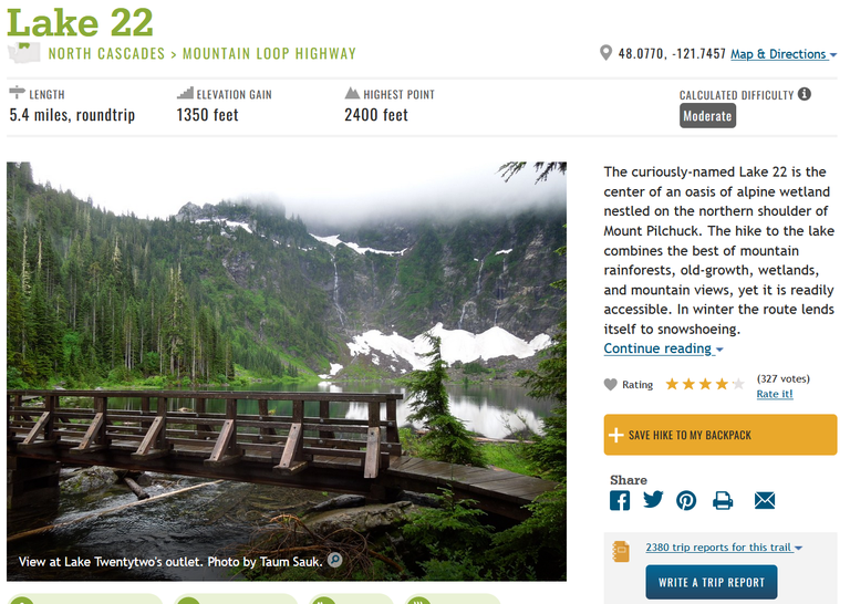
The top section of a Hiking Guide entry includes all the data you need to complete your hike safely, from a shortcut to the driving directions and trailhead location, to the calculated difficulty so you can estimate how much time you might need to do it.
It also includes a short summary of the area, a community-sourced rating, a shortcut to trip reports and a button save your hike to your My Backpack.

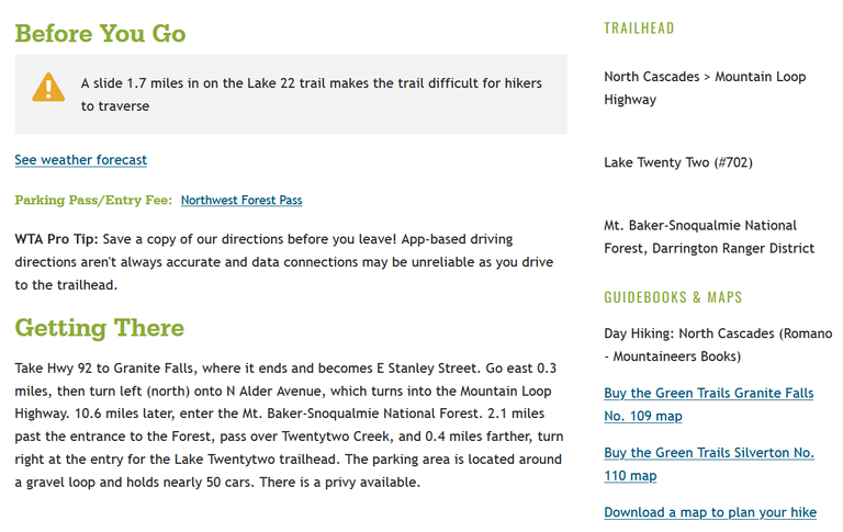
Down at the bottom, you'll find more details like alerts about closures or obstacles on trail, a quicklink to the weather forecast and where you can buy or download maps, as well as the driving directions, or information on taking the bus if that is an option for the trail you're reviewing.
Other things you may want to review in this section:
- Land Manager: The land manager will be listed under the "Trailhead" section.
- Maps: Each hike has an image of a map, which shows where the trailhead is located. The driving directions will take you to this pin.
- Passes and permits: Information about what parking pass you need for the trailhead or if you need a permit to camp overnight.
How to Read Trip Reports
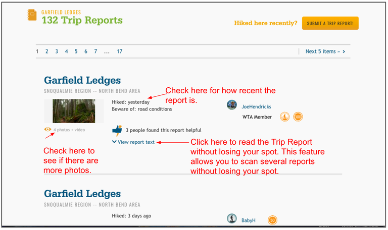
Trip reports are different from Hiking Guide entries: A Hiking Guide entry is the official description of a trail, and it does not change over time. A trip report is the account of one person's experience on that trail on a certain date. At the bottom of each Hiking Guide entry, you can find trip reports, which are helpful for learning about the current conditions. Anyone can write a trip report to share on-the-ground information with their fellow hikers.

Trip reports can be found at the bottom of the Hiking Guide entry. The most recent ones are at the top.
While WTA's Hiking Guide is a wealth of knowledge, it's always a good idea to check with land managers for current conditions, the Northwest Avalanche Center for snow conditions during the winter, and the Department of Transportation for mountain pass road conditions. Do ample research and planning and your hike will be a blast!

