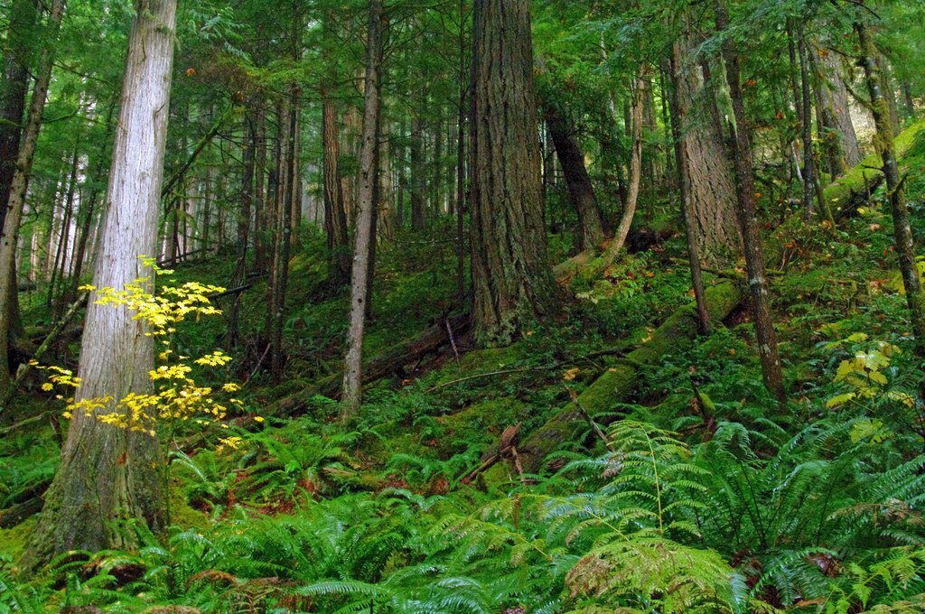

The trail winds its way above the Suiattle River through old growth forest and some mature forest recovering from an old burn from the 1920’s. The vegetation in the upper Suiattle watershed includes a wonderful mixture of west/east species. Along the trail you will see Pacific (western) yew, Douglas-fir and western hemlock, and on the Miner’s Ridge trail, accessible from the Suiattle River trail, you'll see lodgepole pine.
Within minutes of the Suiattle trailhead is the steep, lovely Sulphur Mountain trail. At 0.9 miles is the unsigned intersection with the now-inaccessible Milk Creek trail. There no bridge over the Suiattle River as of October 2014.
At about 3 miles is a commuter campsite (not a destination-camp). It is nice, but there is no water nearby. In early season, expect wet boots at several water crossings on the trail, but later in summer, these are mere rock-hops.
Roughly 6.5 miles in, an impressive log suspension bridge spans Canyon Creek, where there are several nice campsites on both sides of the creek, and pit toilets. At 0.3 miles beyond Canyon Creek, the Suiattle Trail becomes the Pacific Crest Trail. It is worth the 15 minute walk on the PCT south to views of the Suiattle River from the hiker/stock bridge over the River. Further on, the PCT south leads to Mica Lake and Fire Creek Pass in the lap of Glacier Peak, and beyond.
Back on the Suiattle trail, in 2.5 miles, the PCT north intersects with the Miners Ridge Trail (#785) to Miner’s Ridge Lookout, Image Lake and high mountain explorations. Beyond Image Lake lie Lyman Lakes and a multitude of other backcountry adventures.
Suiattle River Trail

-
 Length
- 13.8 miles, roundtrip
-
 Elevation Gain
- 900 feet
-
 Highest Point
- 2,500 feet
Suiattle River Road is closed at the intersection with Suiattle Mountain Road (about 4.5 miles in) due to washout which renders this trailhead inaccessible.
Parking Pass/Entry Fee
Northwest Forest Pass
The trail winds its way above the Suiattle River through old-growth forest and some mature forest recovering from an old burn from the 1920’s. The vegetation in the upper Suiattle watershed includes a wonderful mixture of west-of-the-crest/east-of-the-crest species.
Continue reading
Hiking Suiattle River Trail

WTA worked here in 2022, 2021, 2020, 2019 and 2018!
Map & Directions
 Trailhead
Before You Go
Suiattle River Road is closed at the intersection with Suiattle Mountain Road (about 4.5 miles in) due to washout which renders this trailhead inaccessible.
Parking Pass/Entry Fee
Northwest Forest PassWTA Pro Tip: Save a copy of our directions before you leave! App-based driving directions aren't always accurate and data connections may be unreliable as you drive to the trailhead.


