A Vision for New Columbia River Gorge Trails in Oregon State Parks
This spring Oregon State Parks revealed a draft of their plan to guide the next 20 years of improvements at parks they manage in the Columbia River Gorge. Public comments are due by November 21st so its critical that hikers voice support for the ideas in the plan that will improve and expand hiking opportunities in the Gorge.
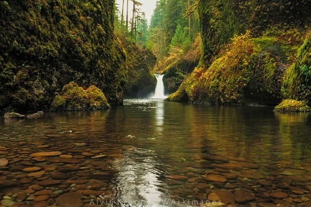
From Eagle Creek to Multnomah Falls, the Oregon side of the Columbia River Gorge is known for its iconic waterfalls, lush forest trails, and soaring cliffs. Oregon State Parks manages 15 state parks with 47 trailheads and more than 150 miles of trails in the Columbia River Gorge.
Local residents and visitors alike treasure the scenic beauty and recreation opportunities found in the Gorge, but that popularity has also meant some trails and trailheads face the increasing pressures of crowding.
A new 20-year plan from Oregon State Parks offers an opportunity to improve and expand hiking opportunities in the Gorge, one which hikers can help shape. The agency unveiled their draft plan in spring, and public comments are due by Friday, Nov. 21.
To add your voice in support of trails, send your comments by email to: gorge.parksplan@oregon.gov.
The plan's vision
The draft plan aims to protect the area's most popular hiking experiences, as well as upgrade facilities to better serve the region's rapidly expanding population. The plan envisions many exciting projects, including additions to 7 of the 34 properties along a 70-mile long side of the Gorge. Many of these ideas incorporate trail improvements supported by the Gorge Recreation Coalition, a group of organizations (including WTA) that works to promote hiking, biking, windsurfing and other recreation in the Gorge.
Read some highlights of the plan below, or the complete draft.
A sample of exciting hiking trail projects in the plan
- At the west end of the Gorge the plan proposes a new hiking trail using an old road grade linking Rooster Rock to Chanticleer Point (Women's Forum Park). In the short term it would be an out-and-back down to the railroad tracks on a route that predates the historic highway. Someday a railroad crossing could allow a link to Rooster Rock making a riverside to cliff top hiking experience showcasing the diverse landscapes of the Gorge.
- Continuing up the Gorge, hikers can expect to see improvements at Latourell Falls State Park where up to six bridges will require replacement during the plan time frame.
- At nearby Bridal Veil Park, a new trail is envisioned that will tie into the Angel's Rest Trail. Planners hope the new route will help alleviate congestion where cars often overflow from the Angel's Rest trailhead onto the shoulders of the historic highway. Plus the addition of approx. 2 miles of trail give hikers another option to hike up to one of the most beloved viewpoints in the Gorge.
- Planners also intend to re-establish the Gorge 400 trail between Ainsworth State Park and John B. Yeon State Park. Although not a destination in itself, this east-west route connects many parks and trailheads throughout the Gorge. Forging this missing link creates a new loop opportunity with Oneonta Gorge, Horsetail Creek and Nesmith Point Trails for more than 15 miles of excellent hiking.
- Another new loop trail called for in the plan adds a mile of trail to the west side of Mitchell Point making a more gradual ascent to the scenic viewpoint or a loop when combined with the existing more direct approach.
- Additional campsites, improved beach access, bicycling facilities and trails, and much more are in the draft too.
Washington Trails Association, Friends of the Columbia River Gorge, Trailkeepers of Oregon and other members of the Gorge Recreation Coalition strongly support these ideas.

What could strengthen the final plan
While WTA applauds the draft plan, the process and the hard work that staff have put in to it, WTA and the Recreation Coalition think there's room for more opportunity to address the critical demand for more and better hiking trails. We hope the final plan reflects the following changes/additions:
- A plan to restore the lower Falls Loop option at Latourell Falls. Once upon a time a bridge made this shorter, family friendly loop possible, but today it is merely a boot path with a slippery log crossing.
- A loop trail at Angels Rest.The plan calls for a new trail at Angels Rest, but we feel that the goal should be to make a loop trail with a preferred direction of travel. At other popular destinations such as Cape Horn and Silver Star Mt., this loop configuration greatly diminish the sense of crowding providing a great hiking experience with relatively little invested in new construction costs.
- A feasibility study of new trails at Bridal Veil. We hope that State Parks will at least include a feasibility study of new trails at Bridal Veil as described by Portland based blogger and trail advocate, Tom Kloster, in his Bridal Veil Canyon Trail Proposal.
Support your favorite trails and share your thoughts by sending your comments by email to: gorge.parksplan@oregon.gov.


Comments