President’s Day Hikes on Federal Lands
Take advantage of federal fee-free day on February 20, and explore a new trail on your public lands.
Approximately 30 percent of Washington lands are managed by our federal agencies, who are charged with protecting signature vistas like magnificent mountain ranges, pristine beaches, open shrub-steppe, and deep, lush forests.
Experiencing those breathtaking places often requires a parking pass or entrance fee, which helps support the trails there. The dollars you spend on passes help employ backcountry rangers and trail crews, whose work helps you enjoy your time outside. These folks stay busy keeping trailheads clean, repairing damage to trails, and educating visitors (among many other tasks), all thanks in part to your pass purchase!
President's Day is one of the days when federal lands cab be enjoyed with or without a pass.
So whether you're embarking on a cross-state adventure or staying close to home, take advantage of February 20, a federal fee-free day, and explore a new trail on public lands near you.
___________________________________________________
Eastern Washington
Goose Butte
Location: Potholes Region
Land Manager: Bureau of Land Management (BLM)
Mileage: 6.0 miles, roundtrip
Elevation: 450 feet
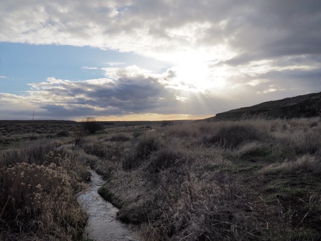
Hike a six-mile horseshoe loop up through the bluffs and along the north side of Crab Creek. Goose Butte offers equally scenic prairie wandering, and boasts a large parking area to boot. To do this route, park on the east end of the lot and look for a two track that leads through a pass gate east of the first cave.
Turnbull National Wildlife Refuge
Location: Spokane Area
Land Manager: U.S. Fish and Wildlife Service (USFW)
Mileage: 5.5 miles, roundtrip
Elevation Gain: minimal
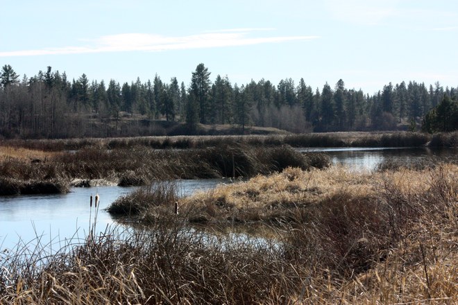
The Turnbull National Wildlife Refuge protects a portion of the Channeled Scablands of ice age flood fame. The refuge has a 5.5 mile auto route through part of it. This makes a comfortable undulating loop for hikers. (Where else can you walk four or five across?). You can also drive or bike the auto route, stopping at the many viewpoints along the way, or do the one-mile , hiker-only Pine Lake Loop.
> Visit Turnbull National Wildlife Refuge
___________________________________________________
Northwest Washington
Baker Lake - Maple Grove
Location: North Cascades
Land Manager: U.S. Forest Service (USFS)
Mileage: 8.0, roundtrip
Elevation gain: 500 feet
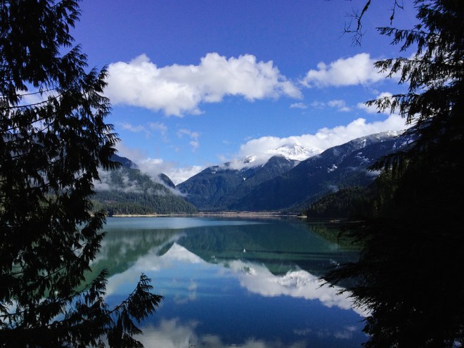
Magnificent old growth forests, stellar views of Mount Baker, turbulent tributaries and of course a big beautiful lake make this trail a great path to travel. Thanks to our blustery winter, you should be able to enjoy some snow on this lowland lake path.
> Visit Baker Lake - Maple Grove
Iceberg Point
Location: San Juan Islands
Land Manager: Bureau of Land Management (BLM)
Mileage: 3.0, roundtrip
Elevation gain: 50 feet
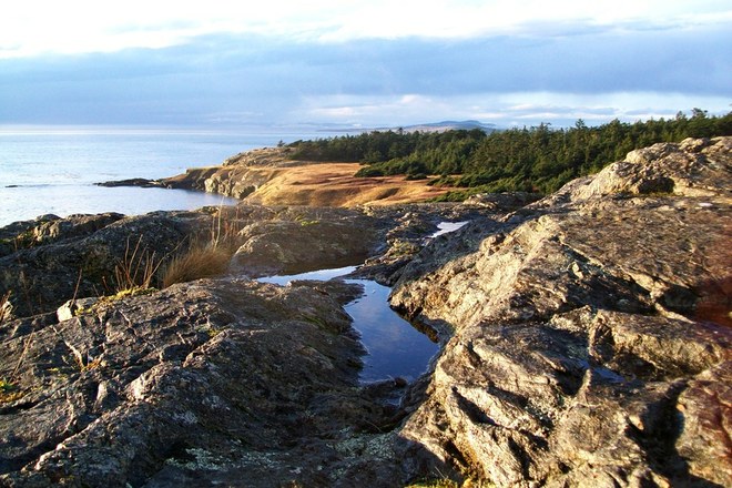
You won't find any icebergs along this coastal loop hike, but views abound. Highlights include some gnarly trees contorted by sea breezes, a warning light for ships on the rocks, views from the cliffs out to the Olympics, and some nearby historical markers.
___________________________________________________
Central Cascades
Middle Fork Snoqualmie River
Location: Snoqualmie Pass
Land Manager: U.S. Forest Service (USFS)
Mileage: 12.0, roundtrip
Elevation gain: 200 feet
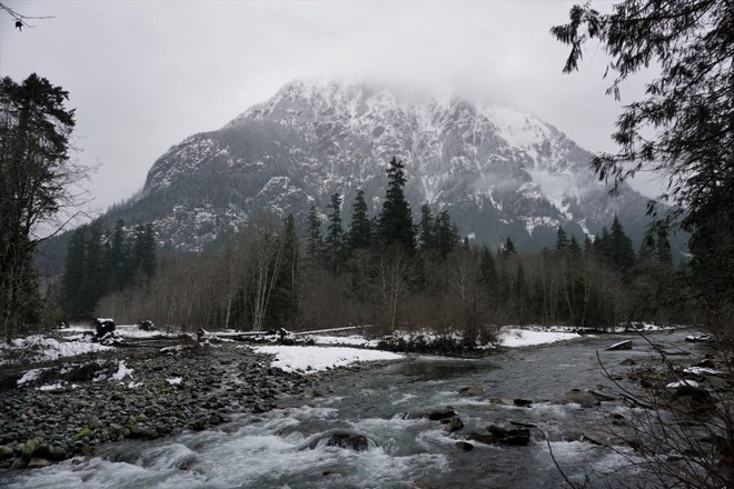
Ramble along a wide riverside trail with peek-a-boo views of rocky peaks disappearing into clouds. The river is your companion the whole way, chattering and changing with each bend. It's a lovely low-country trail, but there will likely be snow, so be sure to pack some extra traction.
> Visit the Middle Fork Snoqualmie River
___________________________________________________
Olympic Peninsula
Dry Creek
Location: Hood Canal
Land Manager: Olympic National Forest
Mileage: 6.0 miles, roundtrip
Elevation gain: 800 feet

Follow gently climbing trail through a lush second-growth forest along the shore of Lake Cushman. Past the shores, it turns away from the lake and begins climbing in earnest, so you'll get a nice lakeside ramble as well as a bit more of a workout on this hike.
Maidenhair Falls
Location: Olympic Peninsula
Land Manager: U.S. Forest Service (USFS)
Mileage: 1.0 miles
Elevation gain: minimal
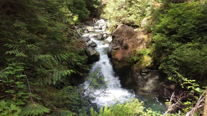
The trail to Maidenhair Falls is proof you don’t have to hike long distances to see beautiful scenery. A mere half mile from the trailhead, this waterfall and its gorge is sure to delight. Despite the trail's low elevation, you may still see some snow here.
___________________________________________________
Southwest Washington
Willapa National Wildlife Refuge – Art Walk
Location: Long Beach
Land Manager: U.S. Fish and Wildlife (USFW)
Mileage: 0.25 miles, roundtrip
Elevation: minimal

This short hike is packed with lovely art installations that will keep hikers of all ages entertained.The trail heads uphill from the parking lot and traverses along a forested ridgeline, crossing a staircase cut into a downed tree before descending into a valley bottom and meandering along a creek. Pass a labyrinth (and take a moment to explore it) before arriving back at the parking lot.
>Hike Willapa National Wildlife Refuge - Art Walk
Volcano View Trail
Location: Mount St. Helens
Land Manager: U.S. Forest Service (USFS)
Mileage: 1.6 miles, roundtrip
Elevation: 400 feet
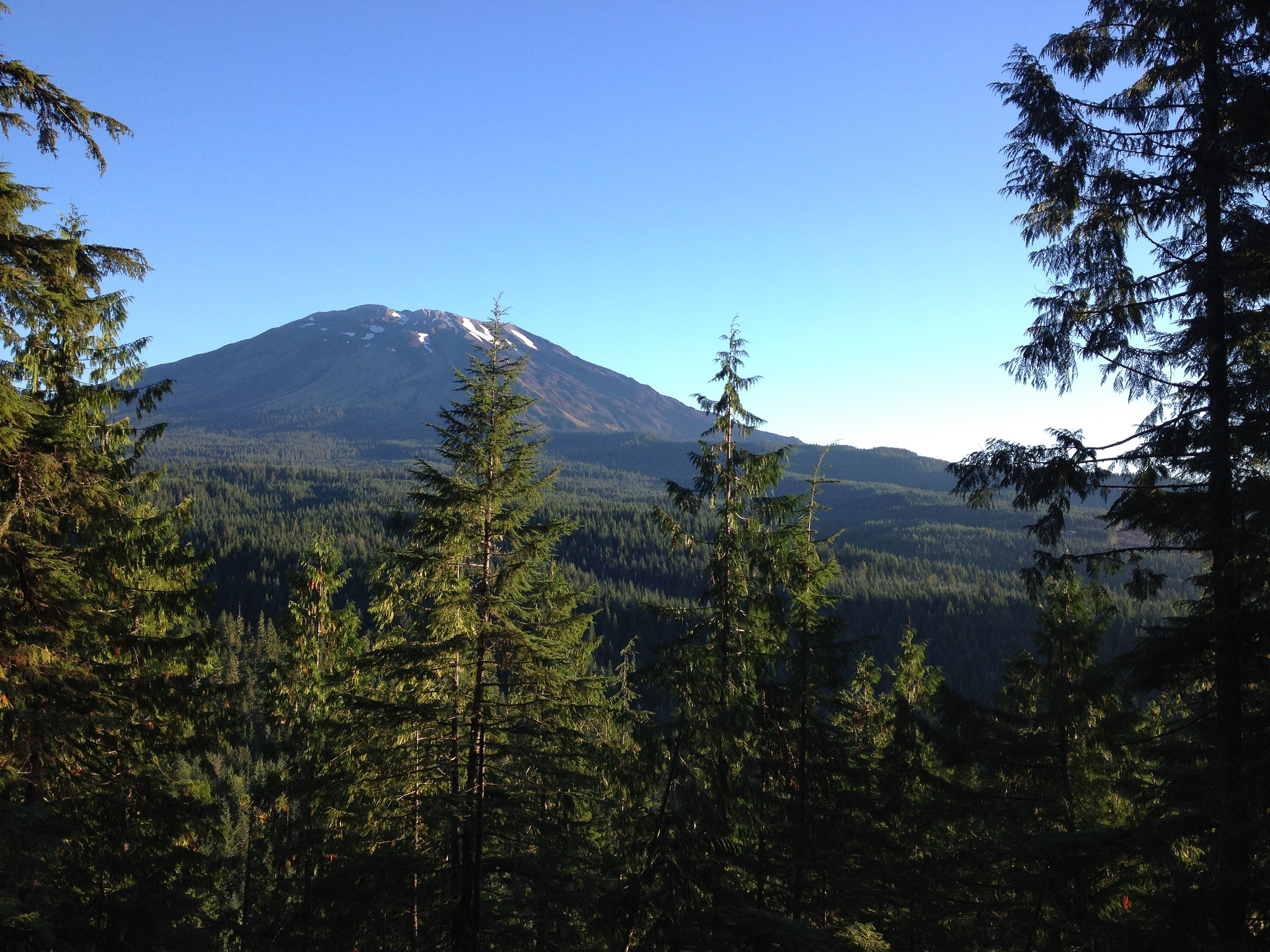
The Volcano View Trail offers hikers of every age a mile-long nature trail that curves around stumps, boulders and hemlocks. Kids will marvel at the western hemlock saplings that spring from the ancient stumps. This twist in the trail was intentional. WTA and land managers who laid out the trail wanted to show hikers a glimpse of the future; the saplings of today will be the magnificent trees of tomorrow.
> Visit the Volcano View Trail
___________________________________________________
Snowshoe Hikes
Glacier Vista Snowshoe
Location: Mount Rainier - Paradise
Land Manager: National Park Service
Mileage: 3.0, roundtrip
Elevation: 700 feet
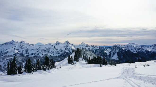
Phenomenal views are standard on this 3 mile trek (if the weather cooperates). Perched on the shoulder of Mount Rainier with views of Mount Adams, Mount St. Helens, and the toothy Tatoosh Range, it's hard to pick the best view for your lunch break. You'll need snowshoes for this one.
> Visit the Glacier Vista Snowshoe
Eightmile Creek Snowshoe
Location: Leavenworth area
Land Manager: U.S. Forest Service (USFS)
Mileage: 12.4 miles, roundtrip
Elevation: 2600 feet

Grab some snacks and hot chocolate for this strenuous snowshoe just outside of Leavenworth. On this route, there are plenty of opportunities to gaze at snow-capped peaks, and unique ice formations that cover this trek. 12 miles too much? You can also try the much shorter Tumwater Pipeline Trail for a shorter day.
Comments