Wildfire Updates: New Closures and Alternative Hiking Options
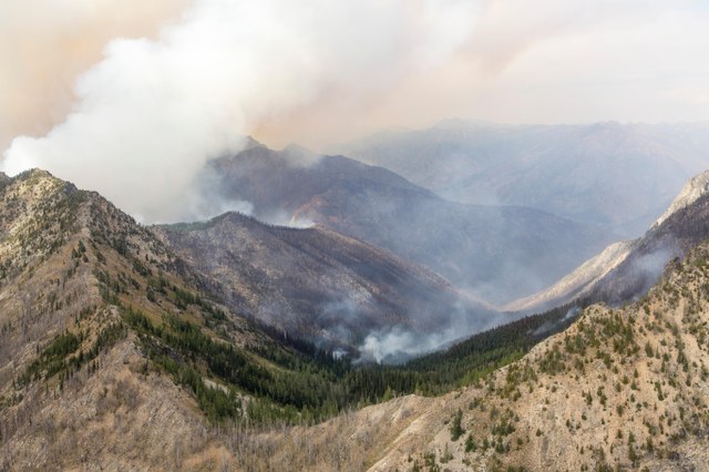
August has been a difficult month for firefighters in Washington, as wildfires have spread rapidly on the eastern side of the state. Get the latest info on trail closures and where you can go to avoid the smoke.
Update 9/4/2015: Several trail closures have been lifted for the upcoming long weekend. Here's what you need to know:
Highway 20/North Cascades
Rain and higher humidity reduced the amount of fire activity throughout the North Cascades National Park, and Highway 20 is now fully open. The North Cascades Visitor Center and most trails on the west side of North Cascades National Park Service Complex are open.
Okangan-Wenatchee National Forest
The Pacific Crest Trail (PCT) has been reopened. The nearby Wolverine Fire is still active, but the area closure area has been retracted to allow the PCT to reopen from Steven's Pass to the Stehekin Valley.
The closure order for many trails north of Highway 2 on the Wenatchee River Ranger District has been lifted. Howeverm a closure remains in effect for trails out of the Chiwawa Basin and lands in the area north of the Chiwawa Loop Road, east of the Beaver Valley Highway and Chumstick Highway to Merry Canyon.
Take a look at this map (pdf) for the new closure area around the Wolverine Creek fire.
Burn bans still in effect
Burn bans are still in effect on the Okanogan-Wenatchee and Colville National Forests, and in parts of the North Cascades National Park Complex, Mt. Baker-Snoqualmie, Gifford Pinchot, and Olympic National Forests, and on state park lands in Eastern Washington.
Not sure if you can have a fire where you're headed this weekend? Call the ranger station. If there's no burn ban in effect, enjoy your campfire responsibly. Read our tips from a previous blog.
______________________________________________
For more fire news, check out the information in our previous entry.
The first half of Washington's summer started as a relatively normal year for wildfires, but low snow levels this past winter and abnormally warm temperatures are finally bearing out into one of the worst wildfire seasons in recorded memory. August has produced a few large blazes and a number of smaller fires, threatening communities, burning trails and blanketing Washington in smoke.
Wildfire resources
Hiking in wildfire season can be unpredictable, so knowing what to do in the event that a fire crops up near you will help keep you safe. As always, we recommend picking hikes that are far away from any current fires due to their unpredictable nature, and it may help to review these tips before you head out.
- Resources for those impacted by the fire
- Check wildfire conditions and closures on Inciweb
- Follow #WAwildfire on Twitter
- Wildfire smoke and air quality updates
- Active fire map
Latest fire closures
Below are some of the more recent area closures. With forest and responder resources stretched to their max, please help out the statewide firefighting efforts by avoiding hiking in these areas and by managing your own risk. (We've got some suggestions of where you might want to hike below.)
- Okanogan-Wenatchee National Forest - All National Forest lands north of Highway 2 on the Wenatchee River Ranger District are now closed to public entry. This is in response to severe fire danger in the area.
- Mount Adams Wilderness - As of August 24, 2015, the Mount Adams Wilderness is closed due to the Cougar Creek Fire. This closure includes Mount Adams summit climbs.
- Cascade Pass - The Cascade Pass Trail from its junction with the Horseshoe Basin Trail to the junction of the Upper Stehekin Valley Trail with the Flat Creek Trail is closed. Basin Creek and Cottonwood camps are also closed. The Trapper Lake area is also closed at this time.
- Chiwawa Valley - With the Wolverine Fire's spread, the area northwest of Grouse Creek Group Campground at the Chikamin Road junction is closed and includes the entire Chiwawa River drainage, trails, and campgrounds.
- Wolverine Fire - Large sections of the Okanogan-Wenatchee National Forest are closed near Lake Chelan due to this fire. See map for closure areas and check InciWeb for updated info.

How you can help
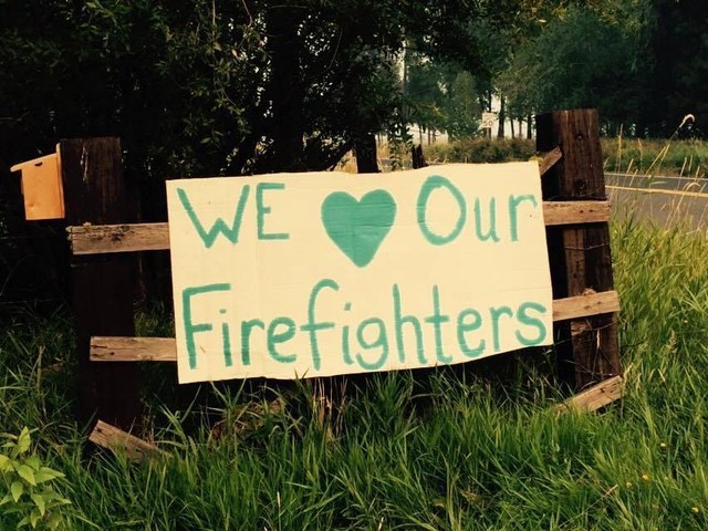
Though the wildfires impact the lives of everyone in Washington, they especially effect the people living in fire-stricken areas and the women and men fighting the flames. Learn more about how you can provide aid or donate to these individuals and organizations in Washington.

Smoke-free hikes
If you're looking for a hike away from the wildfires and smoke, check out one of these options:
- Discovery Park - This Seattle park is home to a great network of trails that span from meadows to the beach.
- Second Beach - If you want to avoid smoke, heading west is probably your best bet. Second Beach is a great 4 mile hike with incredible views.
- Deception Pass State Park - Deception Pass offers great trails and water views, and with a bit of wind, should be smoke-free.
You can also use our Hiking Guide to find a hike near you. Check out the Olympic Peninsula and Puget Sound regions for some of the best conditions in avoiding wildfire smoke right now.
Good news
Despite all the fires, there is some potential good news for the weekend. Forecasts are predicting large amounts of rain (around 2 inches in areas) to fall in the mountains and Puget Sound area, which will hopefully curb some of the currently active fires.


Comments