

Hike a loop around Anti-Aircraft Peak in the Cougar Mountain Regional Wildland Park. Hike past sites associated with coal and clay mining, and a former 1950s-era anti-aircraft missile installation. Enjoy good forest trails, some seasonal wildflowers, and a million-dollar view.
The 1,483-foot "peak" is one of the high points in Cougar Mountain Regional Wildland Park. The name dates from the cold-war era of the 1950s, when a battery of Nike anti-aircraft missiles and its associated radar was installed here as a defense against manned bombers. Later, in the era of inter-continental ballistic missiles, the Nikes became obsolete and were removed, but the name of the peak stayed on.
In addition to the military history, the Cougars were the site of extensive logging, coal mining and brick clay mining. Sites for all these activities can be visited on this hike.
The park has a complex network of trails, and a map is essential. You can download a brochure from King County Parks. A good map is on Page 2 of the brochure.
Since June 2016, there have been some name changes in the park. The trail signs are current, and the downloadable map is up-to-date. But the complimentary map often available at the trailhead may not be. And, as of Spring 2017, even fairly recent maps and guide books may show the old names. The changes will be noted below to minimize confusion.
Begin your hike at the Sky Country Trailhead. Leave the parking area, return to Clay Pit Road and hike up the road. The road is used only by occasional park vehicles, so traffic will be light to non-existent.
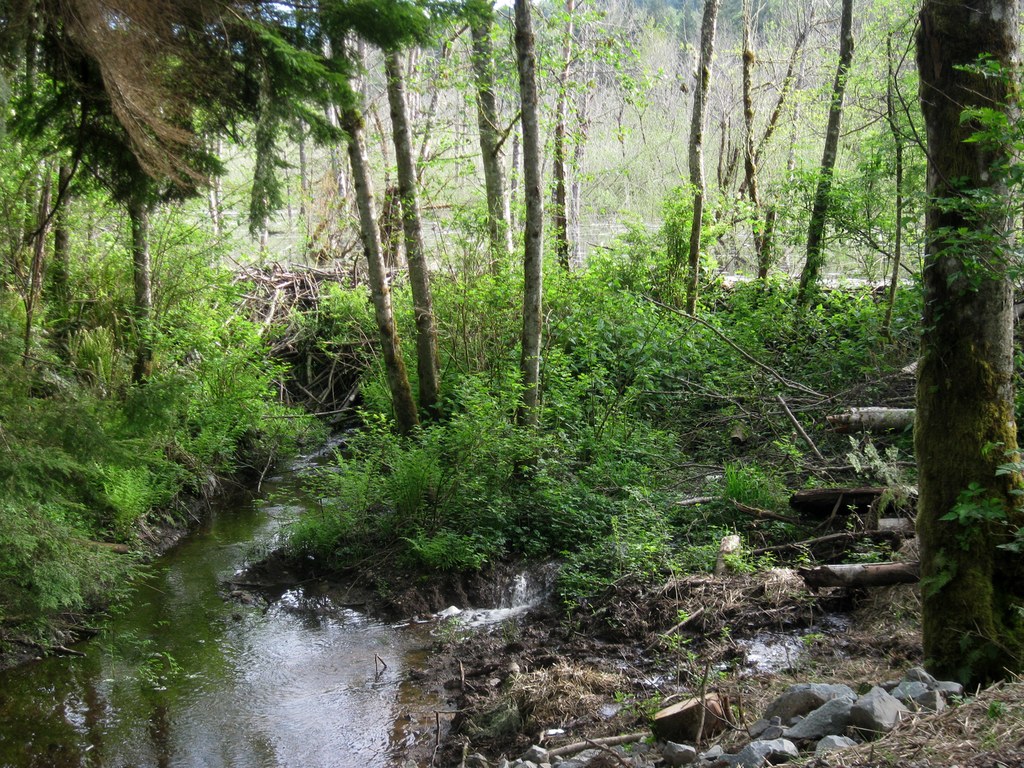
Pass the junction with the Coyote Creek Trail and continue on the road. As you cross the North Fork of Coal Creek, note the impressive beaver dam just upstream that backs water into the Klondike Marsh.
At the next trail junction turn left onto the signed Klondike Swamp Trail and hike it though to a T-junction with the Coyote Creek Trail. (You will pass the Lost Beagle Trail on the way.) Turn right at the T-junction, and then turn right again when you reach the Shangri La Trail.
At the side trail to Radar Park just stay left on the main trail and soon you will find yourself following the fence on the east border of Radar Park. At the south end of the park, information boards offer old photos and historical commentary about the radar and the Nike missiles that once were installed near here.
The trail continues on to the Harvey Manning Trailhead (Prior to June 2016, this was known as the Anti-Aircraft Peak Trailhead. The name was changed to honor Harvey Manning, whose efforts led to the creation of the park.)
Across the parking lot to the east a short signed trail leads to the "Million Dollar View." It's worth checking out, particularly on a clear day when Mount Baker may be visible. A pergola and picnic tables are available at the viewpoint.
Return to the Harvey Manning Trailhead and head south on the Harvey Manning Trail. Like the trailhead now bearing his name, this trail was formerly the Anti-Aircraft Ridge Trail.
When you reach Cougar Pass, turn left on the signed Cougar Pass Trail. Follow this trail to the Tibbetts Marsh Trail, turn right, and follow that trail to the end of Clay Pit Road.
An information board here offers photos and comments about the clay that was mined for many years (until 2015) to make bricks.
As of Spring 2017, many guidebooks and maps - including the downloadable map - indicate that the clay pit area offers "No Public Access." Actually, the former clay pit has been gently re-contoured and planted with native vegetation. The former gate and No Access sign have been removed, and now nothing prevents hikers from exploring the area.
When you are ready, head back west on Clay Pit Road and, in 0.1 mi, note the Mine Shaft Trail on the left. It's well worth the short side trip to check it out. The shaft itself (actually an air shaft used to ventilate the Primrose Mine farther down the mountain) is covered with a heavy steel mesh. When the mine was operating, the shaft would have been covered with a building housing a large blower. An information board here offers more historical detail.
Return to Clay Pit Road. You have the option of following the road all the way back to the trailhead, although there is a more scenic option that adds almost no additional distance: Refer to your map. Then go left at Fred's RR Trail. Almost immediately go right on the Bypass Trail. Go right again on the Cave Hole Trail, then left on the Old Man Trail and right on the concrete road. This will return you to the Sky Country Trailhead where you began your hike.
The scenery along your route today is not highly variable. The entire area was logged many years ago. There are occasional stands of large firs, and many smaller trees.
In spring be alert for wildflowers such as trilliums, yellow violets, avens, bleeding heart, fringe cup, youth-on-age, miner's lettuce, salmon berry, false Solomon's seal, buttercup, and Oregon grape.
You may see a few squirrels on your hike, and deer or elk sightings always are possible. Particularly in the spring, you are likely to hear a lot of bird songs.

 Trailhead


