

This trail makes a pleasant weekday hike for those with creaky knees, as it is not difficult. At the lakes, established campsites with fire pits, benches and tent platforms await a weekend of camping with the kids.
The trail starts out following an old logging road, the once open space filling in with a young forest understory of ferns and huckleberry surrounding the small trees. Take a moment to read the nice, somewhat hidden trailhead kiosk with information about the Morning Star Natural Resources Conservation Area. This is a special designation to protect ecologically significant areas
The old roadbed path is lined with bunchberry (white dogwood-like flowers and red berries to come later), foamflower and false lily of the valley. In a half mile, come to a plank bridge over a brackish creek. Enter a more mature forest missed by the chainsaw, where the true trail begins. Come to the first boardwalk, a long path over a bog with some Jurassic-sized skunk cabbage growing in the mud. After crossing the boardwalk, the trail will start to climb a small ridge. Once at the top, you have reached a high point and will begin to drop down into the lake basins.
After descending the ridge, come to a fork in the trail. The left fork heads a short distance down to the shores of Beaver Plant Lake, at just under two miles from the trailhead. The right fork continues on to Upper Ashland Lake. Take the path to Beaver Plant Lake and drop down to the shoreline. There is a boardwalk that heads a short way to a nice bench perched on a platform, and a good view of the lake. The lake here is very green as the edges are slowly being reclaimed as a grassy marsh. Look for the pink flat-topped flower clusters of rosy spiraea, a low shrub that grows in the moist rocky soil. There are a couple of camp spots back in the trees with a bench and fire pit.
After checking out the lake, head back up to the intersection and follow the trail as it heads past Beaver Plant. Between the two lakes, come to an intersection with the old Bald Mountain trail on the left. This was once an established trail that followed the ridgeline past Bald Mountain to Cutthroat Lakes, but is no longer maintained. Stay to the right and in a quarter mile reach Upper Ashland Lake and more boardwalk. Keep your boots dry by following the boardwalk along the length of the lakeshore. Notice a pink flower with five petals in an open cup, blooming in early summer. Those from the east coast may recognize the flower. It is western bog laurel, a close cousin of the eastern mountain laurel. It prefers an acidic, peaty soil and grows happily here with the huckleberries. At the end of the lake is an intersection, with campsites to the right and the trail leading down to Lower Ashland Lake to the left.
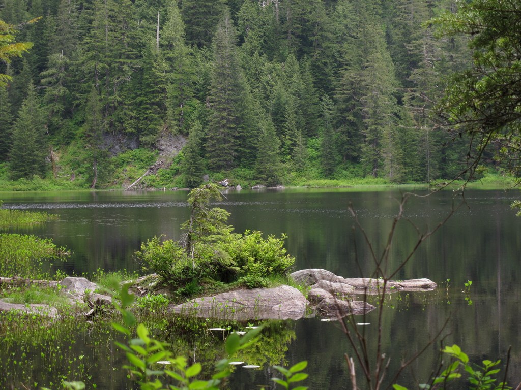
Lower Ashland Lake is the biggest lake and the most scenic. You will descend to the lake on a rooty trail, losing a couple hundred feet of elevation. Mostly forested, you can still partly see the cliff face on the other side. Once at the lake, the trail follows the lakeshore to the other end and a nice camping area with two tent platforms, a fire pit and log benches. Notice a couple of nice, large rocks close to shoreline. If the bugs aren’t too bad and you don’t mind wading in a bit of mud to get there, you could take a nice dip in the lake. There are some interesting white flowers growing in the shallow muddy water you may notice on the way. Called buckbean, the flowers have hairs on the inside of the petals and the smell is not the best.
The trail continues a short ways to the end of the lake and a picturesque little bridge that crosses the outlet creek. The middle of the bridge is a great vantage point for viewing the whole lake. The trail continues to a platform on the opposite side of the lake and stops. Enjoy your lunch here or back by the fire pit.
WTA Pro Tip: In previous guides, the trail down to Twin Falls has been mentioned. The trail is now deemed hazardous and is closed. Should it ever be re-established it will be worth a visit, but for now, please respect the request of the Forest Service and save the hike for when the trail reopens.

 Trailhead


