
The 2.2-mile trail to Barclay Lake starts directly from the parking lot, heading east-southeast through an area that has recovered from clear-cut status. For most of its course, the trail follows the path of Barclay Creek, which is tucked into a narrow valley between Gunn and Merchant Peaks to the north and Baring Mountain to the south.
Because this trail is popular (consider going on a weekday to avoid the crowds), and the area receives 150-200 inches of precipitation each year, WTA has performed trail maintenance to build turnpikes and drainage structures to ensure a passable route. Nevertheless, you may encounter muddy or watery spots along the way. Barclay Lake was not included in the Wild Sky Wilderness because of its historical use by groups larger than those permitted in wilderness areas. This makes it a great destination for Boy Scout troops, extended families, and other large outdoor outings.
The trail gains a net 200 feet of elevation over its course to the lake, though there is enough up-and-down to keep you from getting bored. You will see Douglas firs, western hemlocks, and red cedars, some of which are surviving old-growth specimens. Watch for mushroom species, maidenhair ferns, queen’s cup, trillium, salmonberry, and bunchberry. If you look up, you will catch peek-a-boo vistas of the mountains to the north.
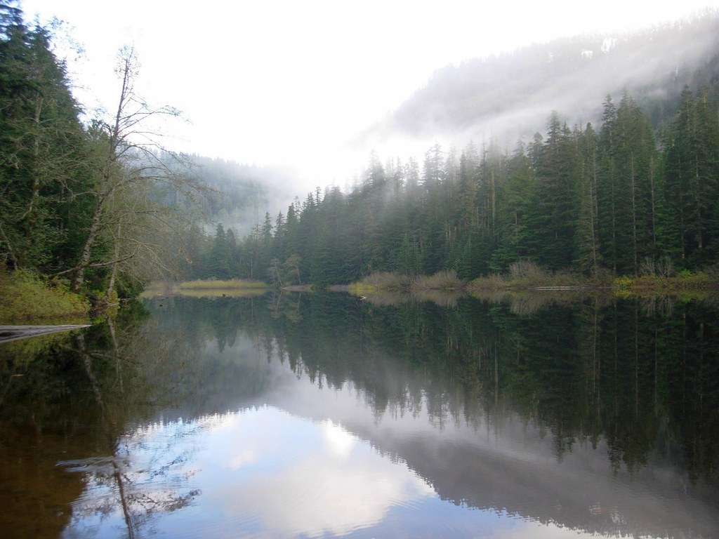
At the 1.2-mile mark, cross over Barclay Creek on a log bridge with a single railing. Use caution, as the bridge may be slippery. Continue 0.5 miles and reach Barclay Lake’s north shore. Baring Mountain’s precipitous and rocky northern face suddenly dominates the view. Take in the reflections of evergreens, sky, and Baring in the lake’s peaceful waters.
Depending on the time of day, you are likely to encounter campers or fishermen, or perhaps even be one of them! The trail continues 0.5 miles along the lake’s north shore for those who want their full 2.2 miles and additional perspectives of Baring.
Barclay Lake

-
 Length
- 4.4 miles, roundtrip
-
 Elevation Gain
- 500 feet
-
 Highest Point
- 2,423 feet
Barclay Lake offers something for almost everyone: a well-maintained trail that is accessible to beginners and children, stunning mountain views, mycology, camping, a serene alpine lake, and a staging area for challenging adventures in the 106,000-acre Wild Sky Wilderness. Keep your camera charged, as this popular pathway in the shadow of Baring Mountain offers many photo opportunities.
Continue reading
Hiking Barclay Lake

WTA worked here in 2025, 2024, 2022, 2021 and 2019!
Map & Directions
 Trailhead
Before You Go
Parking Pass/Entry Fee
Northwest Forest PassWTA Pro Tip: Save a copy of our directions before you leave! App-based driving directions aren't always accurate and data connections may be unreliable as you drive to the trailhead.
Getting There
From Monroe, head east on US-2 to the town of Baring. Near milepost 41 and across from a convenience store, turn left (north) onto 635th Place NE. Cross the railroad tracks and continue 0.3 miles. Reach a junction and keep left on 635th Place NE for 0.1 mile. The road becomes FR-6024; continue 3.9 miles to the trailhead. Watch for potholes. There is a privy at the trailhead and parking for about 20 cars.


