
Everything that makes a river hike fun is here, cool bridges, waterfalls, big trees, lots of dripping moss, and mushrooms.
Start out in woods just south of the railroad trestle. Forget about the busy highway and the railroad as you enter the Alpine Lakes Wilderness in a quarter mile. Just a little farther down the trail, cross Deception Creek on a beautiful log bridge. With carved steps leading to a wide footbridge with a hand railing, kids will love this one! Across the creek, large boulders make a nice place to rest and throw rocks in the water.
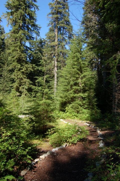
Once across the creek, continue hiking through magnificent old-growth forest. The trail leaves the river now and heads up and over the cliff. You can hear the river below as you switchback up through moss-covered boulders and ferny undergrowth. This mossy forest floor is home to many types of plants. Look for the showy white flowers of trillium in spring.
In addition to the more traditionally recognizable flowers, plants with no chlorophyll that live on decaying organic matter thrive here. Watch for a ground-hugging leaf with a white stripe down the middle: the rattlesnake orchid. Come back in the summer and look for its bloom, tubular white flowers on a short stalk. The forest floor also is home to a colorful saprophyte called pine drops, whose flowers are salmon-yellow urn shaped flowers on an orange stem. Another saprophyte, pinesap, is similar in color but shorter. In the fall this same forest floor will also support a variety of mushrooms.
The trail drops down a little to a nice campsite, and short of three miles, there will be another log footbridge. Cross the bridge over Sawyer creek and notice the abundance of huckleberry bushes. Pick a few to add to pancakes. If you're camping, this is a reminder to bearproof your food in your site-they like the berries as much as you do.
Continue on as the trail takes a gentle up and down course along the ridge. As you approach the river again, listen for the loud roaring sound that indicates a waterfall. The river falls in several short steps, reaches a narrow chasm, then churns through it. Picture time! Play with your camera settings and try to capture it in motion, but be careful when lining up the shot; the drop off is steep and the moss slippery.
Once you pass the waterfall the trail drops down, breaks out of the woods and into an old avalanche ravine. Here may be some views of the surrounding peaks, if the weather is cooperating. Keep heading down along the flats and reach the river again in five and a half miles. There will be a trail junction and a sign. The right side climbs the ridge to Sawyer Pass and Tonga Ridge. Follow the left fork to some nice campsites along the river. Eat lunch here and call it a day, or proceed along with a backpack to meet the Pacific Crest Trail at Deception Pass or Deception Lakes.
WTA Pro Tip: No hike along the Highway 2 corridor would be complete without a stop at Zeke’s Drive In for a burger and shake.
Deception Creek

-
 Length
- 11.0 miles, roundtrip
-
 Elevation Gain
- 1,200 feet
-
 Highest Point
- 3,150 feet
Everything that makes a river hike fun is here, cool bridges, waterfalls, big trees, lots of dripping moss, and mushrooms.
Continue reading
Parking Pass/Entry Fee
NoneHiking Deception Creek

WTA worked here in 2023, 2022, 2021, 2014 and 2012!
Map & Directions
 Trailhead
Before You Go
Parking Pass/Entry Fee
NoneWTA Pro Tip: Save a copy of our directions before you leave! App-based driving directions aren't always accurate and data connections may be unreliable as you drive to the trailhead.
Getting There
Head east toward Stevens Pass on Hwy 2. Eight miles past the town of Skykomish, begin looking for a right-hand turn. One-quarter mile past the Deception Falls Interpretive Site (on the north side of the highway) look for the narrow, brushy turnoff for FR 6088.
Follow the road under a railroad trestle to the end and trailhead. There is room for about 10 cars. There are no toilet facilities.


