
In spring, due to the popularity of this trail, a permit is required for each person hiking the trails on Augspurger or Dog Mountain on weekends and Memorial Day. Note that parking is limited at the trailhead. The spring hiking permits are required in addition to a parking pass. Having a hiking permit does not ensure a parking spot.
The hike begins with a heart-thumping one-half-mile climb through a wooded area to a junction. Turn right and continue your uphill trek. Soon, you will be treated to glimpses of the Columbia River through the foliage. During the spring, you may also come face-to-face with wildflowers on the hillside next to the trail.
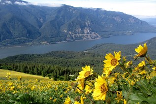
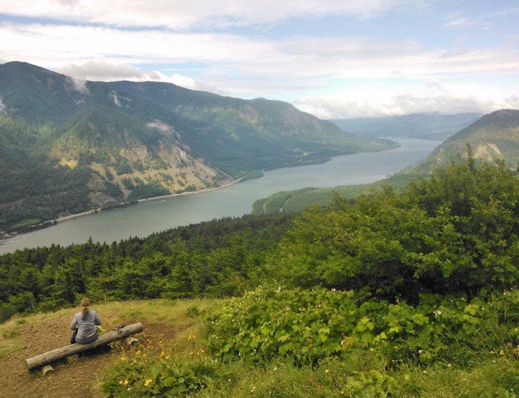
One mile past the junction, the trail comes to a viewpoint where you get a panoramic view of the Columbia River, Wind Mountain and the top of Dog Mountain. This makes a good picnic spot and turnaround point for a shorter hike.
After enjoying the viewpoint, resume your uphill ascent for a half-mile to the second trail junction. Bear right and head up another half-mile to the site of a former fire lookout. The lookout was built in 1931 to watch for fires across the river in the Mount Hood National Forest. The wide openness makes this an excellent spot to pause and take in the scenery.
From the lookout, it is only a half mile to the top of the meadow. This portion of the hike is out in the open and very picturesque. However, you’ll need to turn your focus from the scenery to your feet as you skirt the top of a cliff. It can also be quite breezy, so be prepared for gusty winds.
Getting to the top is a cause for celebration, and you may be greeted by a swarm of people buzzing with excitement after having made the rigorous climb. This is not a spot for quiet introspection. Instead, join the party-like atmosphere and savor the view.
Retrace your steps to return to the car. You can also make this a loop hike by coming back down the Augspurger Mountain Trail. This adds 0.9 mile to the hike, but is more knee-friendly and provides additional views of the Columbia River. A tenth of a mile down from the top of the meadow, take the trail to the right. Continue for 1.1 miles to a junction. Turn left and follow the trail 2.7 miles back to your car.
WTA Pro-Tip: The perfect way to end your Dog Mountain experience is to stop in Stevenson, Washington, just a 15-minute drive away, where you can find cafes, restaurants, gas and even lodging.

 Trailhead