Downey Creek
This trail is the access to Bachelor Creek Trail #796, Bachelor Meadows, Cub Lake and the Dome Peak area. The trail starts on the north side of FR #26 opposite a large parking area, on the east side of Downey Creek just beyond the Downey Creek Bridge.
The trail makes a few switchbacks and gains 300 ft. elevation as a warmer-upper, but from then on proceeds with a gentle slope and a few ups and downs in between. After half a mile, the trail enters the Glacier Peak Wilderness. 
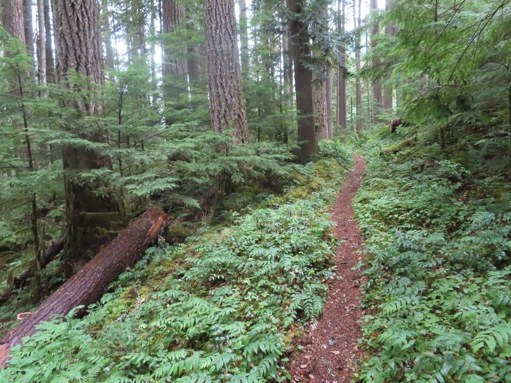
The trail stays above Downey Creek for most of its length, but does meet the creek and follow it for a few hundred yards at several scenic places. The old growth Douglas trees in this area are impressive, but can constitute formidable obstacles when fallen and blocking the trail. At one point opposite an avalanche chute, dense forest has re-grown where it was wiped out by an avalanche thundering down from Green Mountain - the momentum carrying he debris high up on the opposite slopes. The trail crosses five tributaries to Downey Creek before reaching Bachelor Creek at 6.6 miles, elev. 2400 ft. The last of the five creeks (the one draining Downey Lake and Pilot Lake) may be difficult to cross in the spring because it carries a lot of water. There are four possible camp sites along the trail before reaching the location of the former shelter at Bachelor Creek (mp 6). All on the west side of the trail. The quality of the campsites improve increasing distance from the road. The first flat spot at mp 1.6. is not much of a camp site, at a ridge just before the first tributary crossing. Two larger camp sites are at mp 3.0 and 3.5 and the best one is small and hidden right by the bank above the creek at mp 4.0. In case you wonder what happened to Downey Creek Campground shown on old maps, it got washed out by high water in the creek. Remnants of the campground and an outhouse can be seen on the west shore of Downey Creek. There are two walk-in tent camp sites in the old campground above the road and one messy site below the road on the west shore of the creek.
Driving Directions:
Drive Highway 530 north from Darrington or south from Highway 20 near Rockport. Turn east on FR #26, the Suiattle River Road and drive to a parking lot on the other side of Downey Creek bridge, approximately 20 miles from Highway 530. Recent Trip Reports
Hiked here recently?
Submit a trip report!
There are
30
trip reports for this hike.
See all trip reports for this hike.
Huckleberry Mountain, Green Mountain, Downey Creek, Suiattle River, Sulphur Creek, Sulphur Mountain, Milk Creek
— Sep 07, 2010
— Washington Trails Association
Day hike
Issues:
Road to trailhead inaccessible
Expand report text
Hide report text
Read full report
The Forest Service is closing sections of the Suiattle Road (Forest Service road 26) to vehicle traf...
The Forest Service is closing sections of the Suiattle Road (Forest Service road 26) to vehicle traffic for culvert replacement upgrades. Each closure will stop traffic coming from Darrington blocking access to Glacier Peak and the Pacific Crest Trail (PCT). The Suiattle will close at milepost 2 from Sept. 7-10. It will close at milepost 4.2 twice, from Sept. 13-24 and again from Sept. 27-30. Then, there will be periodic daily closures from Oct. 4-30.
“The Suiattle Road is the main access in the area for hikers going into the west side of the Glacier Peak Wilderness,” said Gary Paull, wilderness and trails specialist. "The Suiattle Trail connects to the Pacific Crest Trail and other trails leading to popular destinations of Trinity and Holden Village in the Okanogan and Wenatchee National Forests, Stehekin in the North Cascades National Park. Mountaineers planning on the famous Ptarmigan Traverse need to be aware that the road closure will be 20 miles down the road from Downey Creek Trailhead where they exit this route." For updates on the Suiattle Road closures, call the Darrington Ranger District at 360-436-1155.
Downey Creek #768,Bachelor Creek to Cub Lake,Dome Peak
— Aug 10, 2006
— honeybee and drone
Day hike
Issues:
Blowdowns | Overgrown
Expand report text
Hide report text
Read full report
Downey Creek trail was in good condition except for a few downed trees which were easy to negotiate....
Downey Creek trail was in good condition except for a few downed trees which were easy to negotiate. It is not maintained for stock although someone had taken in one or more horses which punched through numerous places in the trail and obviously had some issues and couldn't get to Bachelor Creek. This is definitely not a trail for horses. It is a nice trail through forest. At Bachelor Creek we headed up on a climber's track which had multiple blowdowns. Also lots of brush which left our boots soaked even though it wasn't raining. After crossing Bachelor Creek where some kind soul had marked the way with surveyors tape we encountered a very overgrown trail. This is the way out for Ptarmigan Traverse travelers and many have missed this overgrown trail and suffered mightily. I see why. The trail is there and climbs immediately from Bachelor Creek. The boot track is there though brush overgrowth has covered it in many places. It is easy to go wrong so if you don't have a good boot track you are most likely not on the trail. Coming out into a nice camp site by Bachelor there is a large boulder where the trail comes in or goes out depending on your direction. Heading further up we encountered an area that has had a massive avalanche/s. We were able to follow the trail through the slide and found later that others had crossed the creek and gone up through the old growth by the perimeter of the slide. The blow-downs were not difficult to negotiate although we did take our packs off once or twice to crawl/slide under logs and we came out this same way. The rest of the way was easy to find. Good huckleberries especially going down into Cub Lake. We camped here for several nights, attempted to climb Dome Peak---got to the top of the glacier and pooped out. Challenging talus---loose and large in places---snow fields not hard to travel on. Used crampons in the morning on one steeper snow field. Snow was soft coming out. Crevasses obvious and not difficult to step over or avoid. Great views of Glacier Peak and very few people. Most finishing up the traverse. No bugs to speak of. Wonderful to be out and away. Day hike
Issues:
Blowdowns | Water on trail
Expand report text
Hide report text
Read full report
with photos
Excellent weekend backpack -- my girlfriend and I saw no other people on the trip, though we did see...
Excellent weekend backpack -- my girlfriend and I saw no other people on the trip, though we did see a black bear on the forest service road leaving Sunday.
Downey Creek #768
— May 21, 2006
— Foist
Day hike
Issues:
Blowdowns | Mudholes | Water on trail
Expand report text
Hide report text
Read full report
I was thinking of doing a backpack Sunday-Monday and try out a new tent (Tarptent Rainbow, very cool...
I was thinking of doing a backpack Sunday-Monday and try out a new tent (Tarptent Rainbow, very cool), but the lousy forecast for tonight and Monday deterred me. I made it a day instead.
Verlot Area/Mountain Loop Trail Heads
— May 06, 2006
— Deputy Rasar,Sno.Co.S.O
Day hike
Expand report text
Hide report text
Read full report
The weather has been very nice lately and a lot of the trailheads are melting out.The Mountain Loop ...
The weather has been very nice lately and a lot of the trailheads are melting out.The Mountain Loop Highway and other areas in the Darrington and Granite Falls areas of the MBSNF are still not |
![]() Stream crossing in early season. Photo by HikerMatt
2011
|
Document Actions
- Email this page
- Print this
- Share


