
The Fire and Ice trail is the Mount Baker area's premiere interpretive trail, telling the story of how glaciers and volcanoes shaped this impressive place.
It's an easy half-mile loop, perfect for families. And because the trailhead is at Heather Meadows, and not at the end of the road, it's also one of the first trails to melt out each summer. The trail itself winds its way through alpine meadows popping with flowers. Be sure to take the opportunity to inspect the tiny plants that burst to life for just a few weeks each year and the windswept mountain hemlock trees that manage to hang on through harsh winters with deep snow.
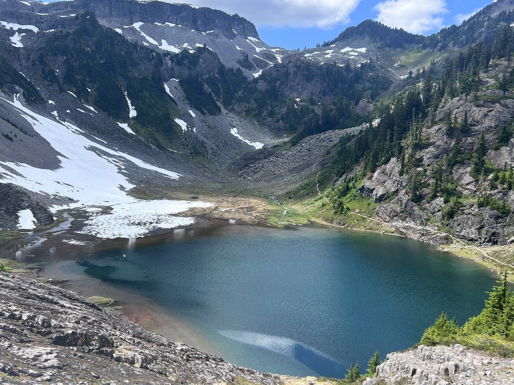
This family friendly trail is one of the first in Heather Meadows to become snow free. Located in the valley between Mount Herman and Table Mountain, this 0.5 mile loop trail winds through meadows punctuated with undersized but very old mountain hemlock—the diminutive products of a very short growing season. Interpretive signs tell the story of the landscape shaped by volcanic eruptions and ice-age glaciers.
Fire and Ice Trail

-
 Length
- 0.5 miles, roundtrip
-
 Elevation Gain
- 100 feet
-
 Highest Point
- 4,400 feet
The last 2.7 miles of the Mount Baker Highway/SR 542 (from Heather Meadows to Artist Point) is closed for the winter season.
The Fire and Ice trail is the Mount Baker area's premiere interpretive trail, telling the story of how glaciers and volcanoes shaped this impressive place.
Continue reading
Hiking Fire and Ice Trail
Map & Directions
 Trailhead
Before You Go
The last 2.7 miles of the Mount Baker Highway/SR 542 (from Heather Meadows to Artist Point) is closed for the winter season.
Parking Pass/Entry Fee
Northwest Forest PassWTA Pro Tip: Save a copy of our directions before you leave! App-based driving directions aren't always accurate and data connections may be unreliable as you drive to the trailhead.
Getting There
From Glacier, travel 22.3 miles east on the Mt. Baker Highway SR 542. Turn right at the Austin Pass Picnic Area sign located on the northwest side of the highway near milepost 55 and park at the bottom of the hill near the Heather Meadows Visitor Center. The trail can be found near the bathroom or on the southwest side of the parking lot by the stone wall. There is parking for about 20 cars.


