
The classic approach (via Sunrise) to this sea of meadows and wildflowers at the base of Mount Rainier is long and tough, putting Grand Park out of reach for most casual dayhikers. Instead, try this "backdoor" approach via Lake Eleanor to enjoy this stunning destination.
The hike begins just off FR 73, following a path along the edge of Eleanor Creek. The trail enters a mixed forest and begins a moderate climb toward Lake Eleanor. Within 0.1 mile, you will cross in to Mount Rainier National Park and in just under a mile arrive at the lakeside.
There are a few campsites around Lake Eleanor that provide nice views of the lake and a pleasant place for a snack, though most hikers will be eager to push onto the meadowlands ahead.
From the lake, the trail climbs a bit then drops about 150 feet to a large meadow before climbing again through larger stands of hemlock and fir. The moderate climb is broken up by short wanderings through progressively larger meadows. Push onward and upward to the wide expanses of Grand Park.
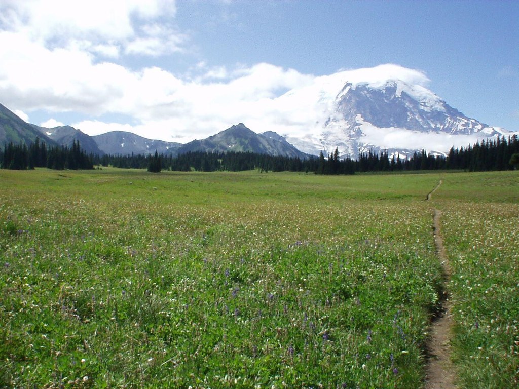
Often filled with wildflowers during the spring and summer months, the miles-long grassland can seem to be awash in color from the moment you arrive. Resist the temptation to linger at the edges and continue onto the meadow's high point for outstanding views of The Mountain.
Find a comfortable spot to settle in and soak up the panorama. If you're hungry for more, you can continue all the way through Grand Park's meadows to connect with the Northern Loop Trail and Wonderland Trail.
Grand Park via Lake Eleanor

-
 Length
- 8.7 miles, roundtrip
-
 Elevation Gain
- 1,460 feet
-
 Highest Point
- 5,630 feet
Parking Pass/Entry Fee
NonePermits Required
Backcountry camping permit. Apply online (fee)
The classic approach (via Sunrise) to this sea of meadows and wildflowers at the base of Mount Rainier is long and tough, putting Grand Park out of reach for most casual dayhikers. Instead, try this "backdoor" approach via Lake Eleanor to enjoy this stunning destination.
Continue reading
Hiking Grand Park via Lake Eleanor
Map & Directions
 Trailhead
Before You Go
Backcountry permits are required to camp at Lake Eleanor. Visit Recreation.gov for more details.
Parking Pass/Entry Fee
NonePermits Required
Backcountry camping permit. Apply online (fee)WTA Pro Tip: Save a copy of our directions before you leave! App-based driving directions aren't always accurate and data connections may be unreliable as you drive to the trailhead.
Getting There
From Enumclaw, drive east on SR 410 for 25 miles. Turn right (west) on FR 73 crossing over, Huckleberry Creek at 6 miles. After the Huckleberry Creek bridge, continue steeply up the hill on FR 73 for another 4 miles to the signed crossing at Eleanor Creek and park on the roadside. There is a small parking lot about 150 feet past the trailhead. (Note that the Forest Service has revised the road numbering and some guidebooks and GPS systems may still identify the last mile before Eleanor Creek as FR 7360.)
Please remember to park mindfully, allowing room for traffic to pass and other hikers to arrive and leave.


