

Starting from the Brown Bear trailhead (6410 feet), named for a closed mining claim, hike 100 yards up to the Pacific Crest Trail and a large trail sign which indicates Canadian Border to the right, Rainy Pass to the left, along with a few other destinations. Turn left and start the trek south through the forest that survived the 2003 Needle Creek Fire that burned through the Trout Creek valley and Harts Pass area.
The trail breaks out of the forest into a view across a talus field. The trail is visible across this field on the far side of a larch grove as it traverses the steep slope and crests a secondary ridge at 0.8 mile (6800 feet). This visible section of trail can hold snow in the early summer and late fall.
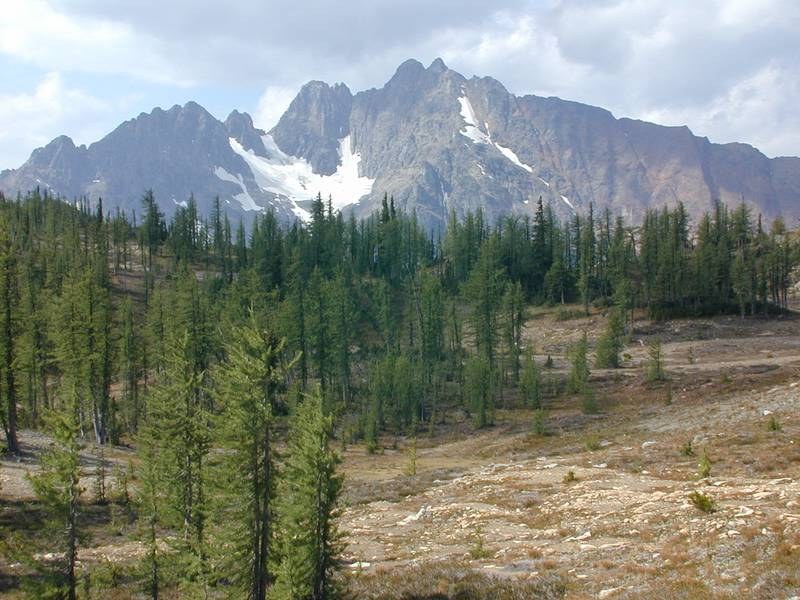
At the ridgecrest, the objective is in sight, 2.5 miles line-of-sight to the southwest and backed by Azurite Peak. The view of the pass will disappear as the trail traverses the around the secondary basins above the South Fork Trout Creek. Down and to the south is the contrast between the silver forest created by the fire and the headwaters forest that survived.
After a short descent and a longer, climbing traverse around an unnamed peak, the trail reaches a barren pass at 1.8 miles (6960 feet) on the east ridge of Tatie Peak. As you stand on the Cascade Crest, to the north is Ninetynine Basin in Western Washington and in the distance is the lookout on Slate Peak.
At 2.1 miles is the informal boot/scramble trail up Tatie Peak. It initially climbs directly to the ridgecrest and then follows it. After a 0.4 mile climb from the Pacific Crest Trail, the 7386 foot peak is reached, with its expansive views. A scramble descent down the southwest ridge on a faint trail regains the Pacific Crest Trail in the unnamed pass at 6890 feet.
For those not going up Tatie Peak, the formal trail traverses below the peak and reaches a sparsely forested, unnamed pass at 2.7 miles (6890 feet) with a few flat spots for camps, but no reliable water. After a short descent the trail crosses a large scree slope, with slightly elevated erosion channels in the middle.
At 3.6 miles (6600 feet) is a forested basin with a few campsites and reliable water about 80 feet below the trail. The climb to the south of the basin can be snow-covered in early and late season.
The trail continues it traverse, crossing a long gravel slope on a narrow trail just before reaching Grasshopper Pass at 4.7 miles (6750 feet). The wide pass has golden larch in the fall and a few campsites, but no reliable water.
The better views of Mount Ballard and Azurite Peak are found 0.4 mile farther south on the trail at 5.1 miles, just before the trail starts its long descent to Glacier Pass. For those wanting a little more privacy and more views, a boot trail takes off to the east and roughly follows the ridge crest for 0.4 mile to reach a high point at 7125 feet. From any of the latter two points, Azurite Peak dominates the view to the west.
 Trailhead


