

Begin this loop hike at Mountain Lake. Begin near the group camp and head up the trail toward Little Summit and Summit Lake. The trail doesn't waste much time, and you'll soon begin climbing. At the trail junction at just after a mile, you can continue forward or, if you'd like to add a short side trip, head up to Little Summit before coming back and resuming your trip.
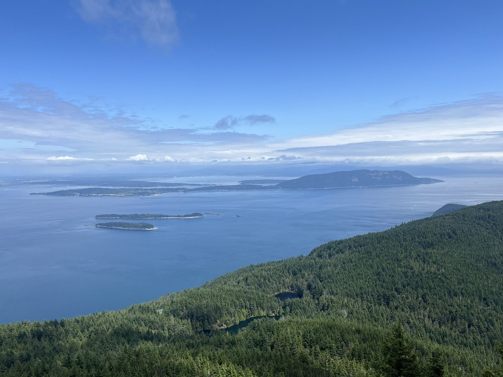
Continue up and soon begin to get some views. At the junction with a trail that comes from Cold Springs, continue straight. Pass by the outlet of Summit Lake and then continue along the ridge before reaching the top of Mount Constitution. You can also drive to this location, so you'll probably have company. Take your time taking in all the views and be sure to climb up the tower. When you're ready, continue your trip from the parking lot by finding the trail to Twin Lakes.
Descend quickly. When you reach a junction on your left, you can take a detour to Twin Lakes or continue on the main trail. When you reach the north end of Mountain Lake, keep to your right and follow the trail back to where you started.

 Trailhead


