

From the parking area, the 3-mile Evergreen Trail starts just beyond the restrooms and maintains a mostly gentle grade with the only significant climbing along the top of the loop. The well-signed path will keep you going in the right direction when you encounter creeks and service roads.
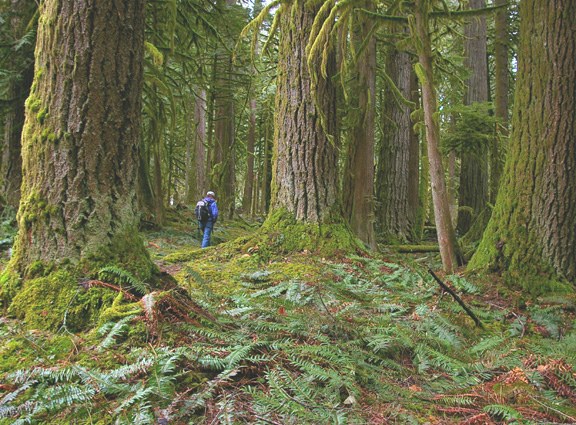
As you hike, notice the rich forest floor, where hidden organisms are recycling downed organic material into nutrients for new plants and food for local wildlife. Then cast your view skyward to the many towering red cedar and Douglas-fir trees, some reaching heights of more than 250 feet.
Along the trail you will cross several quaint wooden bridges where numerous creeks flow down through the park from the top of 5,537-foot Sauk Mountain, which stays snow-covered into late July. Take advantage of one of the many benches to rest and contemplate the variety of dense flora surrounding you. You just may feel as if you've been transported to a primeval forest due to the limited sunlight streaming down through the forest canopy above.
For more, add on the 0.5 mile Fern Creek Trail, a mini-loop in the center of the park where some of the area's largest trees can be seen.
 Trailhead


