

There is something to see every step of the way on this hike; the views start as soon as you open your car door at the trailhead. The trail takes off from the parking lot past a cute little A-frame outhouse, then traverses along the base of the mountain before starting a series of switchbacks upward across the meadow.
The way is steep and narrow, and in some places eroded from hikers cutting the switchbacks. Note: There have been multiple search and rescue missions here. Please be careful when hiking, and do not cut switchbacks; they are there to prevent erosion and environmental damage to the trail, as well as for safety.
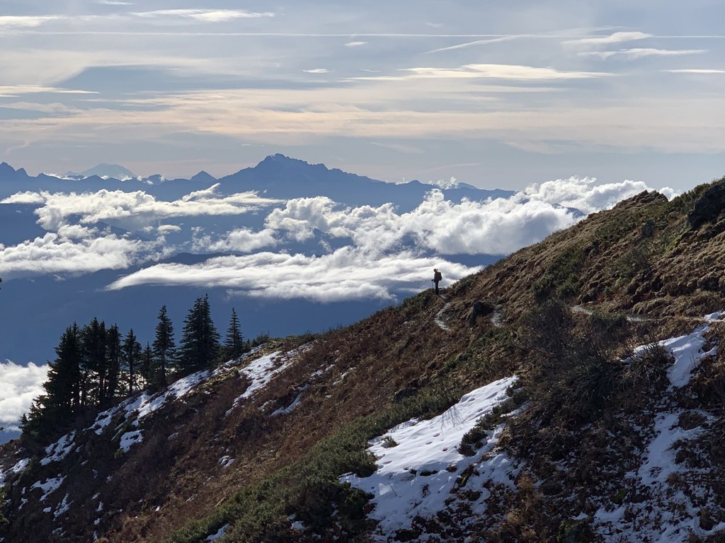
As you hike, the views get even better, so go ahead, stop for a breather, and take a few pictures. The trail is south-facing and exposed to the sun, so be sure to take plenty of breaks and enjoy your view.
Notice too, that the flower species changing as you climb. Leave the oxeye daisy (a non-native) and native thistles behind as you climb through fireweed, cow parsnip and valerian. Soon, purple penstemon, paintbrush and pearly everlasting line the trail. Look for the lacy leaves and flowers of Western meadowrue. Did you know the male and female flowers are on different plants? The male plants have flowers with long showy stamens hanging down. You may pass by a dark purple-black small daisylike flower and wonder what it is. It goes by the name sawwort (Saussurea). Later in the season look for purple asters, Scottish bluebell and yarrow.
Climb higher and rest in the shade of small groves of subalpine fir and hemlock at the edge of the switchbacks. Listen for marmots and watch for their holes. Mount Baker will be peeking out from behind the ridge, and the Skagit and Sauk river valleys will be below. On a clear day, you can see the water of Puget Sound.
In just over a mile the trail crosses a small saddle in the ridgeline and heads north. Look for Glacier Peak and the mountains of the North Cascades spread before you! Early in the season, the snow may start here. If it has just melted, notice the glacier lilies and spring beauty left in its wake. Circle around the north side and there will be an intersecting trail to the right leading downhill. This leads to Sauk Lake, losing more elevation than you gained from the parking lot. There will be little trails leading over the ridge to viewpoints, but stay on the main trail, as you want the Big Picture at the top.
Swing around the hill and come to a flat spot by a nice grove of trees. Look over the edge and see Sauk Lake. From here the trail to the top will be visible below the rock pinnacles. Early in the season, this section of the trail may be covered with snowfields. Cross carefully, or enjoy your lunch from the trees and save the rest for later. If the snow is gone, follow the trail through the rocks. Notice the small alpine flowers, saxifrage, potentilla, thyme buckwheat and yellow coralbells. Clinging to the rocks is a large shrubby grey-leafed plant with odd looking creamy flower clusters called silverback luina.
The trail can be a little hard to follow at the top, but look for worn tread in a saddle between the rocks, cross over and make your way to the lookout site at the top. Soak in the views and try to name all the peaks, a sea of peaks, near and far. The Pickets are obvious, as is Whitehorse Mountain near Darrington, Glacier Peak and over to the south, Rainier. You may see Mount Constitution on Orcas Island. There once was a fire lookout here and you can still see some debris from it at the summit. On a nice sunny weekend it can get crowded up here, so eat your lunch, take your pictures and head down so someone else can enjoy it.
WTA Pro-Tip: Use the National Geographic North Cascades National Park map for peak identification from the summit; it covers more of this territory than Green Trails.
 Trailhead


