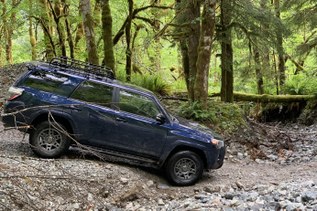

The relative solitude here is because accessing Schaefer Lake requires either a ford of the Chiwawa River or a crossing on a natural log bridge, which, depending on the season, may or may not be available. This is NOT a hike that should be attempted before mid July and even then, hikers should use good judgement.
The Chiwawa is snow- and glacier-fed all season; it is painfully cold as you head out early in the morning but incredibly soothing when you return in the afternoon. The two crossings are signed "Horse Crossing" and "Trail". Depending on the condition of the logs, the horse crossing is often more straightforward. Bring Crocs, Tevas, or water shoes that are light -- you'll be happy to have them for the crossings.
The first three quarters of a mile after crossing the river are in the historic Chiwawa River floodplain. The trail wanders like a drunken sailor around large rotting logs as it tries to stay on high, dry ground. There are plenty of cottonwoods, willows, and Devils Club decorating this section of the trail. In the midst of this riparian section, the trail climbs just a bit and you will find yourself in a natural cathedral, formed by towering cedars 20 or more feet in circumference and Douglas firs that have grown to massive proportions from the on the water and nutrients in the river bed environment. This site alone is worth making the frigid river crossing.
Once across the river and through the cathedral, the trail begins a steady northwest traverse, gaining 1200 feet in two miles. You will cross a couple of unnamed creeks. The trail swings to the west, where you can hear Schaefer Creek far below. In another half mile, cross the remnants of a large rock slide. The boulders here are now covered in moss and there are small creeks running through, over, and around the rocks. The trail picks its way through this section, continuing to climb modestly until you come to a substantial bridge over Schaefer Creek.
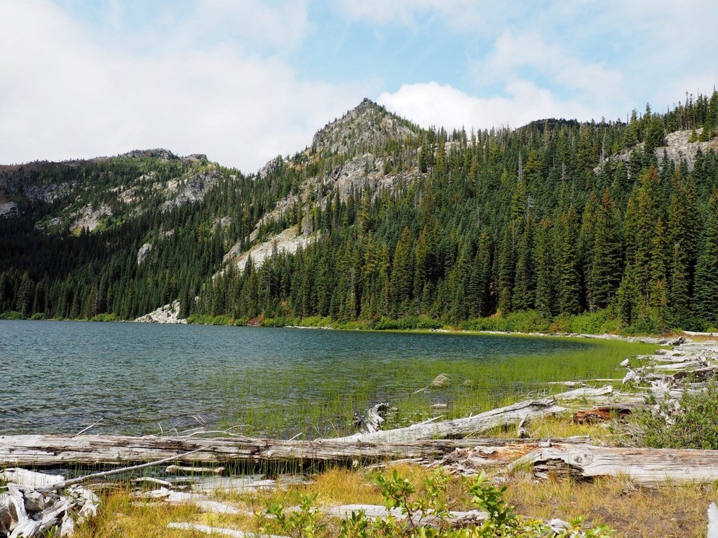
The trail to this point has had been a modest grade and generally good tread, both are about to change. The next mile climbs in steep switchbacks. The trail channels spring runoff and thus the tread is narrow and eroded deeply in places. There are tree roots that traverse the trail and provide much appreciated steps. The switchbacks top out in a narrow valley with Schaefer Creek running next to the trail. In a few minutes you come upon “Little Schaefer”, a very pretty frog pond lake that would have its own name if Schaefer weren’t just up the draw and fifty times bigger. In a few more minutes, arrive are the east shore of Schaefer Lake.
There are a number of nice campsites at the lake, which is good, since there are berries aplenty on this trail. For most of the hike, you are flanked by huckleberry bushes starting at about 3000 feet, all the way to the lake at 5200 feet.
For a good part of the hiking season, a portion of the trail will have ripe berries. In late August, the berries are gone down low, but you find “huckle-raisins” -- dried out berries at lower elevations followed by overly ripe but messy berries higher up, and finally, as you approach the lake, berries perfect for the picking. The meadows around the lake make for excellent blueberry hunting.
WTA Pro tip
There are a half a dozen or so unreserved, free, Forest Service campgrounds on the Chiwawa Road. Schaefer Lake is a solid day hike and the trailhead is a long way from anywhere. Set up a base camp in the Chiwawa Valley, and explore some other great nearby hikes like Spider Meadow, Carne Mountain and Basalt Peak.
 Trailhead