
If you believe that good things only come to those who toil and sweat (or if you don’t like to share the outdoors with other hikers), steer clear of Snow Lake. Its translucent depths, tucked underneath the uppermost 2,000 feet of Chair Peak, are removed from the highway crossing Snoqualmie Pass by just a short trail with minimal elevation gain. Elitists need not apply — Snow Lake is the most visited lake in the Alpine Lakes Wilderness…and rightly so.
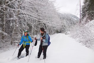
Snow Lake is also a tempting destination in winter, but the steep terrain in the first part of the trail puts visitors at high avalanche risk when snow is present. You should have proper gear and an understanding of how to read the snowpack before venturing out on this trail.
- Trail smarts

- Who Goes First? Right-of-Way on Trail
The trail departs from the north end of the main parking lot of the Alpental Ski Area, which on any given Saturday or Sunday will fill to capacity. Go early or prepare to be friendly! After an initial 200-foot climb up log steps, the trail settles down for a gradual ascent in forest. A mile in, a talus slope offers a break in the trees and views of a landscape that has suddenly grown exponentially more rugged than the parking lot you just left. In the distance, Chair Peak stands tall at the end of a jagged ridge rising over the far side of the valley.
In another 3/4 of a mile, the trail switchbacks to the right, and it’s time to start the mercifully short climb. Over the next two thirds of a mile, the trail weaves its way 500 feet up to the wilderness boundary at a saddle above Snow Lake.
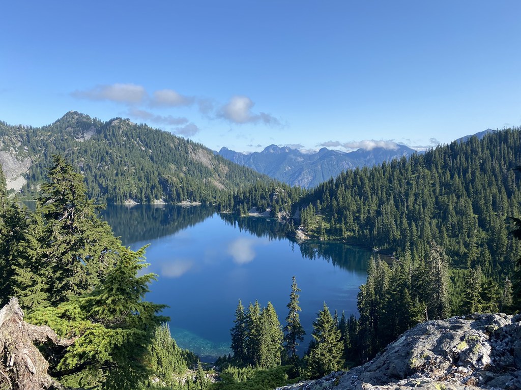
Here you get your first view of your objective. From this angle, it looks unassuming enough — its far shore is mostly rolling hills; but the first rule of Snow Lake is to never settle for the early view. It gets better — much better.
Half a mile from the saddle — and a 400-foot drop in elevation you’ll have to regain on the way back out — the trail reaches an inlet to the lake. Here, a short side trail leads down to the shore, passing the remains of an old cabin, a relic of a time when this part of the shore was private land. Marvel for a moment that Snow Lake was once someone’s front yard, then wander down to the lakeside to enjoy the prior owner’s daily view.
And a nice view it is, of Roosevelt Peak standing out at the head of the lake. Unbeknownst to the many who call it a day here, more spectacular terrain lies just out of sight beyond the shoulder of Chair Peak. Rejoin the trail, cross the inlet, and continue another half of a mile to where the lake’s outlet drains to the Middle Fork Snoqualmie Valley. Along the way, peer deep into the clear, cold water. The depths of the lake are almost as impressive as the ramparts of the neighboring mountains soaring above you.
Just after crossing the outlet, the trail proceeds down to the lakeshore. From here, the full majesty of Chair Peak is coaxed from hiding. Sheer cliffs, crowned by polished rock rise from the distant shore. From the mountain’s heights, waterfalls snake their way down to sheltered coves often striped by ribbons of snow until well into July--the lake’s name is no accident.
If you can tear yourself away, you will quickly reach the end of the trail, which is no end at all but rather an intersection with two other trails. One leads a long way down to the Middle Fork Snoqualmie Valley, the upper reaches of which are visible in the distance. The other leads to yet more mountain lakes.
While there may be yet more views to be had, you can safely turn around here, secure in the knowledge that the reward for the effort will be no greater than what you have already attained. That is the true beauty of Snow Lake--how readily it shares the splendor of the Alpine Lakes Wilderness.
WTA Pro Tip: At 1.75 miles, where the trail begins to switchback upwards, a spur trail offers a brief side trip up the valley to an overlook of Source Lake, the headwaters of the Snoqualmie River’s south fork.

 Trailhead