May Valley Trail
Last modified
Nov 13, 2009 01:10 AM
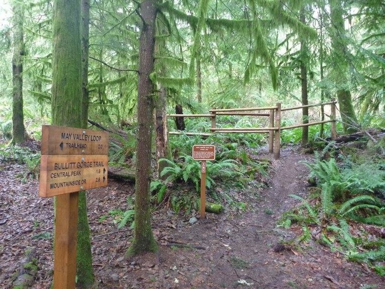
This quiet, little-used trail wanders through a lowland forest and up the South side of Squak Mountain along Bullitt Creek. At the top of the mountain, join the network of trails that lead to a beautiful view of Mt. Rainier and the historical remnant of the Bullitt Family home. Wildlife abounds in the form of birds, and great slugs and other small animals. Various wildflowers and ferns can be found along the trail.
Recent Trip Reports
Hiked here recently?
Submit a trip report!
There are
6
trip reports for this hike.
See all trip reports for this hike.
Day hike
Expand report text
Hide report text
Read full report
with photos
Few cars at the south parking lot when we arrived after lunch. Nevertheless we encountered quite a few people on...
Few cars at the south parking lot when we arrived after lunch. Nevertheless we encountered quite a few people on the trails, all of them walking their dogs.
Followed the directions from the "60 Hikes within 60 Miles" book. The trails were very well signed, but you need to know the names of the trails you intend to follow -- they are missing from the trail map that can be found at the trailhead kiosk or on the State Parks website. The trails themselves were in great condition; some a bit on the muddy side (not surprising, given the recent weather), but not too bad. The viewpoint (a small, unmarked spur of the Perimeter Loop Trail) was amazing; the other attractions along the way (West Summit Shed, Bullitt Fireplace) perhaps less so. On the way back we ended up back on the South Access road, as the last bit (part of the Equestrian Loop Trail) was closed.
Bullitt Access, Bullitt Fireplace, Chybinski Loop, May Valley Trail, Perimeter Loop Trail, Phil's Creek
— Jun 24, 2009
— rnnrgrl
Day hike
Features:
Ripe berries
Issues:
Overgrown
Expand report text
Hide report text
Read full report
Started my Squak Mtn run early at the West Access trailhead. Climbed the Bullitt Fireplace trail past the fireplace and...
Started my Squak Mtn run early at the West Access trailhead. Climbed the Bullitt Fireplace trail past the fireplace and onto Central Peak. There are nice new trail signs at all the intersections now. It looks like the recent heavy equipment work is complete, and the main trails are wide with good drainage. But I didnt stick to those trails. From the peak I dropped down the C6 summit trail, which is steep and narrow. At the intersection with Phil's Creek Trail, I turned right and headed down to the south access road. I wouldnt recommend this trail to anyone right now, well... at least anyone without long pants. The nettles have overtaken the trail and despite all my dance moves I received a consistent stinging. At the intersection with the horse trail, it becomes much wider so a few high steps can eliminate most of the issues. I met another runner coming up the south access road- rare for this early on a weekday, I usually i have Squak to myself. I connected to the May Valley Trail which is a very nice and gradual (runnable) climb. Under the canopy of evergreens here are ferns and salal instead of nettles and salmon berries. There is one grunt section at the end just before connecting with the Perimeter Loop. This section is always dark, even in the middle of the day. I took the loop trail around the west side to the Chibinski Tr, another one of my favorites. There are only a few places along the way here where the spring foliage is encroaching, but otherwise the trail is in great shape. I finished the ~8 mile loop back down the west access.
Bullitt Access #SQUAK-N1,Chybinski Loop #SQUAK-W4,Perimeter Loop Trail #SQUAK-PLT,May Valley trail
— Nov 12, 2006
— Whitebark
Day hike
Expand report text
Hide report text
Read full report
The WTA is doing fantastic work improving drainage on this trail, which like many old road beds is prone to...
The WTA is doing fantastic work improving drainage on this trail, which like many old road beds is prone to water runoff and erosion. Drainage problems exist all the way to the old Bullitt Fireplace site, so I hope that the crews can make it up there given the limited number of work days left. Fallen maple leaves add a beautiful touch of color to this trail right now.
Bullitt Fireplace #SQUAK-C2,Bullitt Bypass #SQUAK-PLT,Old Griz #SQUAK-C4,Phil's Creek #SQUAK-S3,Perimeter Loop Trail #SQUAK-PLT,West Peak #SQUAK-W3,May Valley Trail #SQUAK-PLT
— May 07, 2003
— Sparky Murphy
Day hike
Expand report text
Hide report text
Read full report
Narrative The May Valley Trail has undergone some reconstruction; rather than climbing straight up the ridge, there are gentle...
Narrative The May Valley Trail has undergone some reconstruction; rather than climbing straight up the ridge, there are gentle switchbacks between 950 and 1350 feet elevation, where the trail joins the old trail; thence the trail is brushy in spots. The Perimeter Loop Trail is brushy and has several logs across it. The West Peak Trail has a few brushy spots, but is otherwise in good condition. The West Peak Trail has been logged at its junction with the Bullitt Fireplace Trail making it easier to find. There is a side trail that breaks from the Bullitt Fireplace Trail just east of the Bullitt Fireplace and heads directly to Central Peak over a 80 foot rise. The Old Griz Trail has some brushy spots. There is low-lying brush including nettles along Phils Creek Trail. Weather Broken to overcast clouds. Moderate temperatures. Hazards and Obstructions Some logs across the Perimeter Loop Trail. Flora/Fauna Purple violets, salmonberry flowers, bleeding hearts, foamflower, trillium, Siberian miner's lettuce, cinquefoil and geranium. Robins and other birdlets seen. Camping Not permitted.
May Valley,Bullitt Fireplace #SQUAK-C2,Central Peak #SQUAK-C1,Valley Connector #SQUAK-C3,West Peak #SQUAK-W3,Perimeter Loop Trail #SQUAK-PLT,South Access #SQUAK-S1
— Jan 13, 2002
— Colonel Sparky Murphy
Day hike
Issues:
Blowdowns
Expand report text
Hide report text
Read full report
The Valley Connector and West Peak Trail junction with the Bullitt Fireplace Trail is as shown on the Green...
The Valley Connector and West Peak Trail junction with the Bullitt Fireplace Trail is as shown on the Green Trail map (as opposed to what was reported earlier). They are just buried under a mass of logs.
May Valley Trail,Bullitt Gorge #SQUAK-S2
— Feb 13, 2001
— don
Day hike
Issues:
Mudholes | Water on trail | Snow on trail
Expand report text
Hide report text
Read full report
There is a new trail on Squak Mountain. It is an extension of the May Valley Trail now making...
There is a new trail on Squak Mountain. It is an extension of the May Valley Trail now making it a near two mile 1700 foot climb. The trail now begins at the May Valley Parking area on May Valley Road now closed to vehicle traffic. The trail begins on the short waling horse path to the road where a nature loop is under construction on the west side. You walk up the road about 0.3 mi. through a mean it gate to the Equestrian Loop trail sign . The unmarked trailhead is about 10 yards up the road on the opposite side. The new trail traverses a short ways then heads strait up through third growth timber. The trail then veers to the west and is quite muddy as it is open to horses as well as hikers. The new trail meets the old at about 1020’ 0.7 mi. from May Valley road at a sign. The trail traverses and crosses the stream on a new bridge then follows the old route up to the Bullitt Fireplace. The old section of trail gets little horse traffic and their passage may be prohibited. Few hikers use this trail and it has a lot more solitude than the Cascades. |
Driving Directions
I-90 Eastbound to Exit 15 (WA 900 / 17th Ave NW). After driving through town, road name changes to Renton-Issaquah Road SE. 4 miles from the interstate, turn left on May Valley Road. Drive 2.5 miles to large sign for Squak Mountain State Park on Left
|
Document Actions
- Email this page
- Print this
- Share


