

The Bellevue Botanical Garden (BBG) is a tranquil gem nestled in Wilburton Hill Park. The BBG’s winding pathways, elegant gardens and 150 foot suspension bridge provide hikers and families with a visual cornucopia and gentle refuge from the hustle and bustle of everyday life. Open since 1992, the BBG has about nine distinct gardens maintained with the help of the Bellevue Botanical Garden Society, the City of Bellevue, local gardening groups and volunteers.
Park in the main lot and cross the service road to the main entrance. Stop by the BBG visitor center on your right (open from 9:00 AM – 4:00 PM daily) to pick up a map of the BBG and, if needed, an accessibility guide providing descriptions and lengths of the paths. The paths are mostly made of gravel and vary from mildly rolling to at times a bit steep. Benches are scattered generously throughout the BBG and provide a gentle encouragement to sit down and relax for a while amidst the tranquility.
Two notable excursions in the BBG are walking the Tateuchi Loop Trail and visiting The Ravine Experience. The Tateuchi Loop Trail is a half mile loop that winds through the core gardens at the BBG. To reach the trail, turn left from the visitor center onto a path and follow signs for the Yao Garden.
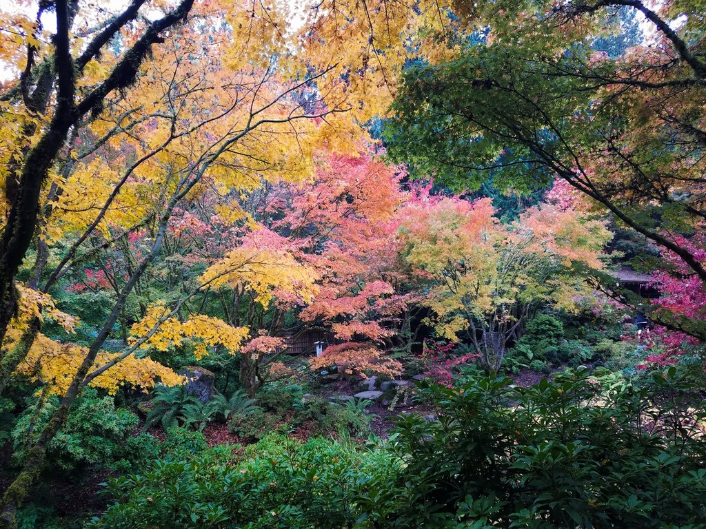
Stop by the Yao Garden on your left and pass through the traditional Japanese gate. Admire the Japanese maple, azaleas and rhododendrons planted to honor the sister city relationship between Bellevue and Yao, Japan. After you’ve explored the Yao Garden, head back to the Tateuchi Loop Trail past the Native Discovery Garden, bearing right at the next intersection towards the Perennial Border Garden. Stop at the Perennial Border Garden to wander through the allium, foxglove, red hot poker, lavender and many other colorful and spectacularly diverse flowers on display.
Continue on the Tateuchi Loop trail towards the Sharp Cabin and read about the history of the families that lived and worked on the land prior to it becoming a public garden. Continuing on, bear right past the Rock Garden and up a short hill to the Shorts House. Take a snack break at one of the tables outside the Shorts House while admiring the neighboring Fuchsia, Perennial and Waterwise Gardens.
The Ravine Experience features a canopy-like forest setting with lush plants, a diverse bird population and a 150 foot suspension bridge that crosses a steep ravine. Pick up the BBG’s Ravine Experience Nature Guide at the visitor center to help you identify birds and plant life, then turn left from the visitor center onto a path and follow signs for The Ravine Experience.
Proceed about one-third of a mile downhill until you reach the bridge. Once you cross the bridge, a short loop can be hiked that is about one-quarter of a mile long. Keep an eye out for the black head and bright blue body of the Steller’s Jay, or the distinctive reddish-orange belly of the American Robin.
The BBG is open from dawn until dusk, and there is no entrance fee. Pets are not allowed in the BBG with the exception of service animals. Restrooms are located next to the visitor center and at the Shorts House. Water can be obtained by purchasing bottled water from the seasonal espresso stand in the Shorts House.
WTA Pro Tip: The BBG has devised a couple systems to help you identify plants in the gardens. One way is via the “Collections Search” tab on the BBG’s website. Click on the “Collections Search” tab and then click “by location”. On the interactive map, choose a garden that you would like to learn more about, and then choose a flower bed within that garden to pull up pictures and names of the plants there. Alternatively, you can download a QR code reader onto your device before you arrive. Use the QR code reader to scan the barcodes at stands populated throughout the gardens designed to help you identify and learn more about the plants you are looking at.
 Trailhead


