
This is a hike along the Boulder River into its namesake wilderness. Young families will enjoy the gentle grade and views of the waterfalls crashing into the river from the steep banks opposite the trail, while those who continue along the up and downs to the trails’ end will be rewarded by a nice lunch spot beside the wild river. This is a relatively easy, popular hike off the Mountain Loop Highway, so WTA crews visit this location annually to repair any damage it has sustained during winter storms.
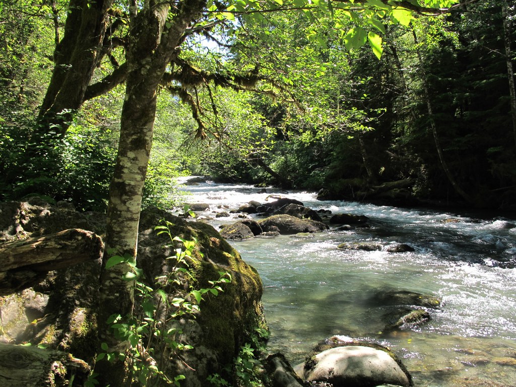
The trail starts on a nice wide flat trail, once an old railroad logging grade. As you approach the river, you can hear the crash of Boulder Falls, but can only glimpse it through the trees. The bank is steep and there is no access at this point. Pass a nice camp spot and the Boulder River Wilderness sign in about a mile from the trailhead. Soon there will be a break in the trees, and the river can finally be seen.
Continue on a short distance and behold a beautiful double unnamed waterfall! Admire the dripping moss and bright yellow monkey flower between the two braids of water. Keep going and soon come to a short switchback. As you make your first switch, there on the left hand side is a huge old-growth tree made for hugging. Notice more old-growth now along the trail, saved by the wilderness boundary. Another waterfall awaits your camera further up the trail, so once you've hugged the tree, continue on. After the second big waterfall, at one and a half miles, the trail climbs away from the river. Although there are no mountain views, the forest here is still beautiful.
Stately sword fern, soft maidenhair fern, deer fern, moss and twinflower line the path. Still mostly good trail, there are some rocky, rooty and muddy spots along this section. The trail will drop down and cross a few creeks before climbing one more time. The trail eventually levels out, then drops down, crosses a muddy swamp, and ends at a nice camp spot along the river, a good place for lunch and maybe a little wading. This used to be called Boulder Ford, as the trail once continued on to Tupso Pass and Three Fingers Lookout. Sadly, there is nothing left of it now.
Boulder River

-
 Length
- 8.6 miles, roundtrip
-
 Elevation Gain
- 700 feet
-
 Highest Point
- 1,550 feet
The Boulder River trail is a nice hike that can be done any time of year. Come in winter while the rain is dripping off the mossy trees, photograph the waterfalls filled with spring snowmelt. Take the kids out for a little picnic in the summer, or leaf collecting in the fall. Come anytime midweek for quiet contemplation.
Continue reading
Hiking Boulder River

WTA worked here in 2025, 2024, 2023, 2022 and 2021!
Map & Directions
 Trailhead
Before You Go
The road to the trailhead is open but expect storm damage.
Parking Pass/Entry Fee
NoneWTA Pro Tip: Save a copy of our directions before you leave! App-based driving directions aren't always accurate and data connections may be unreliable as you drive to the trailhead.
Getting There
From I-5 take Hwy 530, signed for Arlington/Darrington to exit 208. Exit right toward Arlington. Stay on 530 through Arlington. 23.6 miles from I-5, turn right onto French Creek Road, just after milepost 41. Follow French Creek Road, which is badly potholed in some places, for 3.7 miles to its end at the trailhead. There is parking for about 15 cars. There is a vault toilet a mile in from the turnoff on French Creek Road, but no facilities at the trailhead.


