Trails for everyone, forever

Home Go Hiking Hiking Guide Brooks Memorial State Park
link

Brooks Memorial State Park

Southwest Washington > Columbia River Gorge - WA
45.9467, -120.6695 Map & Directions
Length
5.0 miles of trails
Elevation Gain
200 feet
Highest Point
2,856 feet
Lady Slippers at Brooks Memorial State Park. Photo by Bob and Barb. Full-size image
  • Wildflowers/Meadows
  • Mountain views
  • Wildlife
  • Established campsites
  • Old growth
  • Good for kids
  • Dogs allowed on leash
  • Fall foliage

Parking Pass/Entry Fee

Discover Pass

This state park has trails that wind through a forest of Ponderosa pine and Oregon white oak in the Simcoe Mountains near the Columbia River Gorge. Some trails take you up to meadows with wildflowers in the spring and views of Mount Hood in Oregon on a clear day. Continue reading

Rating
0.00 out of 5

(0 votes) Log in to rate

Hiking Brooks Memorial State Park

This state park has trails that wind through a forest of Ponderosa pine and Oregon white oak in the Simcoe Mountains near the Columbia River Gorge. Some trails take you up to meadows with wildflowers in the spring and views of Mount Hood in Oregon on a clear day.

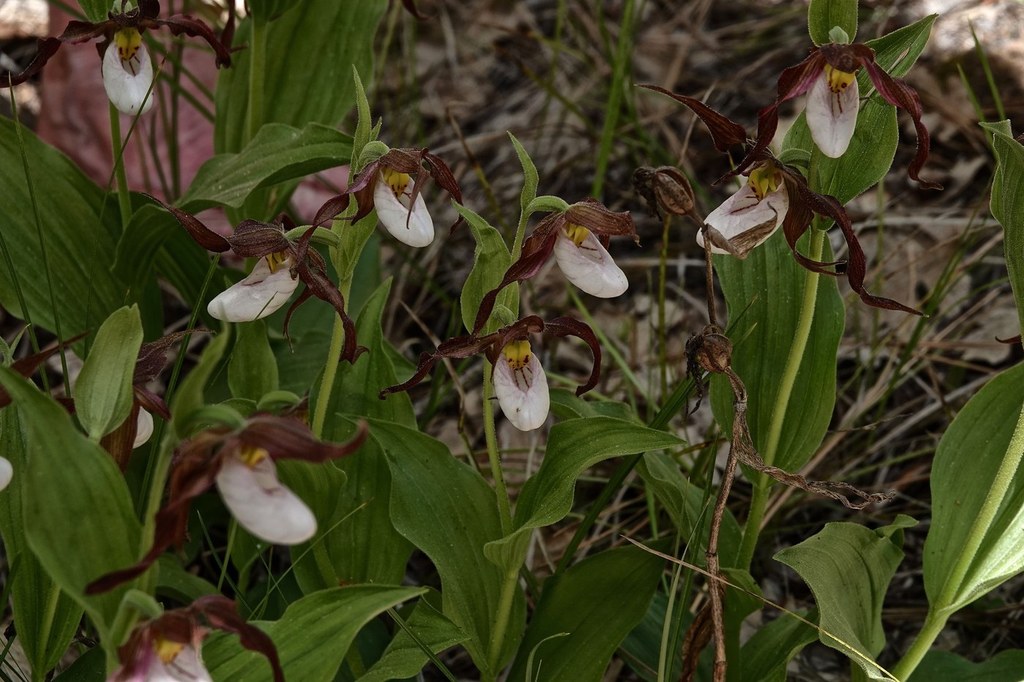
The diversity of riparian, upland forest and wildflower meadow environments in this little-known 682-acre park make it a gem for naturalists. In addition to its many native plants, the park also is a birding stop on the Sun & Sage Loop of the Great Washington State Birding Trail.

Enjoy several miles of trails along the Little Klickitat River, through oak-pine woodlands, and heading up to wildflower meadows. Nestled on the south slope of the Simcoe Mountains, views of Mount Adams to the west are blocked by the high surrounding ridges, but Mount Hood is visible to the south from the high meadows.

The trail system still is under development on the east side of the park so way-finding may be a challenge, particularly on the Monastery Fire Trail. 

In addition to hiking, mountain bikers and equestrians are welcome here. A disc golf course in the pines is located in the day use area next to the campground.

If you're camping here, be sure to make time to visit the Maryhill Museum, Maryhill State Park on the bank of the Columbia River, the Stonehenge World War I Memorial, and Goldendale Observatory State Park, all excellent and informative spots in a gorgeous landscape.

Toilet Information

  • Toilet at trailhead
  • Toilet has running water
  • No toilet at trailhead

More information about toilets

Hike Description Written by
Susan Saul, WTA Correspondent

Brooks Memorial State Park

Map & Directions

Trailhead
Co-ordinates: 45.9467, -120.6695 Open in Google Maps

Before You Go

See weather forecast

Parking Pass/Entry Fee

Discover Pass

WTA Pro Tip: Save a copy of our directions before you leave! App-based driving directions aren't always accurate and data connections may be unreliable as you drive to the trailhead.

Getting There

Brooks Memorial State Park is located 11 miles northeast of Goldendale on US Hwy 97.

From I-90, drive to exit 110, the junction with I-82. Turn south on I-82, driving for 37 miles, passing Yakima on the way. Take exit 37 for US Hwy 97. Drive for 15 miles, then stay right to stay on 97 south. Continue another 37 miles to the entrance to Brooks Memorial State Park.

From Vancouver, take SR 14 east to the intersection with US Hwy 97. Follow the signs for Goldendale. Continue beyond Goldendale for 11 miles to Brooks Memorial State Park.

The park is located on both sides of US Hwy 97. The day use area and campground are located on the west side of the highway with some trails around the picnic area and campground. The more interesting and longer trails are located on the east side of the highway.

From the day use area, drive across the highway and turn right on the paved park service road. Drive past the park office and ranger residence and follow the signs onto a dirt road. Shortly cross a bridge over the Little Klickitat River and turn into the trailhead parking area on the right.

From the parking area, walk back across the bridge and find the start of the trail on the right.

More Hike Details

Trailhead

Southwest Washington > Columbia River Gorge - WA

Washington State Parks

Guidebooks & Maps

https://parks.state.wa.us/DocumentCenter/View/1846/Brooks-Memorial-State-Park-PDF

You can improve or add to this guidebook entry

Brooks Memorial State Park

8 Trip Reports

Hiked here recently?

Submit a trip report!
 
Trip Reports