

Chimacum Ridge Community Forest is a 917-acre property of Jefferson Land Trust. It's managed for watershed protection, ecological values, education, recreation and sustainable forestry. It has about 5 miles of trail, which includes some old logging roads. Most of the hiking is through forests of Douglas-fir, western red cedar, hemlock, bigleaf maple and alder, but some old clearcuts open up views. Most of the trails are open to bikes, horses and hikers, but some are hiker-only. Dogs on leash are allowed. Camping is not allowed; the forest is open from dawn to dusk.
Because this is a working forest, you may encounter motorized equipment and forestry operations.
A short walk north from the trailhead is a timber-frame education pavilion, built with lumber harvested from the surrounding forest. Running south from the trailhead is a wide, well-graded gravel trail that’s open to hikers, bikes and horses. It’s wheelchair-friendly for the first 750 feet, gently gaining 50 feet to a junction with a spur on the right leading to a bench with a view over West Valley.
Continuing up the main trail, the grade steepens but remains wide and well-graded, with several benches along the way. At 0.6 mile and a 240-foot climb from the trailhead, you reach the top of the ridge, where a forest road makes a 3-mile, nearly-level loop around the ridge. The road surface alternates between gravel and dirt.
Turn right on the road, heading south. At 1.6 miles from the trailhead, the road reaches an old clearcut that’s starting to grow back in. The clear-cut has opened views of the Olympics to the south. The road bends around heading north, passing a junction with a trail that leads east and south to a block of adjacent DNR land.
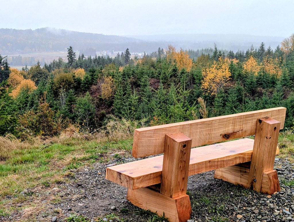
At 2.8 miles, the road reaches an antenna tower and a spur road heading north. Turn right onto that spur. At 3.3 miles, the spur road passes a viewpoint with a bench facing east to the Cascades. In another 0.1 mile, the road reaches a junction. Turn left here and drop a few yards down a slope to another viewpoint with a bench facing west. This point offers fine views of the West Valley and the mountains beyond.
This is your turnaround point. Walk 0.8 mile back to the antenna tower and turn right on the road. At 4.2 miles, you’ll reach a junction with an access road on the right that’s not open to the public. Stay left here and continue another 0.1 mile to a junction with a hiking trail on the right. The hiking trail wends its way in 0.4 mile through the forest and down the west side of the ridge. At the bottom, it comes to a junction with a wide trail. To the left, it’s a short walk back to the trailhead. To the right, the trail leads to the education pavilion.
WTA Pro Tip: After your hike, a nice place to find refreshment is Finnriver Farm & Cidery, just north on Center Road at Chimacum Corner. The Chimacum Corner Store specializes in local produce and is well worth a visit.
 Trailhead


