
Note: Some trails near the Red Cedar (Coal Creek Parkway) trailhead are closed during King County’s Coal Creek Sewer Upgrade Project. See the King County Parks' trail detour map for more information.
This out-and-back trail can be started from the west (Coal Creek Parkway parking lot), east (Red Town Trailhead parking lot) or from one of many spur trails along the route.
Starting from the Red Town Trailhead parking lot, cross Lakemont Boulevard to the signpost indicating the Coal Creek Park Trail. Follow the soft dirt path and descend into the forest on the gently rolling trail. Pause at an information kiosk on your left to learn about the railroad and coal mining activities that took place in this area from the mid-1800s to the mid-1900s. Opposite the information kiosk, spot the airshaft of the coal mine that extends over 500 feet below sea level. There is a short, 0.1-mile interpretive trail you can explore here as well.
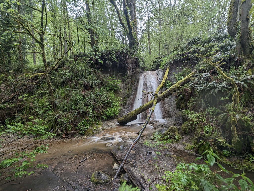
Continuing towards Coal Creek Parkway, cross a wooden bridge over Coal Creek and come upon a short spur trail to a waterfall called North Fork Falls. Take a break on one of the wooden benches here to savor the peaceful and calming flow of the rushing water.
Head back to the Coal Creek Trail and continue on the wide dirt path. Pass a sign for the Cinder Mine Trail, a newly built 0.3-mile trail that leads to a small parking area off Newcastle Golf Club Road.
An aside: Consider parking at this newly built parking lot. It provides access to the Coal Creek Trail via the Cinder Mine Trail, as well as North Fork Falls. To access the falls, walk from the parking lot down the Cinder Mine Trail to the bottom. Turn right onto the Coal Creek Trail and, in about 0.2 miles, North Fork Falls will appear on your left.
Back on the main route, about 400 feet past the Cinder Mine Trail sign, you'll notice a square, roughly 8x8-foot cement footing on your left. This footing was the base of a former locomotive turntable that turned locomotives 180 degrees, enabling them to exit and enter the area.
Pass the turntable site and walk through a sun-dappled gallery of towering trees reaching multiple stories above you, and come upon a wooden staircase. Head up the staircase and emerge onto a wide gravel road with a thicket of blackberry bushes lining the trail on your right. In summer, you can enjoy ripe blackberries as an impromptu snack.
Continue up the gravel road, following signs for Coal Creek Parkway. Arrive at a bench overlooking a ravine to the right of the trail, and enjoy the sweeping canopied views before you. Here, the trail begins descending more earnestly and will continue descending steadily as you make your way to Coal Creek Parkway.
Reach a signed junction with an option to turn right for the Primrose Trail or stay straight on the Coal Creek Trail. The Primrose Trail follows Coal Creek closely and is a lovely, scenic route. It boasts a large wooden bridge and pretty views of a waterfall called Sandstone Falls. The route is only slightly longer (about 0.1 miles) than staying on the Coal Creek Trail, and connects back up with the Coal Creek Trail after roughly 0.7 miles.
After linking back up with the Coal Creek Trail, continue to steadily descend. The trail here becomes more rough and rooty with some narrow sections. Pass through a couple of wooden bridges, and continue to descend down a wooden staircase.
Emerge onto a wide, flat dirt path roughly 2.5 miles from the start of your hike. Here, there are shallow access points to Coal Creek, perfect for a cool splash of water or cooling off your toes. The trail continues for about another half mile, with several additional access points to the Creek dotting the way. On your right, you will see signs for Forest Drive, an access point to a local neighborhood and the Washout Way Trail.
The Coal Creek Trail continues to a small parking lot next to Coal Creek Parkway. Explore the staircase leading under Coal Creek Parkway and emerge on a trail on the other side. The trail here extends another 1.3 miles to 119th Avenue, and is an option for those looking to explore the area further before turning back.
WTA Pro Tip: The Coal Creek Trail can be broken into smaller pieces for those looking for shorter options. Start the trail from the west (Coal Creek Parkway) side to take advantage of access points for wading and splashing in the creek, or start from the east (Red Town Trailhead / Cinder Mine Trailhead) side to hike to the abandoned coal mine, North Fork Falls, locomotive turntable site, or the Primrose Trail. Whatever your route, be sure to bring a map, as the network of trails in this area is intricate and extensive.

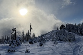
 Trailhead