Trails for everyone, forever

Home Go Hiking Hiking Guide Cooper River Snowshoe
link

Cooper River Snowshoe

Snoqualmie Region > Salmon La Sac/Teanaway
47.4042, -121.0989 Map & Directions
Length
8.0 miles, roundtrip
Elevation Gain
400 feet
Highest Point
2,900 feet
Calculated Difficulty About Calculated Difficulty
Moderate
Cooper River. Toadlicker.
  • Dogs allowed on leash

Parking Pass/Entry Fee

Sno-Parks Permit

A snowy ramble along a river east of Snoqualmie Pass. Continue reading

Rating
3.25 out of 5

(4 votes) Log in to rate

Hiking Cooper River Snowshoe

A snowy ramble along the Cooper River. This walk terminates at Cooper Lake, which is also snowshoeable!

From the parking area at Salmon la Sac, hop onto the Cooper River trail, clearly marked (but with a little bit of exposure right at the beginning; keep an eye on kids in this area.

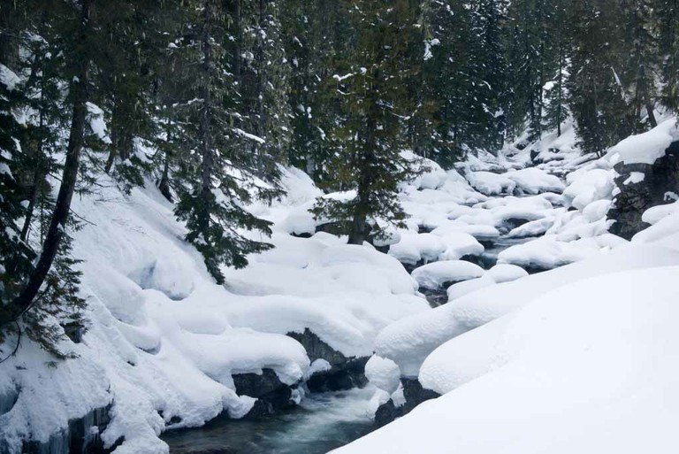
Walk along the the north side of the river through some lovely open forest, typical of what you might find in this part of the state. Note that unlike in summer, snowshoe routes are not always marked, and the footprints of someone who went before you do not always indicate the right way to go. Have a map with you just in case.

For four miles, the trail stays to the right of the river, and you enjoy some mild ups and downs along the way before arriving at a bridge over the outlet of Cooper Lake. Continue to the lake, or turn around the way you came. Don't be surprised to see other people at the lake -- you can drive to it.

Hike Description Written by
Multiple authors contributed to this report, WTA Community

Cooper River Snowshoe

Map & Directions

Trailhead
Co-ordinates: 47.4042, -121.0989 Open in Google Maps

Before You Go

See weather forecast

Parking Pass/Entry Fee

Sno-Parks Permit

WTA Pro Tip: Save a copy of our directions before you leave! App-based driving directions aren't always accurate and data connections may be unreliable as you drive to the trailhead.

Getting There

Drive I-90 to exit 80 signed for Roslyn/Salmon la Sac. Turn north onto State Route 903. You’ll drive for nearly 15 miles, skirting Cle Elum Lake before arriving at a Y-junction in the road near the Salmon La Sac Campground. Veer left onto Road 111, crossing the bridge over the Cle Elum River and following the sign for the Cooper River Trail. Arrive at the large trailhead in another half mile.

More Hike Details

Trailhead

Snoqualmie Region > Salmon La Sac/Teanaway

Cooper River (#1311)

Okanogan-Wenatchee National Forest, Cle Elum Ranger District

You can improve or add to this guidebook entry

Cooper River Snowshoe

45 Trip Reports

Hiked here recently?

Submit a trip report!
 
Trip Reports