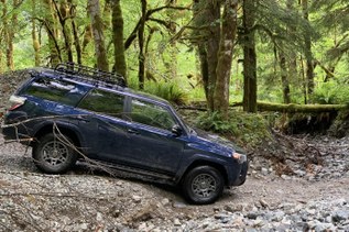

Make the tooth-rattling drive up six mile Dingford Road and pull into the trailhead for Dingford Creek. From here, several destinations are at your disposal. HIkers can head downhill to access the Middle Fork River Trail or Goldmyer Hot Springs, where reservations are required. Or venture around the gate at the far end of the lot to hike along the Old Middle Fork Road to Dutch Miller Gap and beyond.
But with Hester Lake as your destination, opt for the trail marked for Dingford Creek. Begin climbing immediately after leaving the trailhead. The trail leads you steeply up the hillside as you pass moss-covered boulders -- glacial erratics from a time when this area was covered by ice. Watch your step here; rocks are underfoot as well as alongside the trail, and can create a tripping hazard.
As you hike through second-growth hemlocks, you're accompanied by birdsong and rushing water from Dingford Creek to your right. About a mile in you'll pass the adorably named Pumpkinseed Falls fed by Pumpkinseed Lake high above. Take a moment to appreciate the water that glides down a 25-foot granite face into a tiny pool before running off as Pumpkinseed Creek to feed the river below. In summer, the pool provides an excellent spot to splash your face before continuing on.
After the falls the trail levels off and traverses through meadows full of vegetation including Devils Club, and more pleasantly, salmonberry. Expect to make several stream crossings that can be a bit tricky in high water before finally getting to a fork at three miles in.
At the fork, head to the right to access Hester Lake. Despite the initial downward slope, the trail to Hester Lake climbs 1000 feet in two and a half miles, stopping suddenly at the large lake. Pull out that fishing pole -- there are plenty of trout in this lake.
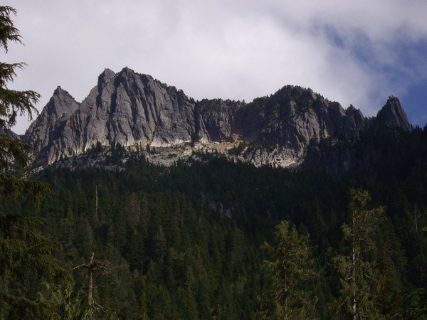
If fishing isn't on your agenda, grab your camera. Mount Price looms ahead of you, its craggy summit soaring to 5587 feet, and offers excellent photo ops in evening or late afternoon light. Spend some time relaxing here before heading back the way you came.
Dingford Creek-Hester Lake

-
 Length
- 10.8 miles, roundtrip
-
 Elevation Gain
- 2,600 feet
-
 Highest Point
- 3,900 feet
Hike a rugged trail through second-growth hemlock forest. You'll cross several lively creeks and see waterfalls on your way to a high alpine lake well-stocked with trout.
Continue reading
Hiking Dingford Creek-Hester Lake

WTA worked here in 2025, 2023, 2021, 2020 and 2019!
Map & Directions
 Trailhead
Before You Go
Parking Pass/Entry Fee
Northwest Forest PassWTA Pro Tip: Save a copy of our directions before you leave! App-based driving directions aren't always accurate and data connections may be unreliable as you drive to the trailhead.
Getting There
From Seattle, drive east on I-90 to exit 34. Turn left onto 468th Street and follow it to the junction with the Middle Fork Snoqualmie Road. Turn right and continue up the Middle Fork Snoqualmie Road for 12 miles to the large Middle Fork trailhead parking area on the right. Pass the parking area and turn right onto a gravel road immediately after crossing a large concrete bridge. The road is marked for Dingford and Dutch Miller Gap. Continue six miles on a heavily potholed road to a gate. Passes and privy are available at the trailhead.