
If Mailbox Peak hasn't totally drained you, head along the ridge to the east up to Dirtybox Peak.
The trail takes hikers through brush and over rocks, some of which may require some scrambling. Entering deep brush, the trail fades, at times disappearing completely. But stay on the ridge spine, and soon enter a forested section. Keeping in view of I-90, make your way up the shady hillside. Arrive at the summit, marked by a large rock nestled in trees.
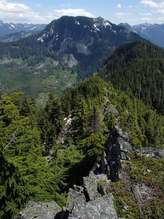
Take a well-deserved rest, and enjoy a view of Mailbox seldom seen. Further views of Mailbox, as well as Dirty Harry's Peak, Bandera Mountain, and Webb Mountain are possible by continuing east, but keep in mind that at this point the scramble becomes more dangerous, with several sections where a fall could be fatal. Experience is highly recommended for anyone exploring further.
Dirtybox Peak

Hike and scramble to a summit between Dirty Harry's Peak and Mailbox Peak.
Continue reading
Parking Pass/Entry Fee
Discover PassHiking Dirtybox Peak
Dirtybox Peak
Map & Directions
 Trailhead
Before You Go
Parking Pass/Entry Fee
Discover PassWTA Pro Tip: Save a copy of our directions before you leave! App-based driving directions aren't always accurate and data connections may be unreliable as you drive to the trailhead.
Getting There
From Seattle, drive east on I-90 to exit 34 (Edgewick Road). Turn left (north) onto 468th Street and follow it to the junction with the Middle Fork Snoqualmie Road (Forest Road 56). Turn right and continue up the Middle Fork Snoqualmie Road to the end of the pavement (about 3 miles from the I-90 exit). Turn right onto a gated road and park, being sure not to block the gate.


