

The Fletcher Canyon Trail is a disproportionately difficult hike for being little more than two miles long. Perhaps because the route is steep and often muddy, obscured by blowdown, or faded entirely, it earns its ire and accolades. Individual accounts may be forgiven for their embellishments, especially those recalled fireside at the lodge tavern on a wet winter’s eve.
The trail starts in a muddy hole beneath a large, old fragment of rock that fell from the ridge above. A small stream runs along the tread before the trail rises up on roots and rocks and then along a muddy track bordered by tenacious devils club. Other understory, although less threatening, include vanilla leaf, trillium, and a variety of ferns.
Soon the raging torrent of Fletcher Creek can be heard in the canyon below. The path rounds the mouth of the canyon and heads nearly south into an open gallery of stately Douglas firs towering over salal and sword fern. A photogenic sign marks the Colonel Bob Wilderness boundary as the route climbs continuously upward.
A short, rocky section requires careful footing just before a view north opens up. Deeply forested ridges remind the hiker this canyon is one of many in this valley. The trail from here is now arduous, requiring maneuvering over blowdown and pushing back the brush and many cascading hemlock needles and maddening spider webs in early morning.
The trail levels just briefly by a series of pools that are spaced between log choked boulders. The chatter of the nearby creek soothes the weary feet of the onward hiker. A rhythm is established by now, and the hiker is in tune with nature. Attention and careful footing is required where a scramble traverses boulders and roots on a thrilling but short climb before another break.
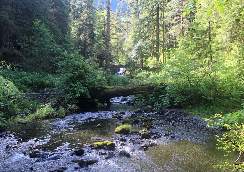
Here the trail enters the realm of rocks and moss. An occasional cut log marks the way, which is faint. Cross a small talus slope before coming down to the river in a muddy, overgrown bottomland. Turn right and beat your way through the salmonberry to the end of a large log that spans the river. Hoist yourself up and walk to the middle for a glimpse of a waterfall.
A primitive campsite sits on the opposite bank at 1.9 miles. Head right after crossing the log and a fire pit will come into view. The small area could host perhaps two small tents. From the camp site a very faint trail heads south before climbing up and down through splendid hemlock forest and ultimately returning to the bank of Fletcher Creek at 2.3 miles.
Here the creek meanders lazily between shaded pools and gravel bars. Alder and old growth hemlock hang over the channels, a favorite thoroughfare for Roosevelt elk, black bear, and river otters. In late summer the creek runs dry, trickling just beneath the lichen covered boulders, the remnant pools lying like blue jewels among the dusty cobble and sand.
 Trailhead


