Trails for everyone, forever

Home Go Hiking Hiking Guide Fort Worden State Park - Point Wilson

Fort Worden State Park - Point Wilson

Olympic Peninsula > Northern Coast
48.1438, -122.7551 Map & Directions
Length
2.5 miles, roundtrip
Elevation Gain
0 feet
Calculated Difficulty About Calculated Difficulty
Easy
  • Good for kids
  • Coast

Parking Pass/Entry Fee

Discover Pass
Saved to My Backpack

On the shore of the Strait of Juan de Fuca, you can walk a fine sandy beach between high bluffs and two access points to reach the Point Wilson Lighthouse at Fort Worden State Park. Continue reading

Rating
3.18 out of 5

(11 votes) Log in to rate

Hiking Fort Worden State Park - Point Wilson

On the shore of the Strait of Juan de Fuca, you can walk a fine sandy beach between high bluffs and two access points to reach the Point Wilson Lighthouse at Fort Worden State Park. Water and sand play possibilities for children of any age are infinite. The total distance is 2 1/2 miles, and whether the tide is high or low, you can walk it either direction. Kids can write their names or leave messages in the sand or throw sticks to dogs. They can watch long-necked black cormorants dive, and then stretch their wings to dry their feathers.

Tell them that in 1792 when Captain Vancouver and his crew explored Discovery Bay in a small boat, it was a foggy morning. He named Point Wilson for a British friend, and then when the sun came out, he saw the large beautiful bay around it and named it for another friend, a British marquis named Townsend. Ask the kids what they think about these places being named for men who never saw them.

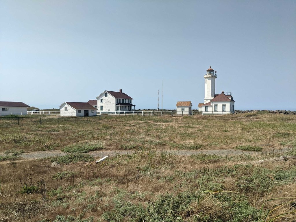
Views are wonderful of Mt. Baker, Vancouver Island, the San Juan Islands, and the Cascades behind them. Follow the beach to the red-roofed Coast Guard lighthouse at Point Wilson.

Please note that lighthouse grounds are not open to visitors. The lighthouse is also open for tours and for visitors to climb the lighthouse from 11 a.m. to 4 p.m. on Saturdays and Sundays from May through September.

The lighthouse is operated by the U.S. Lighthouse Society, under a lease agreement with the U.S. Coast Guard. 

Fort Worden State Park - Point Wilson

Map & Directions

Trailhead
Co-ordinates: 48.1438, -122.7551 Open in Google Maps

Before You Go

See weather forecast

Parking Pass/Entry Fee

Discover Pass

WTA Pro Tip: Save a copy of our directions before you leave! App-based driving directions aren't always accurate and data connections may be unreliable as you drive to the trailhead.

Getting There

From Port Townsend on SR 20: take a left on Kearney Street, right on Blaine Street, left on Cherry Street, and follow signs into the park. The lighthouse is at the far NE corner of the park. You can also park at the west end of the beach as well. Check in at the visitor's center to get a park map.

More Hike Details

Trailhead

Olympic Peninsula > Northern Coast

Washington State Parks

Guidebooks & Maps

Best Hikes with Kids: Western Washington & the Cascades (Burton - Mountaineers Books)

Fort Worden State Park PDF Map: https://bit.ly/30gp4qV

Friends of Fort Worden - Fort Worden State Park Trail Map PDF: https://bit.ly/2JixSra

You can improve or add to this guidebook entry!

Fort Worden State Park - Point Wilson

45 Trip Reports

Hiked here recently?

Submit a trip report!
 
Trip Reports