

The Halliday trail is certainly no holiday, but tackling this steep, infrequently maintained trail means you will get quite the workout, and have the opportunity to experience the varying terrain and environments of the Colville National Forest.
Beginning from the trailhead just a few feet off Highway 31, ten miles south of the Canadian border, set off down an old roadbed for a short distance before arriving at the true trailhead. Sign in here, noting the posting saying this trail travels through a watershed area. Please be vigilant, and bury waste appropriately. Be sure to pack out all other forms of trash.
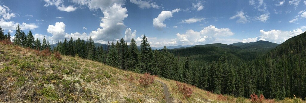
And now, you're off! Halliday climbs mercilessly almost from the get-go, and on a hot day, you'll need to stop frequently for water. Summit a small ridge within the first tenth of a mile, then another, far steeper one. The grade is about 40% in places, and your reward, within the first half mile, is an open spot offering views to the north and east. Hooknose Mountain is the most prominent mountain visible from here; it's shape gives it away. The big skies above often boast huge clouds, too, making this an excellent location for a photo op while you catch your breath.
Continue on from here, diving into the forest now. The trail moderates a touch, though it's still an overall steep climb. Wind through pine forest, and at a mile, cross a large footbridge at the Halliday fen. This wet area is home to rare plant species, and is inside the Halliday Fen Research Natural Area. Another mile along, be on the lookout for a large cedar tree to your right, painted with a band of red. This is the boundary for the Research Natural Area.
Onwards and upwards. Climb and traverse, traverse and climb until, incredibly, the trail begins descending! This steep but short descent loses much (but not all) the elevation you gained as it approaches the junction with the North Fork Sullivan Trail and the Red Bluff Trail.
The junction is 4.2 miles from the trailhead. A left onto the North Fork Sullivan Trail leads eventually to Crowell Ridge, through more steep slopes, pine trees, and open rocky meadows. A right onto the Red Bluff Trail heads back to the trailhead, 5.2 miles down to Sullivan Lake Road.

 Trailhead


