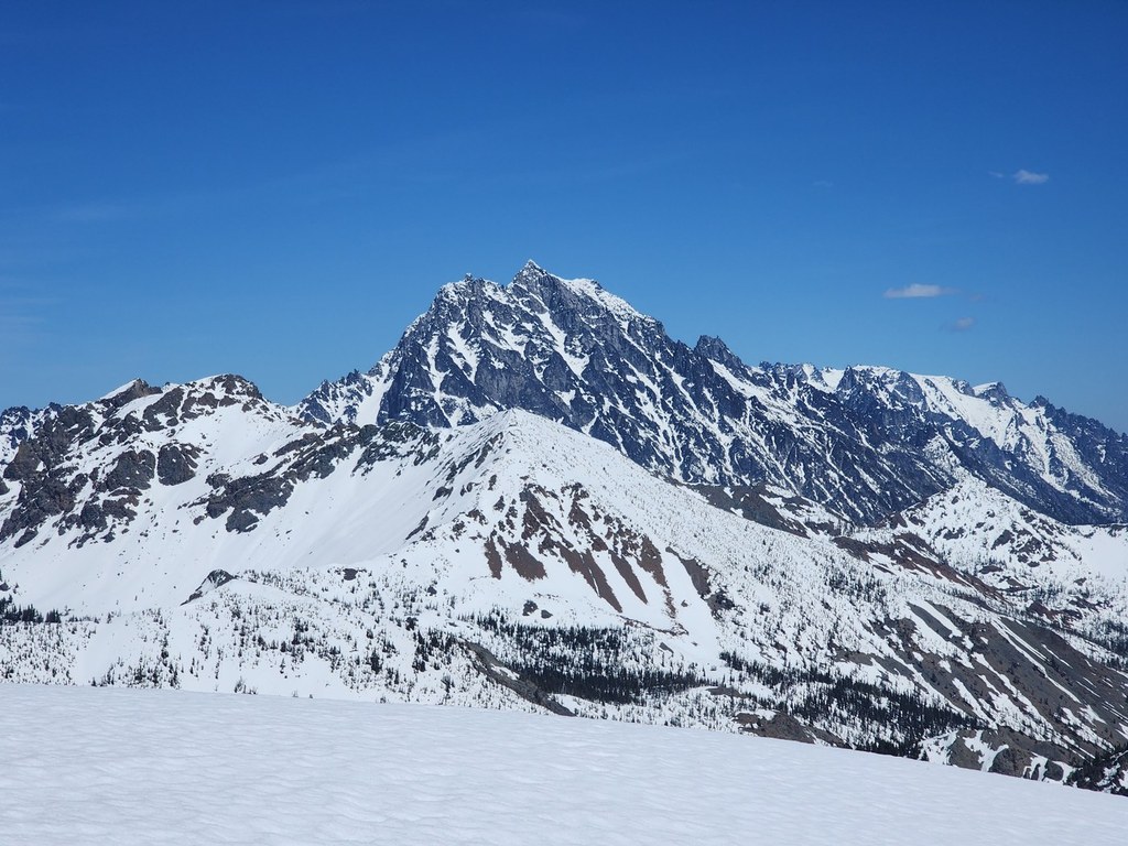

This is a pleasant hike through sparse east-of-Snoqualmie pine forests. Once off trail, you will be ascending alpine meadows of kinnikinnick, heather, low blueberries until you reach the talus and rocky top of the peak.
The trail climbs moderately and sometimes steeply along the slopes above Boulder Creek. Motorbikes, but not ATVs, are allowed, though it appears that usage is light. Along this portion, there are some trail branches. The first one is marked as 1392.7. Stay left. The next one is not marked. Stay left.
After 3.9 miles you will reach an intersection with a 4WD road, marked with a sign. None of the routes match the numbers on the Green Trails map (revision 2004) except the one you arrived on. Take the 4WD road to the left.
In a mile or so, you will see the mountain to your left. If you stay on the 4WD road, there are some branches that go further up, but on foot really just add unnecessary distance. Instead, pick a route up the sparse vegetation for your ascent.
Hawkins Mountain

-
 Length
- 10.0 miles, roundtrip
-
 Elevation Gain
- 3,360 feet
-
 Highest Point
- 7,160 feet
Parking Pass/Entry Fee
Northwest Forest Pass
This is a pleasant hike through sparse east-of-Snoqualmie pine forests. Once off trail, you will be ascending alpine meadows of kinnikinnick, heather, low blueberries until you reach the talus and rocky top of the peak.
Continue reading
Hiking Hawkins Mountain
Map & Directions
 Trailhead
Before You Go
Parking Pass/Entry Fee
Northwest Forest PassWTA Pro Tip: Save a copy of our directions before you leave! App-based driving directions aren't always accurate and data connections may be unreliable as you drive to the trailhead.
Getting There
From I-90 take Bullfrog Road eastbound exit 80, or westbound exit 84. Head north through Roslyn. Follow the paved road a bit past the Cayuse Horse Camp, about 19.5 miles from exit 80. There, you'll see a sign indicating Salmon La Sac campground to the left (continuing on the paved road). Don't do that — go straight onto the gravel road.
Very little is marked from here on. Go 5 miles, watching for roads to the right. The map indicates the turn-off (as opposed to the trailhead). It's unmarked, so you may need to watch for a small sign indicating "Camp Creek" instead. If you see that sign, turn around and go back about 200 yards for the turn-off to the trailhead.
From the turn-off, the road shortly branches. The left branch goes to trail 4W305. The right branch goes another mile to trail Boulder Creek #1392. There's parking for two cars and barely enough room to turn around so you may prefer to park at the branch.
At the trailhead, there's a small handpainted sign that says "private property; hikers welcome".


