Trails for everyone, forever

Home Go Hiking Hiking Guide Horn Rapids Park

Alert: On Oct. 1 the federal government began a partial shutdown that will impact National Parks, National Wildlife Refuges and U.S. Forest Service lands in Washington. Here's the latest information we have for hikers and campers


Horn Rapids Park

Central Washington > Tri-Cities
46.3802, -119.4358 Map & Directions
Length
5.0 miles of trails
Elevation Gain
20 feet
Highest Point
433 feet
Horn Rapids Park spans five miles of Yakima River shoreline. Photo by Mary Hartman. Full-size image
  • Dogs allowed on leash
  • Good for kids
  • Old growth
  • Rivers
  • Wildflowers/Meadows
  • Wildlife

Parking Pass/Entry Fee

None
Saved to My Backpack

A collection of paved trails, dirt trails, and gravel roads provide easy access to a shrub steppe and riparian habitat along the Yakima River. Continue reading

Rating
0.00 out of 5

(0 votes) Log in to rate

Hiking Horn Rapids Park

Horn Rapids is an 800-acre park in Benton County with over five miles of shoreline along the Yakima River. From 1944 to 1947 the site was “Camp Columbia,” a Federal prison work camp for hundreds of American offenders, who worked in nearby orchards and vineyards as part of their sentence.

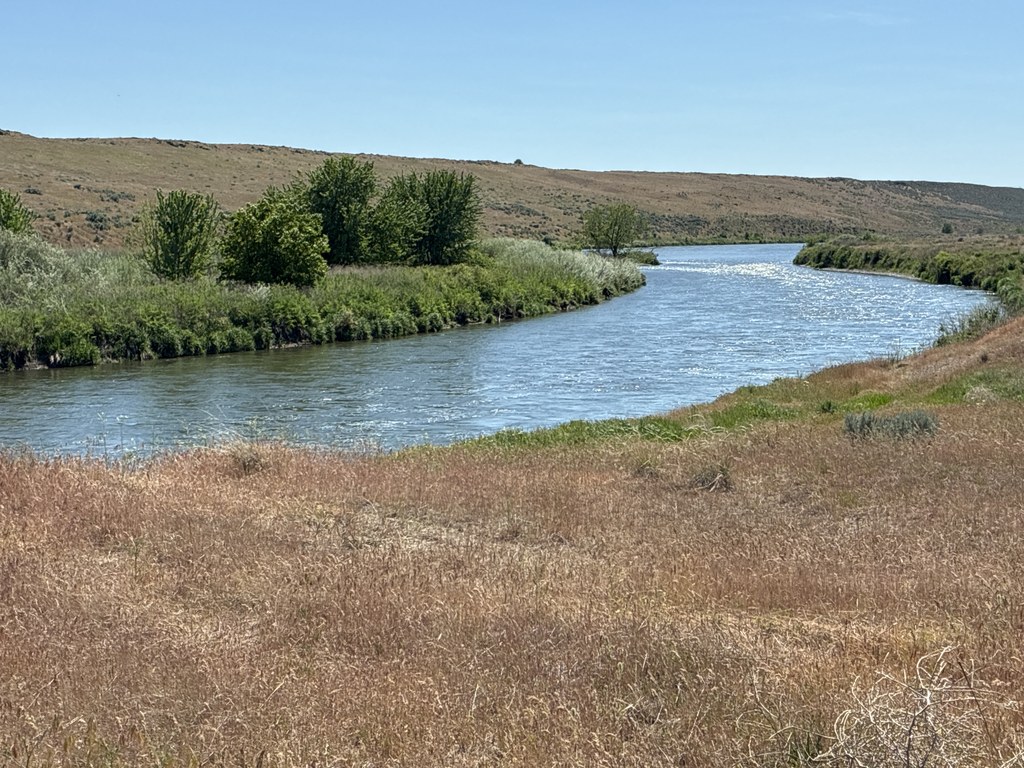
Today this park includes a picnic area, horse camp, model airplane facility, boat launch, and miles of multi-use trails. It’s popular for fishing, boating, and picnicking. There is also a campground, but it’s currently closed (except for large groups with advance notice). The developed portion of the park is located near the entrance, but undeveloped shrub steppe and riparian environments extend for miles along the river shore.

Before you start your hike, check out the kiosk at the trailhead to learn about the abundant flora and fauna of the region, as well as more history of the parkland. Near the kiosk there is a network of about 0.7 mile of paved trails, and although the asphalt has many cracks, it is otherwise level and smooth. These trails pass by groves of cottonwoods and mature sagebrush. Keep your eyes open for the concrete foundations of Camp Columbia buildings. A walking trail of dirt and packed gravel also winds through the developed part of the park and then continues south along the river, ending at a line of bollards about half a mile farther on.

If you’re enjoying yourself, turn left on the gravel park road and keep walking. There are several side tracks that eventually rejoin the gravel road. A bit less than a mile from the bollards you arrive at a primitive boat launch at an area termed “Omaha Beach.” Just beyond that, there’s a handy bench where you can sit and observe a small island in the river. You’re likely to hear a chorus of songbirds and waterfowl.

The gravel road continues south for another couple of miles as the park narrows; you’ll be
walking parallel to WA 225. The gravel road ends at Upper Horn Rapids, where there’s another boat launch. On the opposite side of the highway is the Rattlesnake Slope Wildlife Area, with many more miles of trails to explore.

Drinking water is not currently available in the park; bring your own.

WTA Pro Tip: The trails in Horn Rapids Park are part of the Tapteal Trail system along the lower Yakima River. The Tapteal Water Trail is in the river itself for those who would rather paddle than hike.

Toilet Information

  • Toilet at trailhead
  • Accessible toilet

More information about toilets

Wheelchair Accessibility

0.7 mile of the trail is wheelchair accessible. These paved trails are cracked, but level and
passable.

Hike Description Written by
Mary Hartman, WTA Correspondent

Horn Rapids Park

Map & Directions

Trailhead
Co-ordinates: 46.3802, -119.4358 Open in Google Maps

Before You Go

See weather forecast

Parking Pass/Entry Fee

None

WTA Pro Tip: Save a copy of our directions before you leave! App-based driving directions aren't always accurate and data connections may be unreliable as you drive to the trailhead.

Getting There

From the Richland intersection of WA 240 and Stevens Drive, drive west on WA 240 for about 8.5  miles. At the roundabout, take the 3 rd exit onto WA 225. Drive 0.75 mile and turn left into Horn Rapids Park. Turn left on the park road, then right and park near the kiosk.

From I-82, take exit 225 at Benton City. WA 225 winds through Benton City and heads north. Drive about 10 miles and turn right into Horn Rapids Park. There is an accessible porta-potty at trailhead.

More Hike Details

Trailhead

Central Washington > Tri-Cities

0 (#0)

Benton County Parks

Guidebooks & Maps

Benton County website: www.bentoncountywa.gov/pview.aspx?id=55234&catid=0

DNR Richland

Tapteal Greenway website map: https://tapteal.org/tapteal-trail/

You can improve or add to this guidebook entry!

Horn Rapids Park

1 Trip Report

Hiked here recently?

Submit a trip report!
 
Trip Reports