
Following an abandoned trail, Howson Creek provides an enjoyable hike in light forest. The trail is steep and the tread is narrow, but it offers progressively better views above 4000 feet, north toward Thorp Mountain and the Snoqualmie Peaks, especially from West Sasse Peak. The trail ends at the junction with Sasse Mountain trail, where myriad opportunities to continue into the Teanaway are available.
Only hikers and horses are allowed on this trail. Due to it's being abandoned, it is not much used, and while it stays in fair shape during the summer, trail maintenance crews do not make it here often, so expect obstructions. Volunteer crews do visit occasionally to keep the way clear, but the tread becomes very faint at the top.
The trail climbs from the trailhead at a grade of about 1000 feet per mile for 3.5 miles, so it is for seasoned hikers. The tread is slumping and narrow in places, having not been maintained in many years.
Note that should you elect to hike this trail, there are mapping errors and in many cases it doesn't appear at all. USGS Cle Elum Lake does not show the trail at all. Your best bet is Green Trails 208 for Kachess Lake, but note that the easy crossing of Howson Creek is at around 2700 feet, not 2900 feet as indicated. Also, once you get to the saddle at 5350 feet, the trail continues directly east up the ridge toward Sasse Mountain to around 5500 before it turns sharply south a few hundred yards to the Sasse Ridge Trail. The Green Trails map erroneously places the trail a few hundred vertical feet lower on this section where no trail exists.
The trail begins in quiet forest, following an old forest road to Howson Creek. Crossing the creek, it switchbacks up through the edge of an old clearcut above the creek. At 3350 feet there is a second creek crossing. Despite this, bring plenty of water with you, since there is no water past this point, and this creek may run dry late in the season.
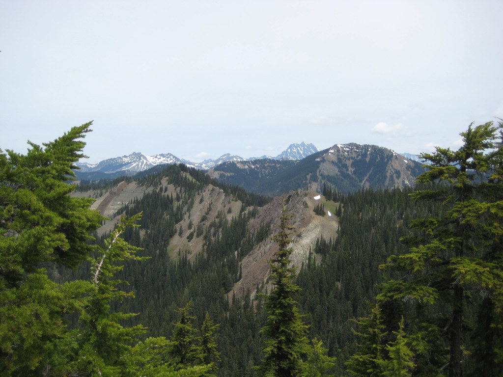
Above 4000 feet the trail is back in light forest, with game trails entering from the north. As it nears 5000 feet, it crosses a talus slope with nice views toward the French Cabin Peaks.
From the mostly open saddle, an unmarked trail heads north, while the main trail, indistinct at first, heads directly east up the ridge until it turns right at 5500 feet through forest to the meadows on Sasse Ridge. As it enters the meadow, the trail disappears. Head left and down to intersect the Sasse Ridge trail at 5550 feet. Find a metal "Howson Creek" trail sign deeply embedded in a tree, facing south.
The wooded summit of Sasse Mountain is only a few hundred yards north up the wide Sasse Ridge Trail. Beginning here, mountain bikes are allowed. For a longer trip continue north to Jolly Mountain.
If you're more interested in another peak-bag, head back the way you came to the saddle. Here, 5550-foot West Sasse Peak is an easy scramble to panoramic views of Mount Rainier to the Snoqualmie Peaks to Mount Stuart.
Howson Creek

-
 Length
- 7.0 miles, roundtrip
-
 Elevation Gain
- 3,400 feet
-
 Highest Point
- 5,700 feet
Following an abandoned trail, Howson Creek provides an enjoyable hike in light forest. The trail is steep and the tread is narrow, but it offers progressively better views above 4000 feet, north toward Thorp Mountain and the Snoqualmie Peaks, especially from West Sasse Peak.
Continue reading
Hiking Howson Creek
Map & Directions
 Trailhead
Before You Go
Parking Pass/Entry Fee
NoneWTA Pro Tip: Save a copy of our directions before you leave! App-based driving directions aren't always accurate and data connections may be unreliable as you drive to the trailhead.
Getting There
Drive I-90 to the Roslyn Exit just west of Cle Elum. Go north, then left on route 903 through Roslyn and Ronald to the upper end of Cle Elum Lake. The trailhead is directly opposite the Cle Elum River Campground, on the south side of the highway. Parking is available for perhaps half a dozen cars.


