
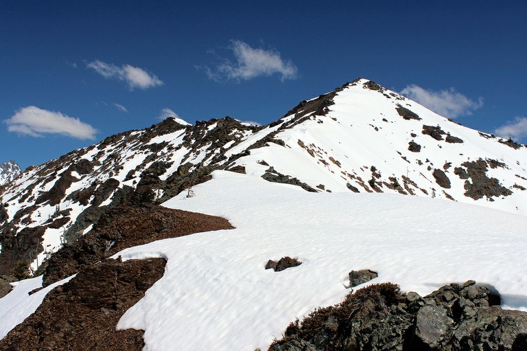
Named for Judi Maxwell, a well-known Mountaineers instructor who worked in the slopes below this mountain, Judi's Peak is the unofficial name for a high peak on the southwest border of Bean Creek Basin in the Wenatchee Mountains.
Judi's is a fun scramble which can be approached from a variety of directions and combined with other peaks such as Bills Peak, Bean Peak, and Mary's Peak. The gentle nature of its slopes, the ridges which connect it to these other peaks, and the myriad number of trails mean that you can easily climb Judi's Peak one way and come out another. It is therefore a "loop-trip" dream peak.
Because it lies in a very popular scrambling area, the peak is frequented by many field trips of the Mountaineers who have their final snow instructional trip here. For solitude, come in May or the fall. Otherwise, be prepared to share the peak, not only with Mountaineers, but with other avid climbers.
From the trailhead, cross Beverly Creek on a bridge and hike half a mile to the junction with the Bean Creek Trail. From here, several different routes lead hikers to the summit. The most direct route crosses Bean Creek with varying levels of difficulty depending on the season.
Follow the Beverly Creek trail to the south ridge of Judi's Peak directly on your right. Leave the trail and head up through open pine forest about one mile (with 2500 feet of elevation gain!)
Judi's Peak
-
 Elevation Gain
- 3,417 feet
-
 Highest Point
- 6,560 feet
Parking Pass/Entry Fee
Northwest Forest Pass
A Class 2 scramble to the top of Judi's Peak in the Teanaway. Climbing experience recommended.
Continue reading 
Hiking Judi's Peak
Judi's Peak
Map & Directions
Before You Go
Parking Pass/Entry Fee
Northwest Forest PassWTA Pro Tip: Save a copy of our directions before you leave! App-based driving directions aren't always accurate and data connections may be unreliable as you drive to the trailhead.
Getting There
Take I-90 East to Exit 85. Turn right onto SR-970. After 5 miles, turn left onto the Teanaway River Road. Follow signs for the North Fork Teanaway for 13.5 miles to a junction at 29 Pines Campground. Take the right fork, going 3 more miles to the junction with the Beverly Creek Road #112. Turn right onto this road, and follow it 1.5 miles to the road end and trailhead for Beverly Creek Trail #1391.


