
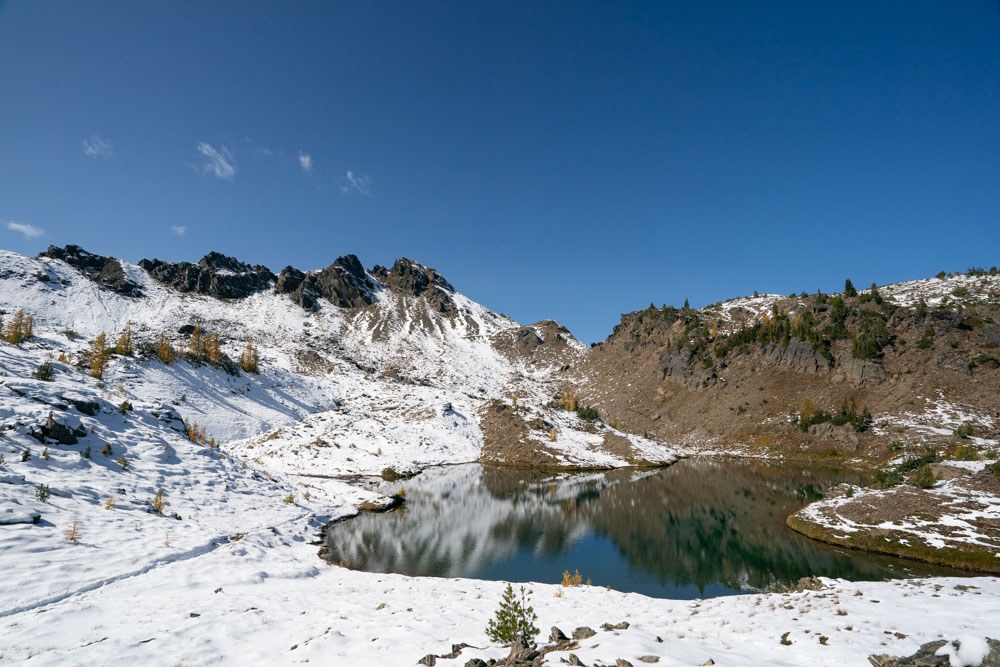

Lake Edna is a smaller subalpine lake situated along the Icicle Ridge Trail. Featuring several backcountry campsites and a toilet with exceptional views, this lake area can be enjoyed for camping, or as a rest spot before turning around for intrepid day hikers and trail runners.
Day hikers can access this lake via the Chatter Creek Trail. This involves a 12-mile roundtrip hike with 5,000 feet of elevation gain. From the end of the Chatter Creek Trail, turn left onto the Icicle Ridge Trail (1570) and follow it uphill for 0.3 mile until you reach the lake.
Backpackers may access the area via Chatter Creek Trail, Icicle Ridge Trail or Chiwaukum Creek Trail. Lake Edna sits below Ladies Pass and Cape Horn, about 21.2 miles from the Icicle Ridge Trail trailhead, and 0.3 miles past the Chatter Creek/Icicle Ridge junction.
The trail skirts around the southern side of the lake. Campsites are laid between the southern and eastern sides, with the toilet located on a spur trail on the southeastern side of the lake. No camping is permitted within 200 feet of Lake Edna.
 Trailhead


