

Overgrown, lined by enormous trees and encroaching ferns, with peek-a-boo views of the former Elwha Dam site, West Lake Mills is a good way to get in a mysterious-feeling 4 miles of walking after visiting the interpretive area near the former dam site.
First, though, you need to hike about 4.3 miles from the Madison Falls trailhead, since that's the closest trailhead that accesses this route after the Elwha River washed out the Hot Springs road.
Once you arrive at the overlook, be sure and enjoy the view and marvel at the dam, then look for the trailhead. It's behind a sign that reads:
Boulder Creek 2.0
Trail End 1.9
Despite the potentially confusing signage, never fear. You'll be rewarded with a view of Boulder Creek at the end. The trail immediately climbs, switchbacking away from the trailhead only to drop suddenly to cross a washout of the drainage of Stokey Creek.
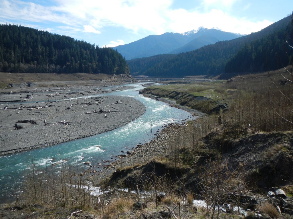
The rolling pace set in the first few hundred yards is the theme of this trail's entire length. Elevation gains and losses increase, making for a surprisingly good workout. After a long climb of about a mile in, look out to your left for a nice view upriver of the mysterious Elwha Valley.
Dive back into the forest, where the trail continues meandering up, down and all around, through open forest set far back from the creek. Notice how quiet it is. The mosses, ferns and other foliage no doubt dampen the creek noise, but you're also quite far away from the creek. Now free-flowing, it's cutting back and forth through the former lakebed and is now quite far away from the West Lake Mills trail.
After 2 miles of forest wandering, arrive abruptly at a dropoff, where Boulder Creek cascades down from its origin at Boulder Lake, 5.5 miles away as the crow flies, but unreachable on trails from there.
The missing 0.1 mile on the sign at the trailhead is a mystery. A footpath heads off uphill from here, but it's certainly not 0.1 mile further to the creek; you can see it right in front of you. On your way back, take time to enjoy the views of the valley and former dam site, which are arguably better on the return trip, since you're walking towards it.
WTA Pro Tip: It is possible to hike another trail back to the trailhead. Turning around from Boulder Creek, you'll head right on the Smokey Bottom trail. This trail wends through the bottom of the old lakebed and offers different scenery (fewer trees, more brush) than West Lake Mills.

 Trailhead


